Issue Date: Saturday, September 3rd, 2022
Issue Time: 9:45 AM MDT
— Flooding is NOT expected today
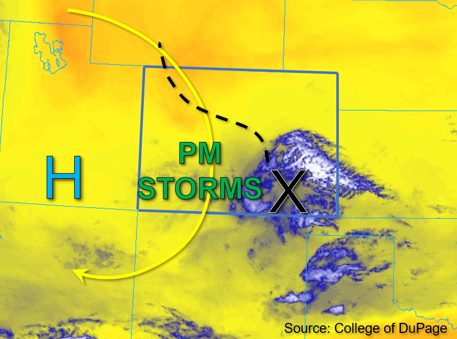
The shortwave and surface boundary associated with a Mesoscale Convective Vortex (MCV) that was responsible for overnight and early morning storms is pushing south out of the state this morning. This feature is marked by an “X” in the water vapor image below, while the blue and white colors display the associated cloud cover and light showers over the southern Southeast Plains this morning. With the southward departure of the shortwave and surface boundary, clearing and warming can be expected across the state. Column moisture is lacking statewide as indicated by PW values of 0.46 and 0.64 inches measured in Grand Junction and Platteville this morning, respectively. Additionally, boundary layer moisture is very minimal across the western portions of the state, while mid-40s to upper 50s°F dew points are common across eastern Colorado.
By this afternoon, scattered storms are expected to develop along and west of the Continental Divide. The highest rainfall rainfall chances should be confined to the higher elevations of southwest Colorado where instability values may reach up to 500 to 800 J/kg of CAPE this afternoon. Given forecast quicker steering flow and a relatively dry boundary layer, virga showers and gusty winds are the most likely threats with these storms. However, if dew points in the mid and upper 40s°F can be reached over southwest Colorado, isolated brief heavy downpours will be possible. Meanwhile, eastern Colorado should remain dry after this morning’s weak showers depart the southern border counties. Flooding is NOT expected today.
Today’s Flood Threat Map
For more information on today’s flood threat, see the map below. If there is a threat, hover over the threat areas for more details, and click on burn areas to learn more about them. For Zone-Specific forecasts, scroll below the threat map.

Zone-Specific Forecasts:
Southwest Slope, San Juan Mountains, San Luis Valley, Grand Valley, Central Mountains, Northern Mountains, & Northwest Slope:
Light showers are departing the southern border counties this morning, otherwise skies are mostly clear across western Colorado. By this afternoon, scattered storm development is likely across the Central and San Juan Mountains, as well as portions of the Southwest Slope and the San Luis Valley. Given the forecast relatively dry boundary layer, these storms should mostly be virga showers producing gusty winds. Some isolated heavy downpours are possible primarily over the San Juan Mountains and eastern Southwest Slope where isolated max 1-hour rain rates up to 0.75 inches are possible. Over the Central Mountains, 1-hour rain rates up to 0.6 inches are possible. Flooding is NOT expected today.
Primetime: 1PM to 10PM
Front Range, Urban Corridor, Northeast Plains, Palmer Ridge, Southeast Mountains, Southeast Plains, & Raton Ridge:
A few light showers and associated cloud cover over the southern border counties are exiting the state this morning, with clearer skies north. This afternoon, a few isolated storms may be possible over the Southeast Mountains and southern Front Range, but given limited instability and moisture, any storms that do form will likely be virga showers producing gusty winds. Isolated max 1-hour rain rates up to 0.4 inches will be possible with a storm or two that may occur over the Southeast Mountains and southern Front Range. Flooding is NOT expected today.
Primetime: 2PM to 8PM