Issue Date: Thursday, September 1st, 2022
Issue Time: 10:05 AM MDT
— Flooding is NOT expected today
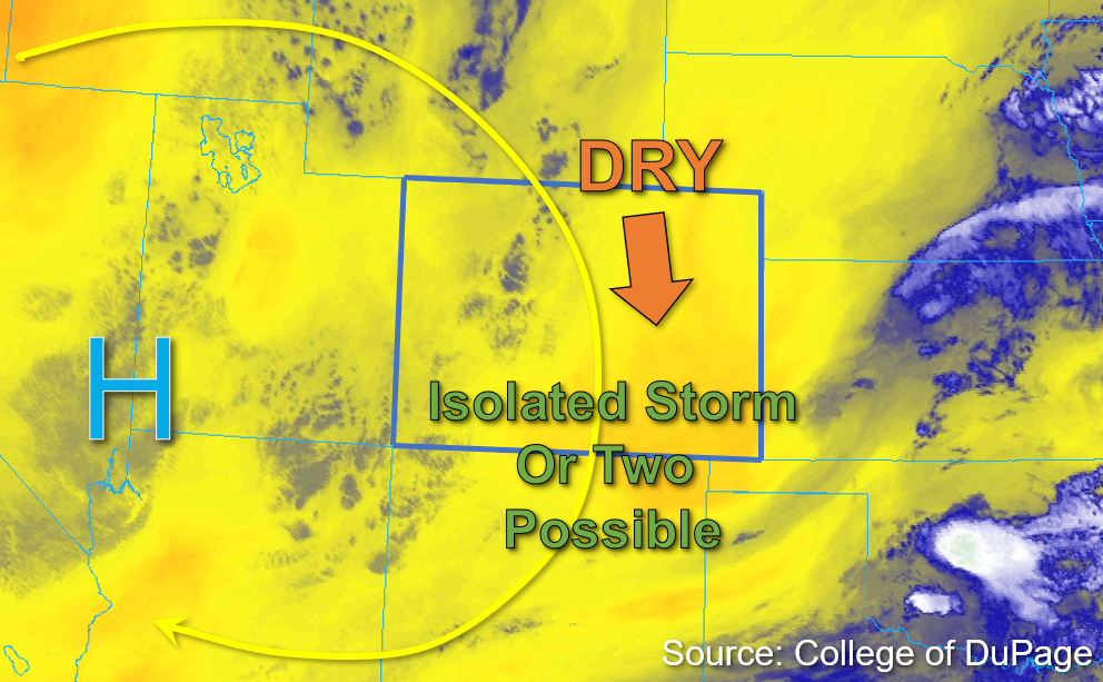
The upper-level high-pressure system to the west has shifted slightly southward to the southwestern Utah border with southeastern Nevada. This slight shift is going to produce a more northerly steering flow that will continue to advect dry air from Wyoming, as shown in the water vapor image below. PW values of 0.5 and 0.52 inches were measured in Grand Junction and Platteville this morning, respectively, indicating increased drying through the column from yesterday over eastern areas. The most notable change is that surface moisture has decreased significantly from yesterday over the northern and central portions of the state, with dew points in the mid-30s to low 40s°F common in the lower elevations west and upper 20s to low 30s°F dew points in the mountains this morning.
The highest surface moisture remains over far southeastern Colorado where some upper 50s and low 60s°F dew points are in place. That said, significant mixing out of moisture is expected with the dry air intrusion from the north throughout the day. As subsidence continues to build and contribute to warm temperatures aloft, and with negligible instability forecast, storm chances are very low today. An isolated storm cannot be ruled out over the southern high terrain, as well as over the far eastern border counties where marginal moisture and instability may be just sufficient enough to sustain an isolated brief storm or two. However, steering flow up to 25mph should move storms quickly southward out of state and flooding is NOT expected today.
Today’s Flood Threat Map
For more information on today’s flood threat, see the map below. If there is a threat, hover over the threat areas for more details, and click on burn areas to learn more about them. For Zone-Specific forecasts, scroll below the threat map.

Zone-Specific Forecasts:
Southwest Slope, San Juan Mountains, San Luis Valley, Grand Valley, Central Mountains, Northern Mountains, & Northwest Slope:
Some widely scattered clouds are drifting southward across portions of the Northern and Central Mountains this morning. This afternoon, a few stray cumuli may continue this southward movement across the higher elevations, and a few brief virga showers may be possible. However, given the decreasing surface moisture that is already limited to begin with, no meaningful precipitation is expected, except perhaps over the far southern San Juan Mountains and Southwest Slope. Isolated 30 minute rain rates up to 0.3 inches may be possible over the far southern border counties but flooding is NOT expected today.
Primetime: 2PM to 8PM
Front Range, Urban Corridor, Northeast Plains, Palmer Ridge, Southeast Mountains, Raton Ridge, & Southeast Plains:
Lingering cloud cover from the departing shortwave to the east has dissipated this morning, leaving behind mostly clear skies for eastern Colorado for the remainder of the day. That said, a few isolated storms may develop over the far eastern and southeastern border counties, with a few stray virga showers also possible over the Front Range and Southeast Mountains this afternoon. Given decreasing surface moisture and lacking instability, any showers/storms that do form should be brief and move southward relatively quickly given faster steering flows. Over the far eastern border counties, as well as over the Southeast Mountains, an isolated storm or two may produce 30-minute rain rates up to 0.3 inches. Flooding is NOT expected today.
Primetime: 3PM to 8PM