Issue Date: Tuesday, August 30th, 2022
Issue Time: 8:30AM MDT
— Flooding is NOT expected today
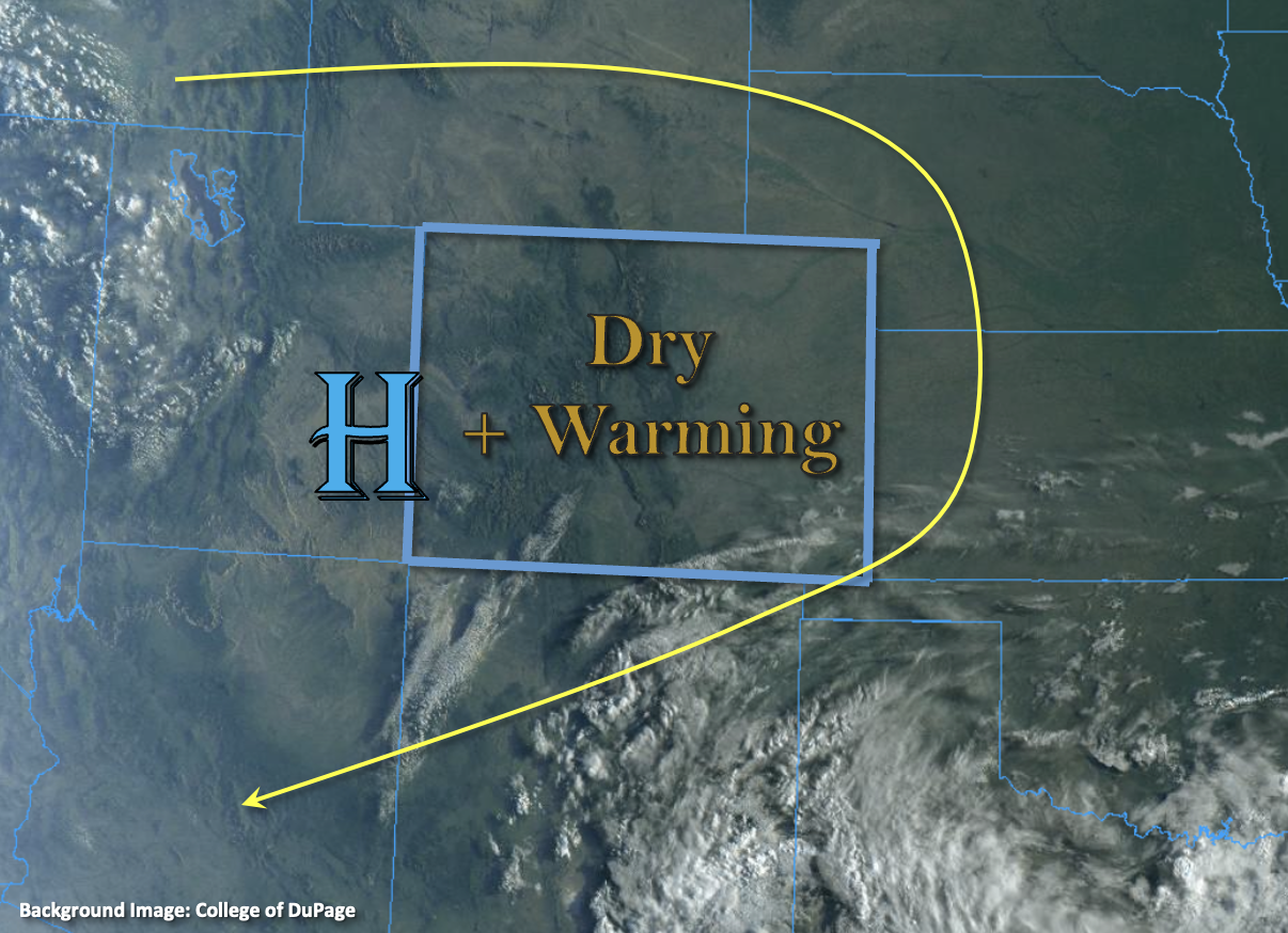
The satellite imagery below shows nearly clear skies over the state, which is due to the combination of High pressure and a much drier air mass overhead. PW at Grand Junction and Platteville were measured at 0.56 and 0.65 inches, respectively, so values remain below average. With subsidence and limited surface moisture continuing from yesterday, very little rainfall is expected. In fact, this may be our first dry day (statewide) since June 10th! The best chance for spoiling that dry day would be a high-based shower breaking the cap over the mountains with this most likely to occur somewhere along and near the central and southern portions of Continental Divide. Even if an isolated storm or two can develop today, only light rainfall is anticipated, so flooding is NOT expected.
Today’s Flood Threat Map
For more information on today’s flood threat, see the map below. If there is a threat, hover over the threat areas for more details, and click on burn areas to learn more about them. For Zone-Specific forecasts, scroll below the threat map.

Zone-Specific Forecasts:
Southeast Mountains, Front Range, Raton Ridge, Urban Corridor, Palmer Ridge, San Luis Valley, Northeast Plains & Southeast Plains:
It’s a cooler start to the day when compared to yesterday over portions of the far eastern plains, but temperatures should be on the rise throughout the day. Afternoon highs are expected to reach into the low 90s °F over the Urban Corridor, Northeast Plains and western Southeast Plains. Outside of the possibility for an isolated high-based storm or two over the southern Front Range and Southeast Mountains, it should remain dry. Flooding is NOT expected.
Central Mountains, Northern Mountains, San Juan Mountains, Southwest Slope, Northwest Slope & Grand Valley:
Temperatures continue to run above normal with 90s °F forecast for the lower elevation valleys and 70s °F and 80s °F forecast for the mountain valleys. A couple high-based storms may occur along or near the Continental Divide in the Central and San Juan Mountains, but even if they can break through the cap, totals should remain light, so flooding is NOT expected.