Issue Date: Wednesday, August 24th, 2022
Issue Time: 10:50 AM MDT
Summary:
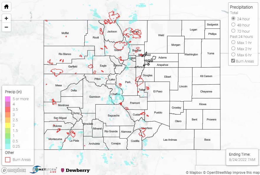
Tuesday continued the trend of decreasing precipitation coverage across the state, as showers and storms were confined to even higher elevations than previous days. Precipitation amounts were also lighter, with QPE data suggesting maximum totals of 0.25-0.75” in narrow swaths from the Northern Mountains into Park/Chaffee Counties, and southward into the San Juans and Southeast Mountains.
Two Flash Flood Warnings were issued by the Boulder WFO for portions of the Cameron Peak burn scar, while another Flash Flood Warning was issued for portions of the East Troublesome burn scar. State Highway 125 was temporarily closed in Grand County between Forest Service Road 112 and Trail Creek as a precaution, but no flooding was reported. Farther south, a small portion of I-70 was closed near Idaho Springs due to rockslides.
Notable rainfall totals across the mountains include:
• 0.70” near Nathrop
• 0.63” near Buena Vista
• 0.61” near Georgetown
• 0.48” near Pagosa Springs
• 0.40” near Grand lake
If you observe flooding in your area, remember to use the “Report a Flood” page to make any flood reports when you can safely do so. For precipitation estimates in our area, check out the map below.
Click Here For Map Overview