Issue Date: Tuesday, August 23rd, 2022
Issue Time: 10:50 AM MDT
Summary:
Monday felt like a broken record as the pesky upper-level low lingered in the region, providing enough synoptic lift during daytime heating to spark showers and storms over the high terrain by shortly after noon. Precipitation coverage was more limited yesterday, with convection mainly confined to the mountains south of I-70 and west of I-25.
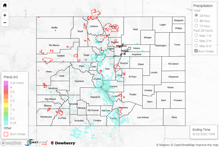
QPE data suggests precipitation amounts of 1-1.50” from the Central Mountains southward across the San Juans and Southeast Mountains. A National Weather Service co-op observer measured 1.15” in just over 2 hours near Rosita; other notable rain gauge observations include:
• 0.95 and 0.91” near Salida
• 0.84” near Woodland Park
• 0.72” near Buena Vista
• 0.65” near Georgetown
• 0.61” near Breckenridge
Farther north, isolated showers and storms over the Northern Mountains prompted a Flash Flood Warning and Flood Advisory for portions of Grand County, including the East Troublesome burn scar. Local law enforcement reported that Highway 125 was closed in both directions, from Trail Creek to Forest Service Road 112, due to mudslides.
If you observe flooding in your area, remember to use the “Report a Flood” page to make any flood reports when you can safely do so. For precipitation estimates in our area, check out the map below.
Click Here For Map Overview