Issue Date: Monday, August 22nd, 2022
Issue Time: 2:20PM MDT
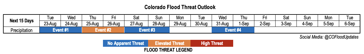
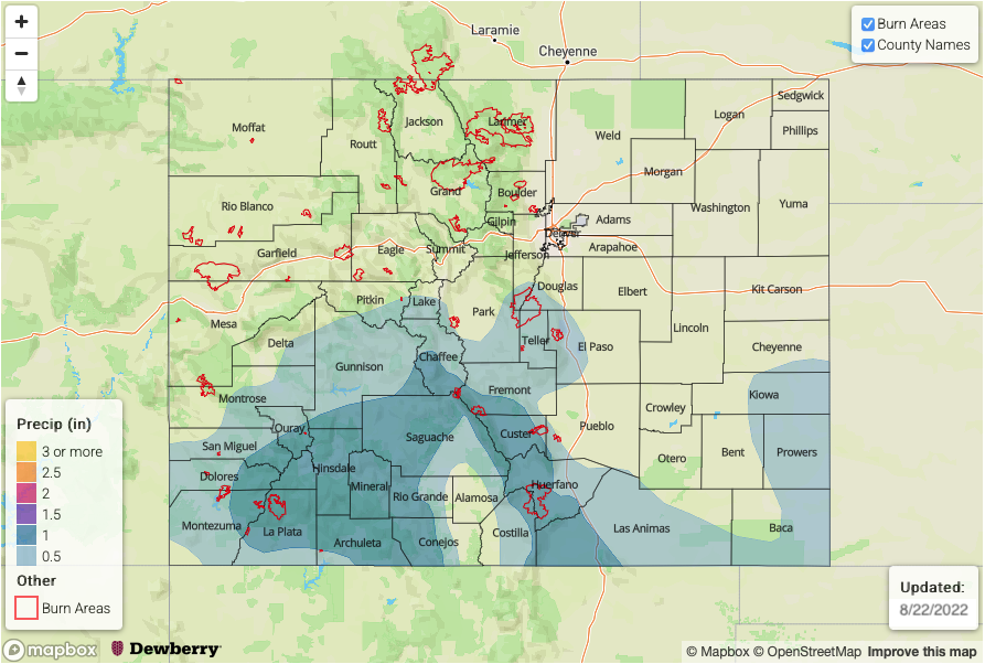
Valid Dates: 8/23 – 9/6
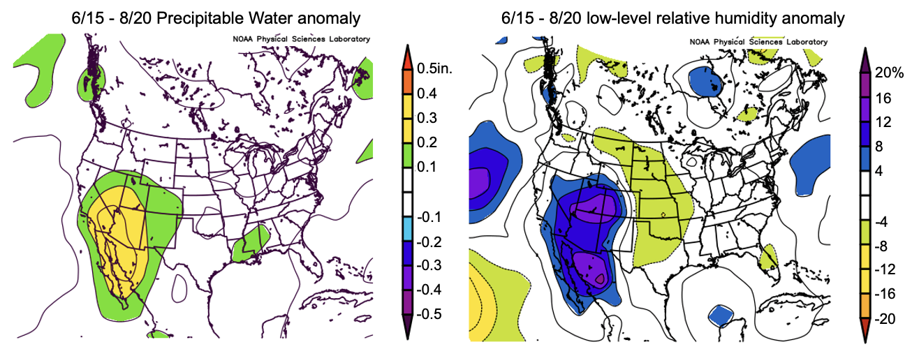
Today will mark the 72nd consecutive day with precipitation somewhere across Colorado, and last Outlook’s prediction that we will easily get to 75 looks on course. Several weeks ago, we presented moisture anomalies that have accompanied the active rainy weather over the Four Corners. Below is an updated analysis, showing PW (left) and low-level relative humidity (right) anomalies since mid-June, when the monsoon turned on in earnest. Note that the legends are flipped, with blue/purple values corresponding to below normal PW but above normal relative humidity. We can see that above normal moisture has occurred over a wide stretch of the southwest United States, in association with an anomalous ridge centered over the southern Great Plains (not shown). Compared to several weeks ago, moisture anomalies have also expanded a bit westward. Over Colorado, the surplus moisture has not benefited everyone equally with southern and southwestern sections of the state doing much better job of translating the moisture into actual rainfall. In this Outlook, we are finally seeing signs of a major pattern shift away from what we have seen over the past few months. In short, with the upper-level ridge weakening, monsoonal moisture will generally decrease statewide but not before another pulse later this week.
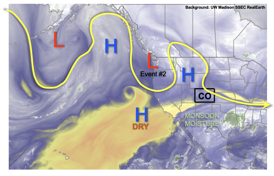
As shown in the water vapor image, below, a very amplified pattern is noted this afternoon across the eastern Pacific Ocean and western North American continent. Close to home, a departing disturbance will lead to mid-level height rises and general subsidence through Wednesday. Pleasant weather and only isolated to widely scattered weaker storms are expected through this time (Event #1). By Thursday, a currently stationary upper-level low pressure over the Pacific Northwest will begin to move southeast, bringing in a surge of moisture from both the northwest and south. A increase in storm activity is expected through Friday, with an Elevated flood threat anticipated for mainly the higher terrain (Event #2). Subsidence behind the departing disturbance should drop rain intensity to below flood thresholds by Saturday and Sunday, though widely scattered storms are still possible over the central and southern high terrain.
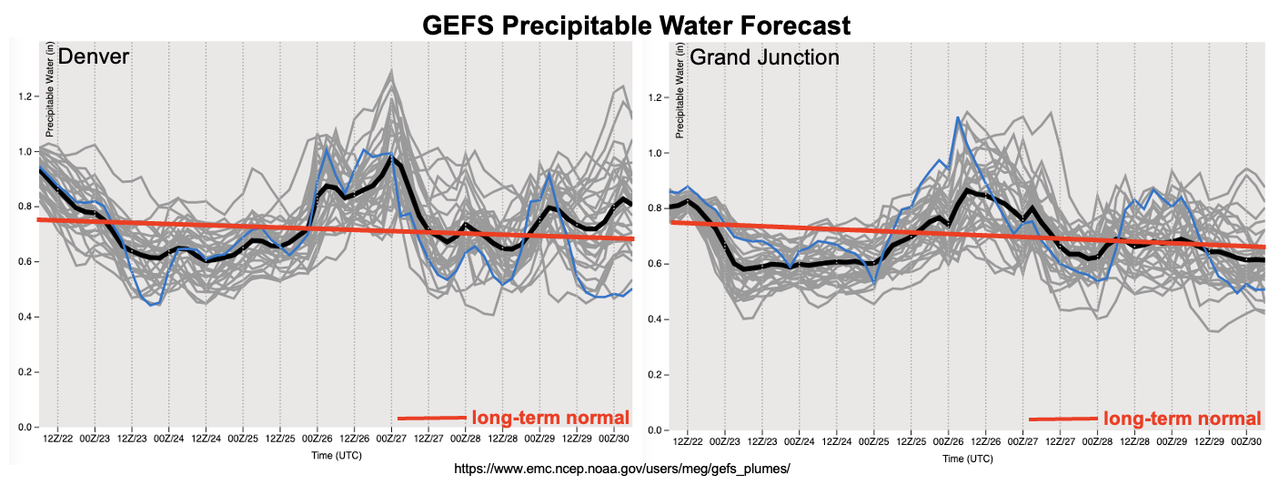
As shown in the forecast PW plumes, below, significant drying is expected in the wake of Event #2 so that Monday or Tuesday of next week look to be our earliest chance of a dry day statewide. Thereafter, with a weak ridge developing over or just north of Colorado, monsoonal moisture should stay suppressed south of us. However, enough moisture could creep into the San Juan Mountains for an uptick in storm activity by the middle of next week. Flooding is not expected at this time.
Temperatures statewide are expected to run fairly close to seasonal normal, so that a nice stretch of late summer days looks to be on the menu for many folks.
The identified precipitation events are described in more detail below.
Event #1: Tuesday – Wednesday (August 23 – August 24)
No Apparent Flood Threat But Isolated To Widely Scattered Weak Storms Expected Over Southern High Terrain
Afternoon and evening storms are expected daily, though max 30-min rain rates should stay at 0.6 inches or lower, preventing any flood threat.
Event #2: Thursday – Friday (August 25 – August 26)
Low-end Elevated Flood Threat Returns To Southern And Central Higher Terrain
Scattered to numerous storms are expected on Thursday and Friday. Highest coverage over the northern and central high terrain on Thursday, shifting southward to the central and southern high terrain by Friday. Max 30-min / 60-min rain intensity up to 0.9 and 1.2 inches warrant an low-end Elevated flood threat mainly for steeper terrain.
Eastward over the lower elevations, rainfall will be more in the isolated to widely scattered variety. However, a few stronger or even severe storms could form over the Southeast Plains towards the KS and OK border on Friday. An Elevated flood threat could materialize for a small portion of this area, contingent upon the storms forming far enough westward.
Event #3: Saturday – Sunday (August 27 – August 28)
No Apparent Flood Threat, But Isolated Storms Still Expected For Higher Terrain
With moisture on the decrease and weak subsidence overhead, storm coverage will drop into the isolated to scattered variety by Saturday. Still, max 30-min rainfall up to 0.5 inches could occur over the climatologically preferred San Juan Mountains and Southeast Mountains. However, flooding is not currently expected.
Event #4: Wednesday – Thursday (August 31 – September 1)
Storm Chances To Increase For Far Southern High Terrain; No Apparent Flood Threat
With moisture moving in from the east/southeast, enough of it could graze our southern border counties and produce widely scattered showers and storms. Max 30-minute rain rates up to 0.5 inches are possible, but flooding is not expected at this time.