Issue Date: Saturday, August 20th, 2022
Issue Time: 11:20 AM MDT
Summary:
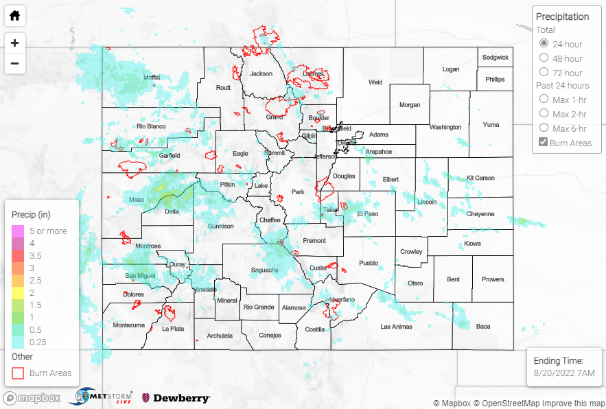
Monsoonal moisture was on the uptick across the state on Friday as a shortwave trough approached the region. Showers and storms developed over the high terrain by early afternoon, with the heaviest rain falling over and around the Grand Valley and Central Mountains.
Numerous Flash Flood Warnings and Flood Advisories were issued across the western slope and mountains, including for portions of Rio Blanco, Garfield, Mesa, Delta, Gunnison, Montrose, and San Miguel Counties. Rainfall totals in this region were impressive, with QPE data suggesting up to 2.5”. Gauge observations lend credence to these estimated totals; CoCoRaHS reports include 1.89” near Cedaredge and 1.45” near Whitewater, while an automated gauge measured 1.58” near Palisade. A debris flow/mudslide was reported over County Road 3 near Marble across northern Gunnison County.
Farther east across the Front Range and Urban Corridor, Flash Flood Warnings were issued for portions of the Calwood burn scar and Colorado Springs. QPE data suggest up to 1” of rain fell, with a CoCoRaHS report of 0.99” near Colorado Springs and an automated gauge reporting 0.94” northwest of Golden. No flooding was reported. QPE also suggests amounts of up to 1” across portions of the Palmer Ridge.
If you observe flooding in your area, remember to use the “Report a Flood” page to make any flood reports when you can safely do so. For precipitation estimates in our area, check out the map below.
Click Here For Map Overview