Issue Date: Thursday, August 18th, 2022
Issue Time: 10:15 AM MDT
— Flooding is NOT expected today
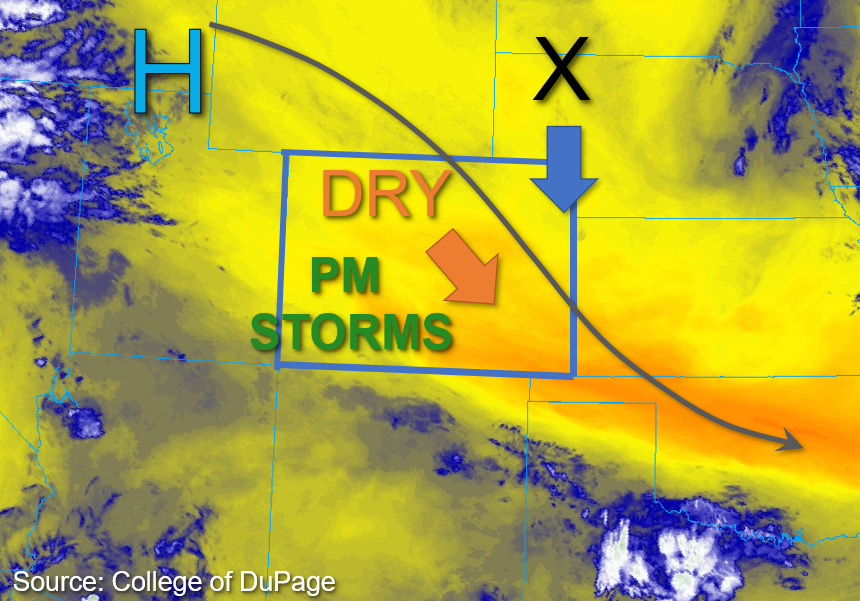
This morning, an upper ridge positioned over southeast Idaho continues to push dry air into the region, as shown in the water vapor image below. As the high-pressure center continues to build in from the northwest, the dry, sinking air should suppress the return flow of moisture and provide a break in rainfall for most of the state today. That said, some lingering monsoonal moisture is in place across the Four Corners region of southwest Colorado. Grand Junction measured a PW value of 0.80 inches, which reveals a decrease from yesterday but with somewhat higher values near 1 inch south. And while instability is somewhat modest in the area with values forecast to reach between 500-1000 J/kg this afternoon, the residual moisture in tandem with added uplift from elevated terrain should be sufficient to allow for isolated storm development over the southwest portions of the state this afternoon. These storms may produce briefly heavy rainfall particularly where they may briefly anchor to the steeper terrain, but rain rates are expected to remain below flood thresholds. Additionally, storm cores are expected to be small and produce only localized impacts, so NO flooding is expected for western Colorado today.
Further east, Platteville measured a PW of only 0.57 inches this morning, which is a significant decrease from prior days as the moisture continues to be scoured out from the southward surge of dry air. An upper-level disturbance is forecast to move from the Nebraska/South Dakota border southward across the eastern plains of Colorado this afternoon and evening. This feature could trigger a few afternoon storms along the boundary. Instability is forecast to reach between 1500-2000 J/kg of CAPE for portions of the eastern plains this afternoon and early evening, and there may be enough moisture recovery in the boundary layer to allow for some isolated briefly heavy downpours. However, the dry air intrusion and subsidence should keep rain rates below flood thresholds. Therefore, there is NO flooding expected for eastern Colorado today.
Today’s Flood Threat Map
For more information on today’s flood threat, see the map below. If there is a threat, hover over the threat areas for more details, and click on burn areas to learn more about them. For Zone-Specific forecasts, scroll below the threat map.

Zone-Specific Forecasts:
Southwest Slope, San Juan Mountains, San Luis Valley, Grand Valley, Central Mountains, Northwest Slope, & Northern Mountains:
Fog across the San Luis Valley from early this morning continues to dissipate this morning, otherwise, skies are mostly clear and temperatures are a few degrees warmer than yesterday. This afternoon, a couple rounds of isolated are possible over the Southwest Slope and western San Juan Mountains where the residual monsoonal moisture is in place. These storms could produce max 30-minute rain rates up to 0.6 inches, with isolated 1-hour rain rates up to 0.75 inches possible if a storm is able to anchor to the higher terrain. Some light runoff and gusty winds will be possible with these storms; however, given the smaller storm cores likely, NO flooding is expected today.
Front Range, Urban Corridor, Northeast Plains, Palmer Ridge, Southeast Plains, Raton Ridge, & Southeast Mountains:
Some patchy fog over the far eastern plains is dissipating this morning. Otherwise, skies are clear and drier, warmer conditions are expected for these forecast zones today. This afternoon, a few isolated storms may be possible in association with a southward-moving upper-level impulse. Given significant drying over the last 24 hours along with somewhat faster steering flow, rain rates up to 0.4 inches in 30 minutes are anticipated over portions of the eastern Palmer Ridge, and Northeast and Southeast Plains. If moisture recovery is sufficient this evening across the Southeast Plains, isolated 1-hour rain rates up to 0.75 inches are possible if a stronger storm or two develops. Additionally, small hail and gusty winds would be possible with these storms. However, NO flooding is expected today.