Issue Date: Sunday, August 14th, 2022
Issue Time: 11:30 AM MDT
Summary:
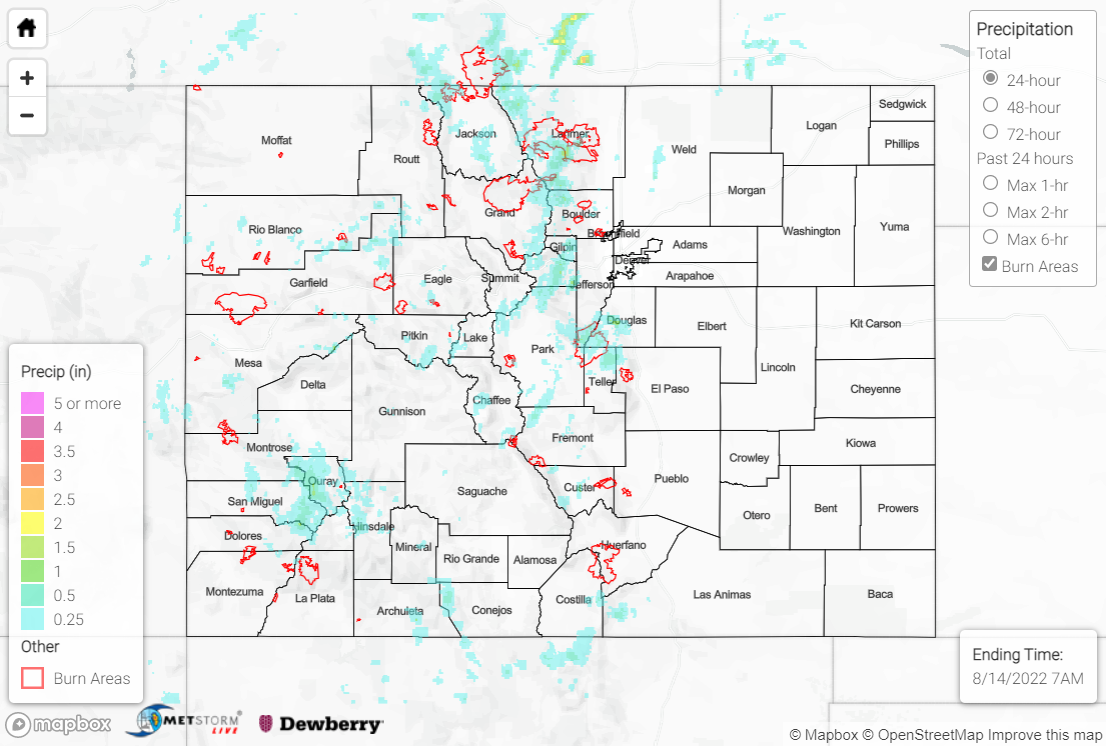
High pressure remained parked to our southeast on Saturday across the southern high plains. Moisture increased across the state compared to Friday, but the bulk of the monsoonal moisture plume remained just west of our area. Nonetheless, showers and storms developed over the mountains of the northwest half of the state by mid-afternoon, with exceptionally slow steering flow yielding increased flash flooding concerns. Storms remained confined to the high terrain, although a few attempted to move off the foothills into the Urban Corridor and eastern plains; dry air near the surface limited the precipitation in this vicinity to mostly virga.
The heaviest rainfall was observed across the eastern Northern Mountains and northern half of the Front Range, where QPE data suggests up to 1.50-2.00” might have fallen. A patchwork of six Flood Advisories and one Flash Flood Warning were issued across Grand, Jackson, and Larimer Counties, including for portions of the East Troublesome and Cameron Peak burn scars; thankfully, no flooding was reported. Another Flood Advisory was issued for northern Park County, also with no flooding reported. Notable rain gauge observations include 1.18” at an automated station near Woodland Park, 0.87” at an automated station south of Estes Park, 0.62” from a CoCoRaHS observer west of Evergreen, and 0.61” from a CoCoRaHS observer north of Allenspark.
Further west across the high terrain of the southern Northwest Slope, Grand Valley, northern Southwest Slope, and northern San Juan Mountains, heavy rain was also observed, with QPE suggesting up to 1.00-1.25”. A Flood Advisory was issued for central Mesa County just south of Grand Junction for mainly arroyo and small stream flooding, but no flooding was reported. Another Flood Advisory was issued for portions of Ouray, San Juan, and San Miguel Counties near Black Bear Pass, with emergency management reporting heavy rain and minor flooding in the area; no debris flows were reported. Notable rain gauge observations include 0.87” at an automated station west of Uncompahgre Peak and 0.82” from a CoCoRaHS observer north of Ridgway.
If you observe flooding in your area, remember to use the “Report a Flood” page to make any flood reports when you can safely do so. For precipitation estimates in our area, check out the map below.
