Issue Date: Saturday, August 13th, 2022
Issue Time: 11:45 AM MDT
Summary:
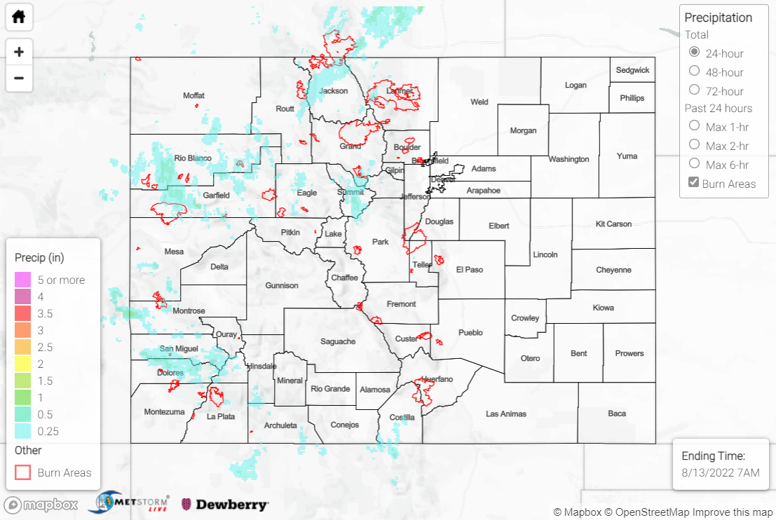
Friday saw isolated to widely scattered showers and thunderstorms develop over the high terrain by late afternoon. The heaviest precipitation was confined to the southern Northwest Slope/Grand Valley/Southwest Slope, in addition to the Northern Mountains and western Front Range.
QPE data suggests amounts up to 1” were observed where storms occurred. Notable rain gauge observations include 0.70” southeast of Pagosa Springs, 0.70” near Breckenridge, and 0.64” near Steamboat Springs. No severe weather was reported, but a Flood Advisory was issued for western portions of the Cameron Peak burn scar; no flooding was reported. Additionally, a Flash Flood Warning and two Flood Advisories were issued near the Uncompahgre National Forest, but again, no flooding was reported.
If you observe flooding in your area, remember to use the “Report a Flood” page to make any flood reports when you can safely do so. For precipitation estimates in our area, check out the map below.
