Issue Date: Friday, August 12th, 2022
Issue Time: 10:45 AM MDT
Summary:
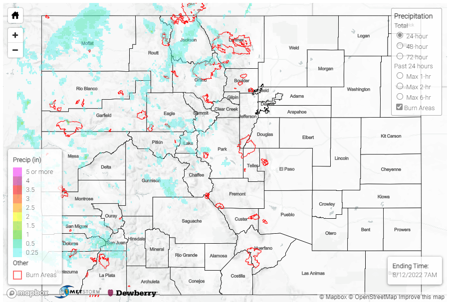
The western half of the state saw some relief from the dry weather on Thursday, with rainfall across the southwest slope up to the Front Range. There were several Flood Advisories issued across the western slope; locations include on and near Black Canyon of the Gunnison National Park, northeast of Telluride, and also over a portion of the Pine Gulch burn scar. 0.5” hail and high winds of 40-50 mph were reported associated with the flood advisory in the National Park – a CoCoRaHS reporter in Montrose nearby reported similar. Near Grand Junction, high winds of up to 47 mph were reported, and nearby in Palisade saw 0.43”.
Flood Advisories were also issued for parts of the Cameron Peak and East Troublesome burn scars yesterday afternoon – via CoCoRaHS, Lake Granby near East Troublesome received up to 0.26”. However, no flooding in either of these locations was reported.
Moving east, the Northwest Slope saw some rainfall as well, including 0.57” and 0.39” in Yampa and Phippsburg. There were also high winds of up to 52 mph reported in Craig.
Lastly, precipitation in the southwest quadrant of the state ranged from trace amounts to 0.19”, with notable amounts of 0.28” in Rico an 0.44” in Cahone. The Urban Corridor and Eastern Plains continued to stay precipitation-free.
There was no flooding reported yesterday.
If you observe flooding in your area, remember to use the “Report a Flood” page to make any flood reports when you can safely do so. For precipitation estimates in our area, check out the map below.
