Issue Date: Friday, August 12th, 2022
Issue Time: 8:55AM MDT
— Flooding is NOT expected today
— Fire-Burn Forecast Summary: 5 burn areas under LOW; click HERE for more info
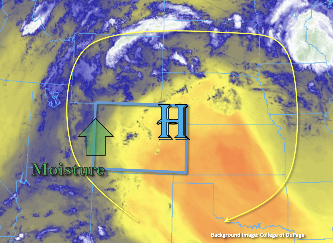
The High continues to circulate monsoon moisture northwards on its west side and dry air on its east side as shown in the water vapor imagery below. This dry air and subsidence will continue to keep eastern Colorado dry through this forecast period. As the High moves slightly east throughout the day, a bit of monsoon moisture will continue to advect across Colorado’s western border. This moisture can be seen in the Grand Junction sounding this morning, which came in at 1.01 inches. There was also an increase in dew point noted, which has climbed a few degrees over the last couple of days. Generally speaking through, dew points over western Colorado are steady or have undergone a slight decrease from this time yesterday. However, in the valleys where dew points have slightly risen, there may be a slight increase in rain accumulation as storms move off the high terrain, although strong outflow winds should continue to be the main threat. Details aside, there should be plenty of moisture for widely scattered to scattered storms to develop over the mountain and high terrain by this afternoon.
The precipitation pattern is expected to look similar to yesterday with better storm coverage along and west of the Continental Divide, but there should be a slight downtick in coverage with less mid-level energy moving overhead. Slow steering flows in the 10-15 mph range are again forecast, which may allow storms to drop some brief heavy rainfall as the move towards the NW (south) and NNE (central/north). However, smaller storm cores, outflow driven storms and shorter duration heavy rainfall should limit the chance for flooding. Therefore, NO flood threat has been issued.
Today’s Flood Threat Map
For more information on today’s flood threat, see the map below. If there is a threat, hover over the threat areas for more details, and click on burn areas to learn more about them. For Zone-Specific forecasts, scroll below the threat map.

Zone-Specific Forecasts:
San Juan Mountains, Central Mountains, Southwest Slope, Northwest Slope, Northern Mountains & Grand Valley:
Best storm coverage today is forecast over the San Juan Mountains and western elevated plateaus and mesas. South, isolated max 30-minute rain rates up to 0.8 inches and storm totals up to 1 inch will be possible with most storms producing between 0.5 and 0.75 inches of rainfall. Further north, max 30-minute rain rates up to 0.75 inches will be possible. In addition to brief downpours, stronger storms will likely produce outflow winds (up to 55 mph) as the move off the high terrain and possibly some small hail (pea size to marble). Flooding is NOT expected today, and some lighter rainfall may linger overnight in the mountains. Afternoon high temperatures continue to run hot with 90°Fs forecast for the lower valleys and 70Fs for mountain valleys.
Primetime: 1:30PM to 3AM
Front Range, Urban Corridor, Palmer Ridge, Southeast Plains, Southeast Mountains, San Luis Valley, Raton Ridge & Northeast Plains:
It will be likely be dry again for the Southeast Mountains, although an isolated storm may produce some very light rainfall. The bulk of rainfall activity is forecast over the Front Range this afternoon through this evening, and with capping over the adjacent plains and NNE storm movement, little to no spillover is expected into the adjacent plains. Max 1-hour rain rates up to 0.9 inches are forecast with most of the rainfall falling in the first 30-mintues. Flooding is NOT expected today, but some light showers will be possible over the mountains into tomorrow morning. Afternoon high temperatures will remain 5-10°F above average with 90°Fs forecast for elevations below 6000 feet.
Primetime: 1:30PM to 3AM