Issue Date: Thursday, August 11th, 2022
Issue Time: 2:45PM MDT
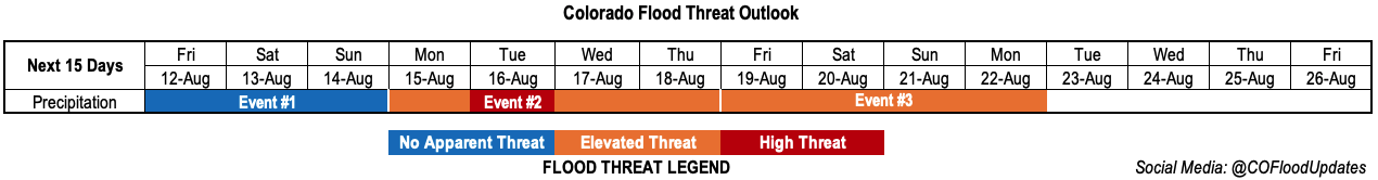
Valid Dates: 8/12 – 8/26
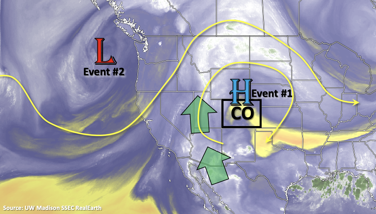
There has been a welcome break in heavy rainfall over the last couple of days, which should continue through early this weekend before more widespread rainfall and the chance for heavy rain returns to the forecast. That also means that the state should continue its rain-day streak through this next FTO period with plenty of afternoon and evening rainfall forecast with the subtropical High migrating across the western US. For Event #1, the center of the High will move slightly west of Colorado before rebuilding back over the Great Basin next week (Event #2). This summer ridge should also help to keep hot temperatures in the forecast until a cold front drops through Colorado early next week and brings some relief from the heat starting on Tuesday. Northwesterly flow aloft is then forecast through the end of next week, which will likely allow for shortwaves to move through the state and help increase the chance for rainfall over the adjacent plains.
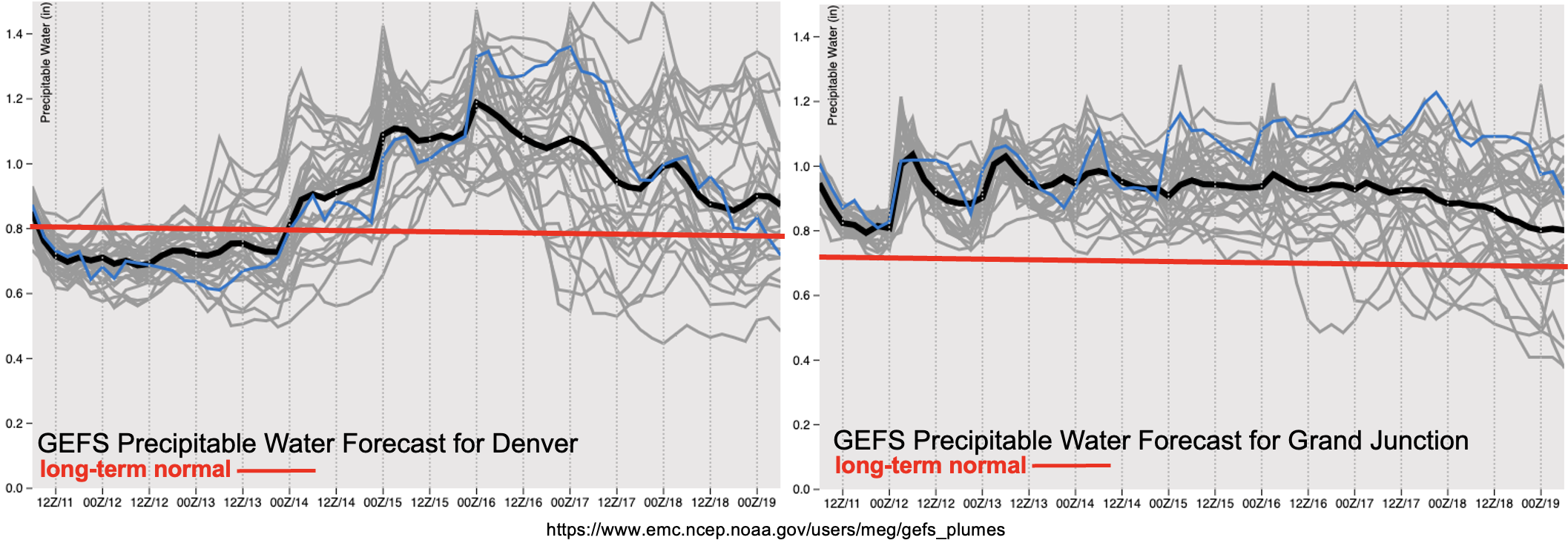
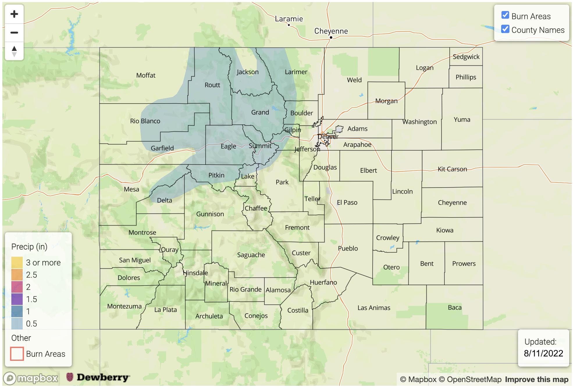
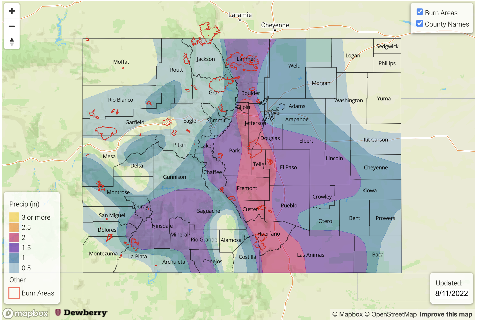
While there’s a nice cap and drying over eastern Colorado today, PW values should have a quick upturn behind the passage of the cold front early next week with values returning to much above normal for this time of year. A High flood threat has been issued for Tuesday with an Elevated threat issued Monday and through the end of next week. There is a chance for Wednesday’s threat to be upgraded in Monday’s FTO, but at this time, there is concern that continuous rainfall and cloud cover may inhibit instability to build, and thus limit the flood threat. Over western Colorado, PW values look to remain elevated over the next week keeping rainfall in the forecast each day with the best chance for higher accumulations central/south (right, below). Daily surface moisture and small disturbances will need to be tracked in the FTB with on and off flood low-end flood threats likely to be issued for the area. Overall, this long monsoon season looks to stay active with a peak in the flood threat anticipated early to mid-next week.
Event #1: Friday – Sunday (8/12 – 8/14)
No Apparent flood threat for scattered high terrain storms due to lack of surface moisture.
Although there is a slight increase in storm coverage anticipated over the mountains and western high terrains this weekend, storm cores should be relatively small and lack rainfall rate intensities to cause a flood response. Max 30-min/1-hour rain rates up 0.7/0.9 inches will be possible along with strong outflow winds and dangerous lightning under the more intense storms that develop. Best chance for a minor flood threat day would be on Sunday due to an increase of mid-level lift and moisture moving in from the west. This would most likely occur over the northern and central mountain areas.
Event #2: Monday – Thursday (8/15 – 8/18)
Longer duration precipitation along a front and post-frontal moisture will cause a High/Elevated flood threat to be issued next week.
The calm weather won’t last long as the High finally breaks down and allows a cold front to push through the state early next week. There is an increased likelihood that PW values will return to well above average, especially east, and some heavier rainfall may fall over the adjacent plains in a 3 to 6 hour period. The forecast becomes more complicated on Wednesday in a post-frontal upslope flow regime with ongoing convection and cloud cover potentially limiting instability, and thus the flood threat. Still, with PW well above average, some longer duration rainfall may be able to exceed the 1.75 inch/3-hour flood threat threshold. The Elevated flood threat issued on Wednesday and Thursday is for the southern mountains.
Event #3: Friday – Monday (8/19 – 8/22)
Another monsoon surge looks likely over the weekend, causing an Elevated flood threat to be issued.
It is still a bit far out for many details about this third event, but long-term guidance hints at some mid-level energy and favorable monsoon moisture returning the state for next weekend. If the northwest flow sets up overhead as anticipated, it is likely that a couple weak disturbances could move through the flow and help expand precipitation into the eastern plains. More updated and accurate details about this event will be available in Monday’s FTO.