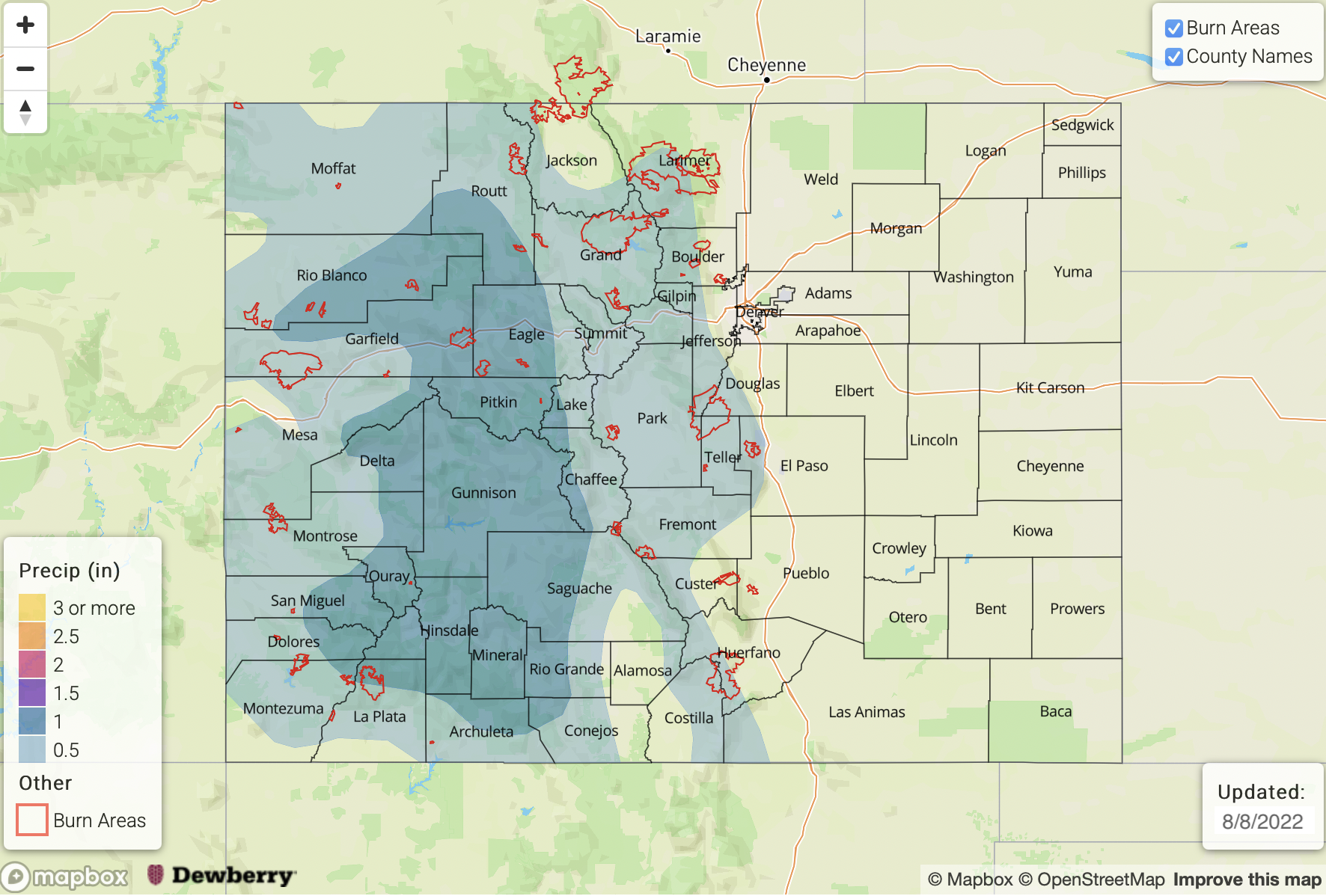
Issue Date: Monday, August 8th, 2022
Issue Time: 3PM MDT
Valid Dates: 8/9 – 8/23
We are now approaching 60 days of precipitation somewhere across Colorado, as this busy monsoon season has taken few breaks thus far. Tomorrow looked to be the best chance for a dry day statewide, but at least isolated storms are now looking more probable. Thus, we will likely eclipse 60 straight days with rainfall!
In this Outlook, we see a battle between some drier air (a rarity since mid-June!) and the restart of more monsoonal air being imported from the south, as shown in the water vapor image, below. With little in the way of large-scale dynamics, all eyes will be on the position of the monsoonal ridge. In the short-term, the ridge will strengthen overhead, temporarily blocking the import of fresh moisture. Thus, we expect reduced storm chances through Wednesday, though at least isolated activity is still expected over the higher terrain. But after this brief “lull”, at temporary isolated heavy rainfall will return by later this week (Event #2) warranting an Elevated Flood Threat. With weak steering flow, storms are likely to have a hard time making it off the higher terrain, thus only limited rainfall along with hot temperatures (3-5F above normal) are expected for most of eastern Colorado through this weekend.
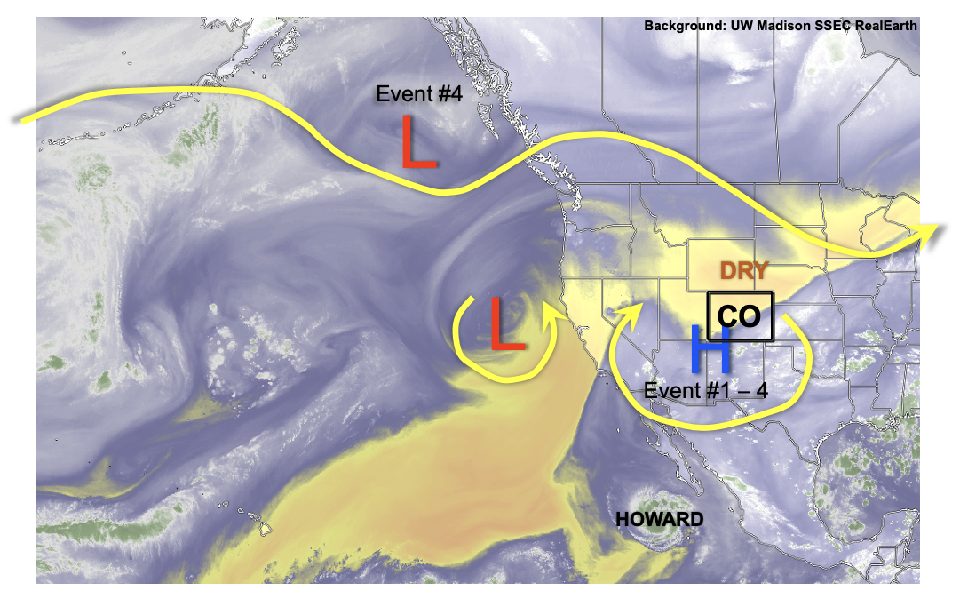
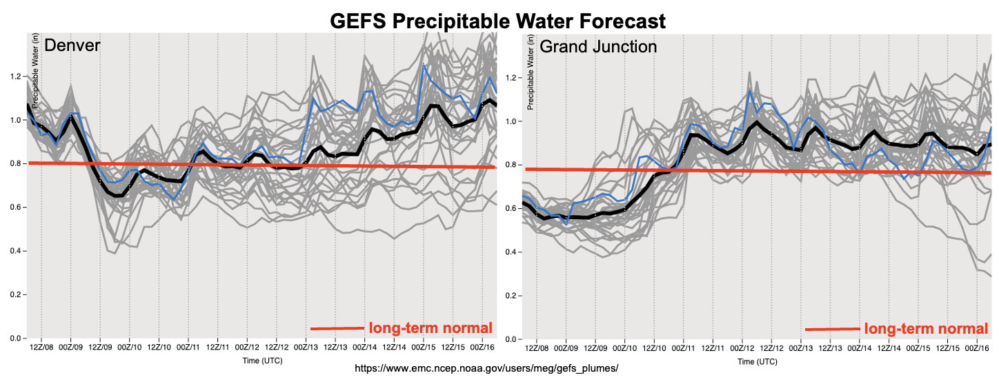
As shown in the GEFS PW plumes, below, the battle between dry and moist air appears to favor the latter by early next week. With plenty of above normal moisture around most of western North America by that point, it appears to be the start of another prolonged busy period of heavy rainfall for our state. In addition to the usual monsoonal dynamics of southerly moisture transport, a couple of cool front disturbances could swing down from Canada, providing boundary layer support to fuel storms. There is significant model uncertainty at this time, but enough consensus exists to identify a fourth precipitation event beginning next Monday with an Elevated flood threat.
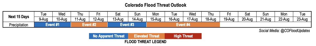
The identified precipitation events are described in more detail below.
Event #1: Tuesday – Wednesday (August 9 – August 10)
Isolated To Widely Scattered Higher Terrain Storms; No Apparent Flood Threat
Isolated to widely scattered storms are expected mainly over the southern and central higher terrain during the afternoon and evening hours. Max 30-min rainfall up to 0.4 inches looks possible on Tuesday, increasing to 0.6 inches by Wednesday. However, there is no apparent flood threat at this time.
Event #2: Thursday – Friday (August 11 – August 12)
Scattered Higher Terrain Storms With Low-end Elevated Flood Threat
Fresh monsoonal moisture will increase storm coverage and maximum rain rates by Thursday. The best chances of storms will be over the central and northern higher terrain. Max 30-min/60-min rain rates of 0.8 and 1.1 inches, respectively, could support a minor flood threat. Daily Bulletins will have a better look at these features as the depth of moisture recovery is determined.
Event #3: Saturday – Sunday (August 13 – August 14)
Isolated To Widely Scattered Mainly Higher Terrain Storms; No Apparent Flood Threat
Another period of dry air intrusion from the east should reduce storm coverage for all but the highest terrain. Isolated activity still looks possible for the entire higher terrain from the WY to NM borders. However, max 30-min rain rates of up to 0.5 inches suggest flooding is not expected at this time.
Event #4: Monday – Thursday (August 15 – August 18)
Elevated Flood Threat At Least For Higher Terrain With Some Spillover Likely Onto Plains
Things turn interesting by Monday, when a fresh pulse of monsoonal moisture looks to increase PW to above 1 inch for a prolonged duration. Additionally, one or more cool front could drop south out of Canada, further enhancing storm coverage.
Although there is significant uncertainty, it currently appears that mainly higher terrain storm on Monday will give way to more widespread storms by Tuesday and Wednesday. Any cool front presence will allow storms to move off the higher terrain and sustain a 3-6 hour duration threat of heavy rainfall. At this time, given the very long lead time, an Elevated flood threat looks appropriate. However, more details will be available in the next Outlook, which could support an increase to a High threat.