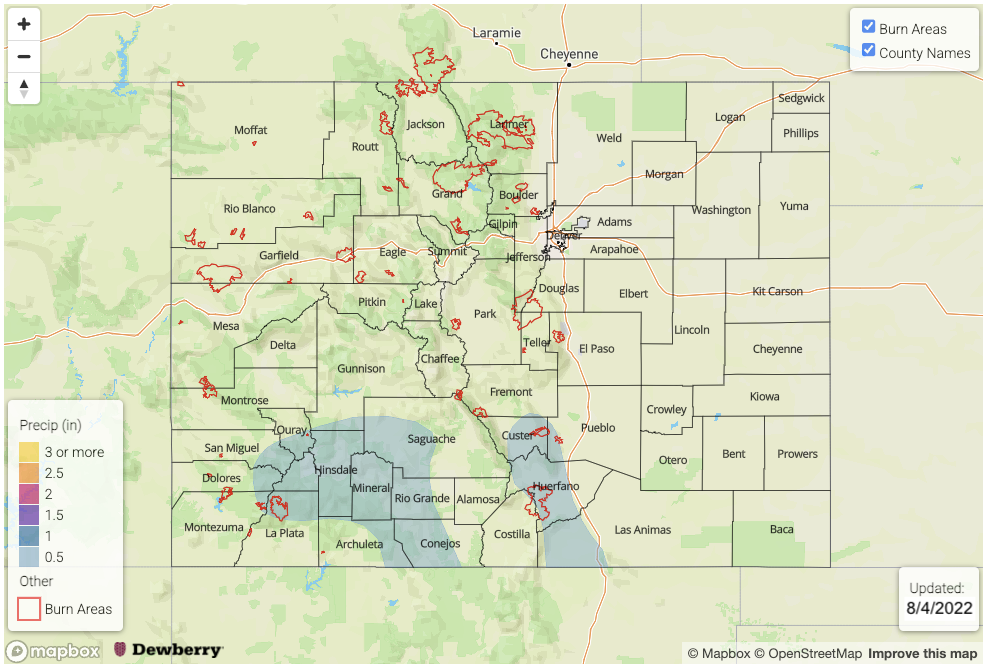
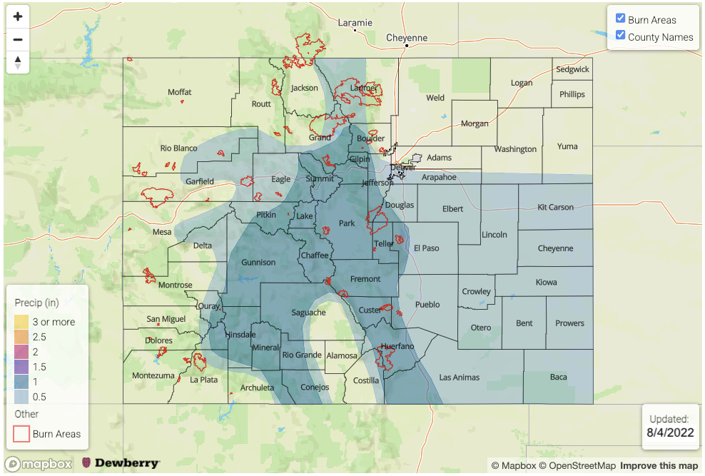
Issue Date: Thursday, August 4th, 2022
Issue Time: 3PM MDT
Valid Dates: 8/5 – 8/19
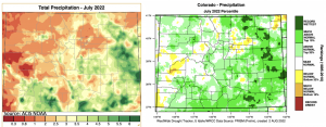
Below is a quick recap of precipitation from July using PRISM data. On the left is the estimated total precipitation for the month (inches), and on the right is the percentile of precipitation. Outside of portions of the western central and southern valleys, precipitation was generally above normal to much above normal statewide, and for portions of the eastern plains, July was the wettest on record. The one exception for the eastern plains is Sedgwick and Phillips Counties, which are still experiencing Extreme Drought conditions and recorded much below normal precipitation. As we’ve been monitoring in the SPM and FTB, it was a very wet month for the southern Southeast and San Juan Mountains with maximum estimated precipitation coming in at over 6 inches. A CoCoRaHS station outside of Pagosa Springs measured 5.18 inches for the month. As expected, local rivers are running higher than usual for this area with increased runoff from saturated soils, and gauges are showing well-defined spikes in streamflow associated with each day’s rainfall. Head on over to the DWR site to check them out.
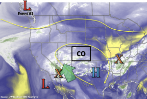
Heading into this next Outlook, it will remain very active on the rainfall front through this weekend (Event #1) before a nice break in precipitation and heavy rainfall chances next week (Event #2). Driving this weekend’s precipitation event will be an incoming trough that should displace the ridge axis eastward. In turn, this and a Low off the west coast will help to pull the subtropical moisture plume and mid-level energy marked below northwards into western Colorado first, and then into eastern Colorado later this weekend. Following Event #1, drying is expected for a couple days, although residual moisture, south, will likely continue to produce diurnally driven storms over the high terrain. Guidance is hinting at another monsoon surge after that (Event #3), so we aren’t quite done with this long rainy season yet. Here are some quick stats about Colorado’s heavy rainfall threat. Since mid-June, there have been 37 threats issued, and the current FTB threat streak is at 13 days with additional threats likely continuing over the next 3 days.
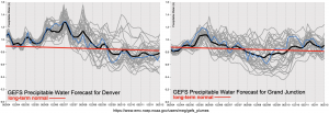
A High threat has been issued for Saturday and Sunday with above average PW values forecast statewide. The drying trend early next week can be seen by the downward trend in the middle of the PW plots below. Although moisture does look to decrease, PW values are likely to remain right around average. Although some capping is expected next week, the isolated storms that are able to pop over the high terrains (most likely south), may still be able to produce a flood threat with steering flows. Be sure to tune back into the FTO on Monday as there will likely be more clarity as to how much of a break in heavy rainfall there will actually be.
Event #1: Friday – Sunday (8/5 – 8/7)
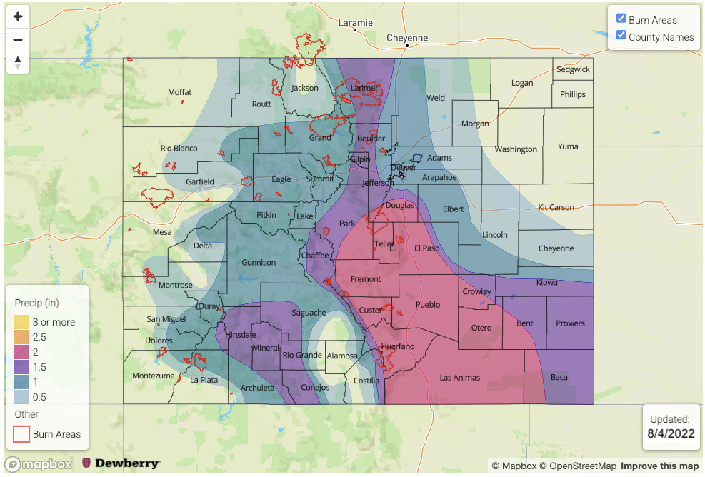
Above average moisture, increased dynamics and saturated soils will cause a High flood threat to be issued for this weekend.
This event will first begin over western Colorado and shift into eastern Colorado with the passage of a trough to the north. The flood threat on Friday should continue to be in the 30-minute to 1-hour range from storms, but some longer duration, moderate rainfall may also be possible this weekend with the passage of a front. Depending on the timing of the frontal passage, a couple of severe storms may be possible with the main threat being strong outflow winds. As for potential flood impacts, saturated soils further south, may continue to cause rises on local rivers and creeks and there is an increased threat for mud flows and debris slides over steeper terrains. Over the lower elevations and valleys, road flooding and field ponding will be possible.
Event #2: Monday – Thursday (8/8 – 8/11)
No Apparent flood as PW decreases and rising heights help to suppress precipitation chances.
Widely scattered to scattered storms will be likely over the high terrain during this period with the best coverage over central western Colorado and the southern mountains. With the High building over western Colorado, increased subsidence and capping should keep the adjacent plains and valleys dry. Max 30-minute rain rates up to 0.5 inches will be possible, so at this time, there is No Apparent flood threat.
Event #3: Friday – Monday (8/12 – 8/15)
Guidance is hinting at a return of monsoon moisture, so an Elevated flood threat has been issued with highest precipitation amounts forecast over the high terrain.
The monsoon season looks to continue with another monsoon moisture surge possible over the western Colorado and the mountains at the end of next week. Rain rates could easily reach the 1 inch in 1 hour threshold with PW anomalies likely increasing to above average values. Tune back into the FTO on Monday as the details of this next event will inevitably evolve.

