Issue Date: Tuesday, August 2nd, 2022
Issue Time: 10:55 AM MDT
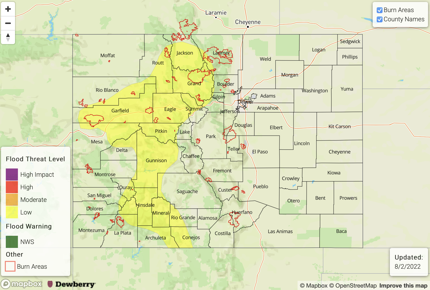
— A LOW flood threat has been issued for the Northern Mountains, Northwest Slope, Central Mountains, Grand Valley, and San Juan Mountains
— Fire-Burn Forecast Summary: 4 burn areas under MODERATE threat, 4 burn areas under LOW threat; click HERE for more info
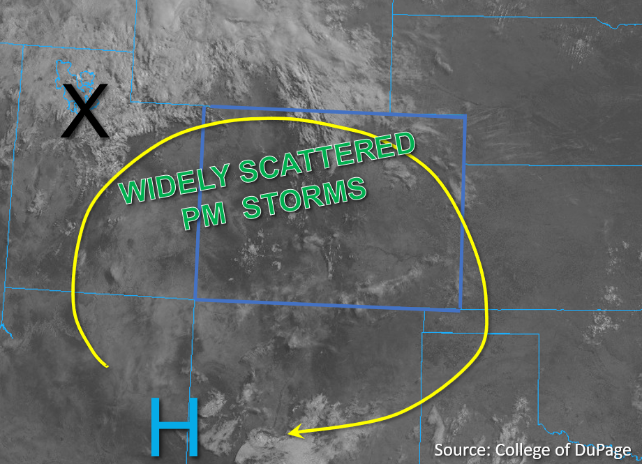
The high-pressure system from yesterday has shifted further to the southwest as compared to yesterday, and it is currently centered over the New Mexico and Arizona borders, as shown in the visible satellite image below. This morning, the persistent northwest flow upper air pattern continues, but as the day continues expected a slight increase in overall westerly steering flow as the shortwave over Utah, marked by the “X” in the below image, moves eastward. Both surface and column moisture have increased a fair amount over western Colorado since yesterday with Grand Junction measuring a PW value of 1.22 inches this morning, which is just shy of the maximum moving average. Over eastern Colorado, the Platteville profiler measured PW of 0.86 inches, which is an increase from yesterday. Dew points are quite elevated indicating plenty of surface moisture with 50s°F for most of Colorado and low to mid-40s°F for the higher elevations.
While these numbers show an overall increase in moisture depth statewide, the deepening High pressure along with a midlevel dry air intrusion is expected to mix out some of the boundary layer moisture this afternoon, which should cause dew point values to fall to the mid-40s to low 50s°F for most of Colorado. Still, in the presence of ample surface heating instability is forecast to reach between 500-1000 J/kg of CAPE across much of eastern Colorado, and upward to 1200-1500 across southwest Colorado.
By this afternoon, scattered (north) to widely scattered (south) storm development is expected across portions of western and northern Colorado. Given the higher instability forecast and sufficient column moisture, convective storms are likely. Given the forecast faster steering speeds up to 20mph and deepening high pressure helping to promote subsidence and suppress storms, heavy rainfall should be brief, thus limiting the heavy rainfall to over 30-minute periods. A few rounds of storms are likely, and the stronger storm cores may produce heavy rain rates to exceed flash flood thresholds particularly where storms can anchor to the higher terrains. A LOW flood threat has been issued for portions of western Colorado.
Today’s Flood Threat Map
For more information on today’s flood threat, see the map below. If there is a threat, hover over the threat areas for more details, and click on burn areas to learn more about them. For Zone-Specific forecasts, scroll below the threat map.
Zone-Specific Forecasts:
Southwest Slope, San Juan Mountains, San Luis Valley, Southeast Mountains, Grand Valley, Central Mountains, Northern Mountains, & Northwest Slope:
Aside from a few high clouds, skies are mostly clear across the western half of the state, which will allow plenty of instability to develop before the shortwave and upslope flow kick off storms. By early this afternoon, isolated to widely scattered storms are expected to develop over primarily the northern and central high terrains. Where any storms can anchor to the mountains, 30-minute rain rates up to 0.75 inches and 1 hour rain rates up to 1.25 inches are possible. A LOW flood threat has been issued for portions of the Northern Mountains, Northwest Slope, Central Mountains, Grand Valley, and San Juan Mountains. In addition to quick downpours, thunderstorms may produce some stronger outflow winds and small hail.
Primetime: Noon to Midnight
Front Range, Urban Corridor, Northeast Plains, Palmer Ridge, Southeast Plains, Raton Ridge, & Southeast Mountains:
Skies are mostly clear this morning with hot temperatures expected to quickly rise this afternoon into the low to mid-90s°F and possibly even low triple digits over the eastern plains. This afternoon, a few isolated storms may drift across the mountains and adjacent foothills with increasing westerly steering flow. A few briefly stronger storms possible over the Northeast Plains and Palmer Ridge where max 30-minute rain rates up to 0.75 inches and 1-hour rain rates up to 1.25 inches will be possible. These storms are expected to be elevated due to the high dewpoint depressions, so they should pose more of a strong wind and lightning threat. NO flooding is expected today.