Issue Date: Monday, August 1st, 2022
Issue Time: 3PM MDT
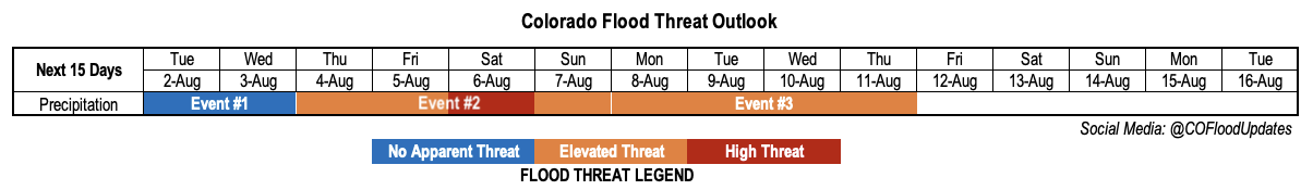
Valid Dates: 8/2-8/16
As mentioned in the July 25th Outlook, there were 44 straight days of rain somewhere across Colorado. Well, fast forward one week and we can safely bump that number up to 51 straight days. And fast forwarding at least 7-10 more days within this Outlook, that streak will easily continue to play out.
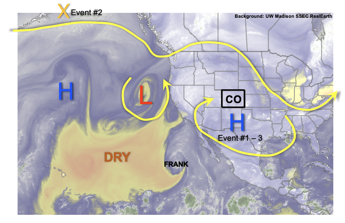
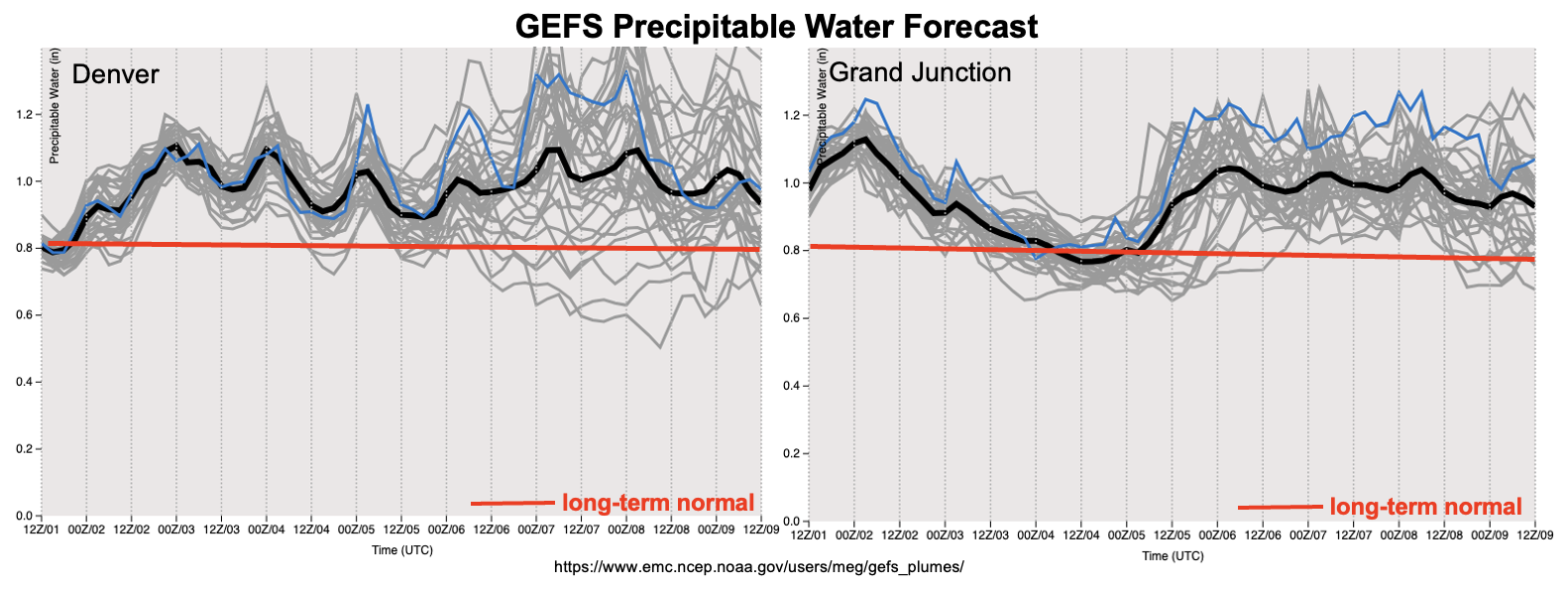
It has certainly been a memorable monsoon already, and it has been many years since we have seen this kind of consistency in the flow of above normal moisture into our state. As shown in the water vapor image, below, this Outlook is a status quo of the past 45 days or so. The circulation of the monsoonal ridge will continue to wobble across the western North America. But, it will be centered primarily to the south and east of Colorado. With plenty of moisture available over the eastern tropical Pacific, moisture here at home will continue to be above normal to, at times, near record level (see forecast PW plumes, below). As an interesting aside, tropical cyclone activity over the eastern Tropical Pacific is currently almost twice the normal value (compared to well below normal over the western Pacific), possibly helping explain our abundance of moisture here.
To start this Outlook, we see a relative lull in the flood threat as moisture will dip just a bit (Event #1), which combined with quicker steering flow will promote at least scattered storms but limited heavy rainfall potential. But by later this week, a monsoonal surge will re-ignite the heavy rainfall mainly over the higher terrain. An Elevated threat is warranted over a prolonged stretch (Event #2). The passage of a Pacific cool front (currently located over the Gulf of Alaska) looks to enhance the heavy rainfall ingredients so that a High flood threat looks possible though the exact timing is uncertain. With plenty of antecedent precipitation, soils will be particularly vulnerable not only to enhanced runoff rates, but also mud flows and debris slides. This provides extra confidence in the issuance of a High flood threat.
The pulse of monsoonal moisture responsible for Event #2 looks to carry further north. However, in its wake, above normal moisture should continue through mid next-week, leaving an Elevated flood threat for the higher terrain. At this time, the threat looks to shift further west towards the Utah border as more subsidence and relatively drier should curtail the threat over eastern Colorado.
Throughout this Outlook, temperature anomalies will persist in a similar fashion as the past month or so: most of western Colorado should be cooler than normal due to the presence of storms and frequent cloudiness. More variations in temperature is likely for eastern Colorado as very hot days are mixed with more seasonable days following cool front passages, and also when storms are able to make it off the higher terrain.
The identified precipitation events are described in more detail below.
Event #1: Tuesday – Wednesday (August 2 – August 3)
Scattered High Terrain Storms, But No Apparent Flood Threat
Widely scattered to scattered showers and storms are expected daily during the afternoon and evening. The best coverage will be over the western and central higher terrain. Max 30-min rainfall up to 0.5 inches is currently expected. However, outside of fire burn areas, flooding looks unlikely at this time.
Event #2: Thursday – Sunday (August 4 – August 7)
Mainly Higher Terrain Elevated/High Flood Threat; Uncertainty For Lower Elevations
An increase in storm coverage should begin on Thursday over the southern higher terrain, then spread northward by Friday. During this period, the flood threat appears to mainly reside in the 30-60 minute duration where 1.0 inch and 1.5 inch intensity is possible, respectively.
By Saturday, a frontal passage from the north is expected. Depending on the exact setup with timing, moisture availability and steering flow, a 36-48 hour period of enhanced threat will be possible over the Front Range southward through the Southeast Mountains. Heavy rainfall in the 3-6 hour duration looks possible, with max 6-hour accumulation exceeding 3 inches possible. Additionally, precipitation could extend well into the evening and overnight hours, adding to the impact. Given enough heavy rainfall coverage, along with the growing importance of wet soils, this could translate into a riverine flood threat.
The flood threat for the eastern Plains looks limited at this time.
The next Outlook should have more details on this Event.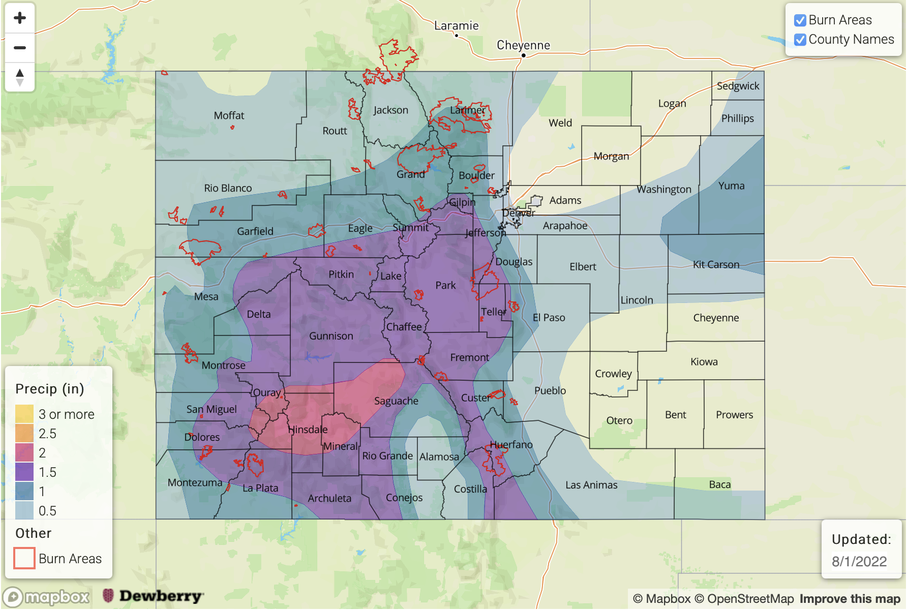
Event #3: Monday – Thursday (August 8 – August 11)
Plenty Of Storms Expected Daily For Higher Terrain; Elevated Flood Threat
With moisture dialing back a bit, afternoon and evening storms are likely to drop in coverage but still be of at least the scattered variety. The best coverage looks to be over the western and central high terrain. Maximum intensity of 0.8 inch/30 minutes and 1.2 inch/60 minutes supports an Elevated flood threat for the risk of isolated flash flooding, debris slides and mud flows.