Issue Date: Monday, August 1st, 2022
Issue Time: 10:55 AM MDT
— A MODERATE flood threat has been issued for portions of the San Juan Mountains
— A LOW flood threat has been issued for the Southeast Mountains, Southwest Slope, Grand Valley and portions of the Central Mountains and Northwest Slope
— Fire-Burn Forecast Summary: 4 burn areas under MODERATE threat, 2 burn areas under LOW threat, click HERE for more info
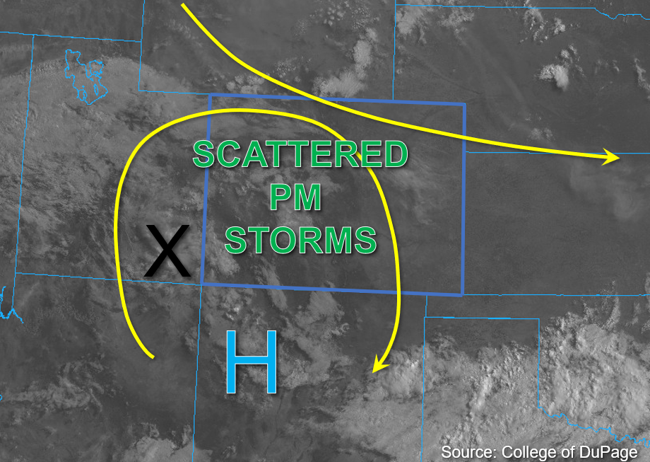
There are some high clouds over the mountains and southwest corner of the state to start the day, but August is off to a pleasant start for most this morning with afternoon temperatures on the rise statewide. The upper air pattern looks similar to yesterday with clockwise rotation around the High, which should progress slightly northeastward throughout the day and help to keep convection more isolated to widely scattered over the high terrains. Additionally, a mid-level disturbance in the flow is located over southeastern Utah this morning, as shown by the “X” in the water vapor image below. This should help provide a focal point for storm development over southwestern Colorado by midday.
Plenty of residual monsoonal moisture remains over the western half of the state and southern Colorado this morning with PW observed at 1.10 inches in Grand Junction and 1 inch values estimated across southwest Colorado. There is also less cloud cover than the last couple of days over the area, which should allow for plenty of warming by this afternoon. As the disturbance moves eastward, topographic influence along with instability in the range of 700-1000 J/kg of CAPE should provide plenty of uplift for at widely scattered storm development over the higher terrains. Given the forecasted weak steering flow, these small storms should again have the potential to drop heavy rainfall in a 30-minute period. Storms should become more scattered over the eastern and southern San Juan Mountains this evening with moderate to light on and off rainfall forecast. These could produce an additional 1 inch+ of rainfall by morning. After several consecutive days of rainfall over this region (see the SPM), both the convective storms and more widespread rainfall will increase the flood threat if they track over the saturated soils. For this reason, a MODERATE flood threat has been issued with a LOW flood threat extending northwards and eastwards over the high terrains.
East of the Continental Divide, boundary layer moisture is more limited and is expected to mix out by early this afternoon. Still, with PW at Platteville around 0.70 inches, a few weak storms are possible over the mountains. An isolated storm or two may drift off the Cheyenne Ridge into the Northeastern Plains Colorado this afternoon, but storms should mostly stick to the mountains with SSE steering flow. Slightly higher moisture was noted over the Southeast Mountains and with extra mid-level lift moving through the area, an isolated storm may produce some flooding issues over the Southeast Mountains. A LOW flood threat has been issued.
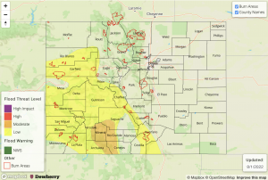
Today’s Flood Threat Map
For more information on today’s flood threat, see the map below. If there is a threat, hover over the threat areas for more details, and click on burn areas to learn more about them. For Zone-Specific forecasts, scroll below the threat map.
Zone-Specific Forecasts:
Southwest Slope, San Juan Mountains, San Luis Valley, Grand Valley, Central Mountains, Northwest Slope & Northern Mountains:
Local heavy downpours will be possible with the small storm cores that develop this afternoon and evening. Max 30-minute rain rates up to 1.25 inches and 1-hour rain rates up to 1.5 inches will be possible, which could cause isolated mud flows, debris slides and excessive runoff. This is especially true if they track over already saturated soils. More widespread totals in the 1 to 1.5 inch range over the San Juan Mountains will have the potential to cause rises in local streams and rivers with increased runoff from saturated soils, so a MODERATE flood threat has been issued. Further north, max 30-minute rain rates up to 1.1 inches will be possible, which could cause isolated road flooding and debris and mud flows. A LOW floor threat has been issued. Lighter showers may linger over the high terrains tonight through tomorrow morning (most likely north).
Primetime: 12PM to Ongoing
Front Range, Urban Corridor, Northeast Plains, Palmer Ridge, Southeast Plains, Raton Ridge, & Southeast Mountains:
Heavy rainfall chances remain across the southern high terrains with max 30-hour rain rates up to 1.25 inches possible. This could cause isolated mud flows and debris slides as well as road flooding over steeper terrains. A LOW flood threat has been issued. Further north, isolated max 30-minute rain rates up to 0.5 inches will be possible, which will limit the flood threat.
Primetime: 1PM to 11PM

