Issue Date: Monday, August 1st, 2022
Issue Time: 9:50 AM MDT
Summary:
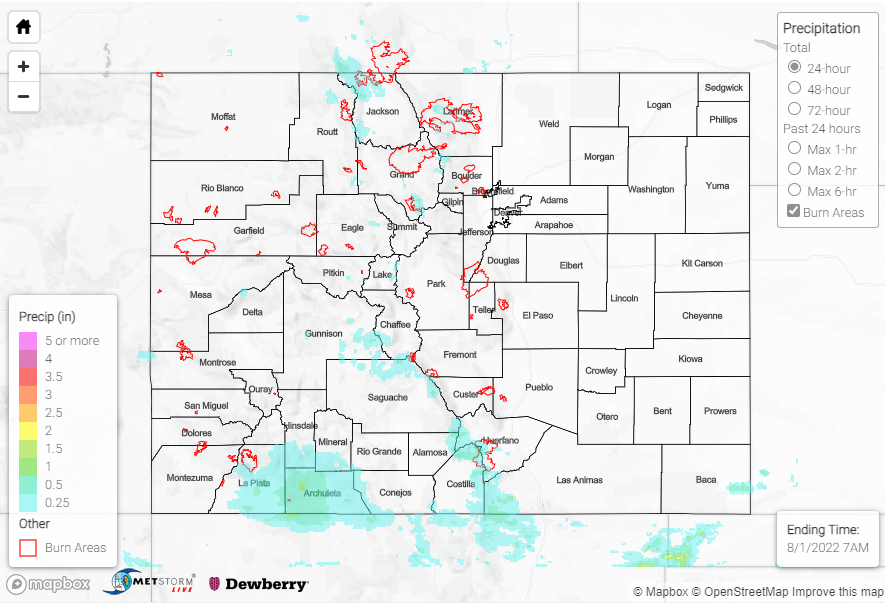
Sunday saw less rain than the last few days, with the majority of precipitation from the southwest corner of the state up to the northeast. The Southern Plains and Northwest Slope stayed quite dry.
East of Chromo near the southern border saw the most rain yesterday, reporting up to 0.91” of precipitation, along with hail in the area. The rest of the Southern Slope received between 0-0.20” roughly, with a few outliers such as as 0.52” west of Durango, and 0.39” in Placerville, among others. One flood advisory was issued near Durango, but flooding was reported. The Northern Plains saw second highest totals – up to 0.83” in Fairfield via CoCoRaHS.
Across the Central Mountains, Front Range, and Urban Corridor, many areas received between 0″ and 0.2”. Some more notable amounts include:
-0.78” near Aspen
-0.28” near Leadville
-0.51” in Divide
-0.24” in Briggsdale
-up to 0.32” near Fort Collins
There were two flood advisories for the Cameron Peak and East Troublesome burn scars, but no flooding has been reported. In other news, a small fire broke out in Larimer County on Wild Wing Drive, issuing evacuations for residents. Residents were able to return home later that day as the fire was quickly contained.
As a reminder, the Grand Junction radar is down, which means QPE totals in the western part of the state will be underestimated.
No flooding was reported today. If you observe flooding in your area, remember to use the “Report a Flood” page to make any flood reports when you can safely do so. For precipitation estimates in our area, check out the map below.
