Issue Date: Friday, July 29th, 2022
Issue Time: 9:30 AM MDT
Summary:
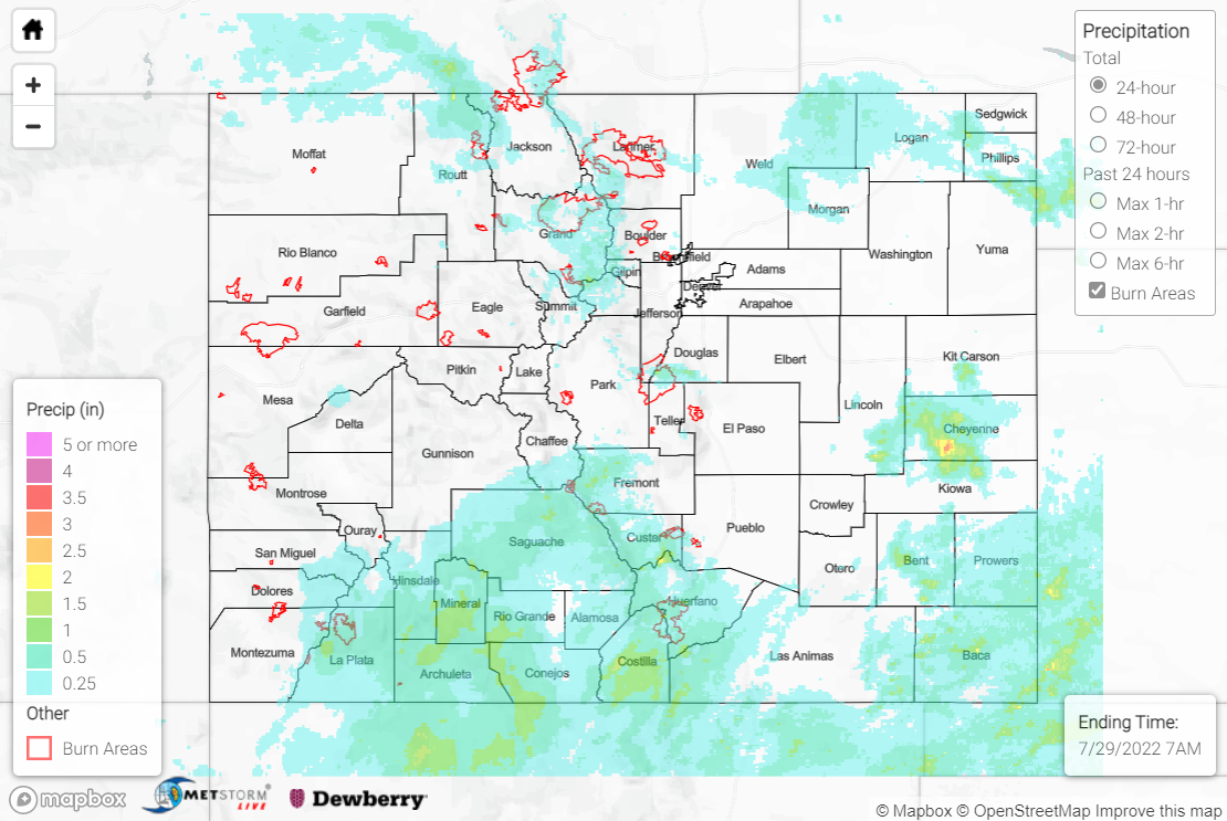
Lingering clouds from earlier convection to start the day on Thursday delayed and limited surface heating and associated convective development. Plentiful monsoonal moisture was in place and where clearing occurred later in the day, storms were able to develop over the high terrain. Rainfall was generally limited to the northern and southern thirds of the state.
Across the Northern Mountains, northern Front Range/Urban Corridor, and northern Northeast Plains, QPE data suggests 0.25-0.75” of rain was observed, with localized amounts up to and exceeding 1.00”. Notable rainfall totals at lower elevations include 1.00” and 0.93” in Fort Collins, while at higher elevations, 0.86” and 0.71” were observed north of Hot Sulphur Springs over the East Troublesome burn scar. Flash Flood Warnings and Flood Advisories were issued for both the East Troublesome and Cameron Peak burn scars, but no flooding was reported. Additional Flood Advisories were issued for northern Jackson County, portions of Douglas and Jefferson Counties, and the central Northeast Plains, but no flooding was reported in these locations.
Across the Southwest Slope, San Juan Mountains, and Southeast Mountains, QPE data suggests widespread amounts of 0.50-1.00”. However, as mentioned in yesterday’s SPM, the Grand Junction radar is offline, so these QPE totals are likely underestimated, and rain gauge data confirms this. CoCoRaHS observers reported amounts as high as 1.63” near Pagosa Springs, while gauges near Durango, Saguache, and San Acacio measured 1.50”, 1.39”, and 1.18”, respectively. A Flash Flood Warning was issued for the Spring Creek burn scar, but no flooding was reported. Flood Advisories were issued for southern portions of the Southwest Slope and San Juans, with forecasters using satellite and lightning frequency data to infer heavy rainfall and issue the advisories, but no flooding was reported in these regions, either.
Across the eastern Southeast Plains, QPE data suggests isolated totals exceeding 1.00”, particularly across central Cheyenne, northern Kiowa, Bent, southern Prowers, and Baca Counties. Notable rain gauge observations in this vicinity include 1.91” near Walsh, 1.20” near Springfield, and 0.96” near Two Buttes.
If you observe flooding in your area, remember to use the “Report a Flood” page to make any flood reports when you can safely do so. For precipitation estimates in our area, check out the map below.
