Issue Date: Tuesday, July 26th, 2022
Issue Time: 10:30 AM MDT
Summary:
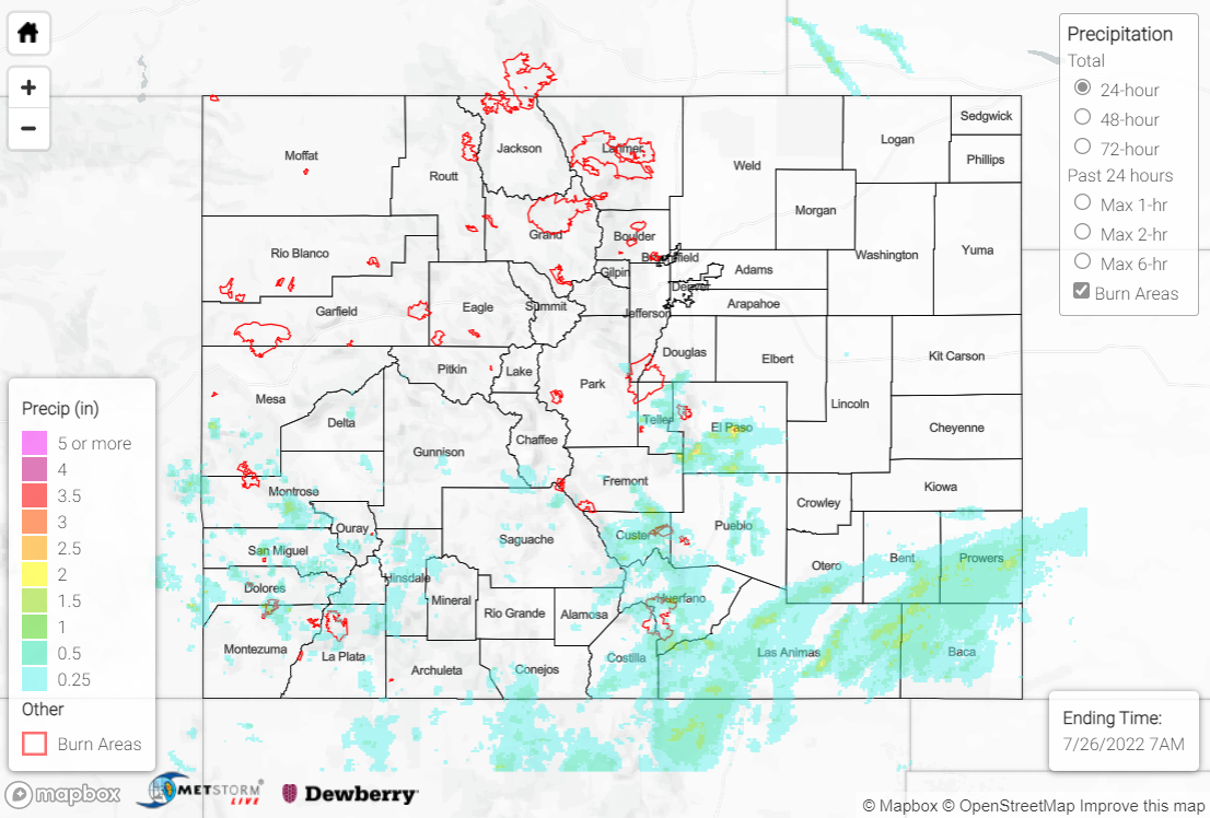
Northwest flow aloft led to drying on Monday across northern Colorado, while Sunday’s monsoonal moisture lingered over the southern half of the state. Showers and storms developed with diurnal heating by early afternoon across the high terrain south of I-70, while ascent along a surface boundary helped precipitation eventually extend across southern portions of the Southeast Plains.
The heaviest rain fell across the western Palmer Ridge and far southern Urban Corridor, where QPE data suggests localized amounts up to 2.50” were observed. Gauge observations in this vicinity include:
• 1.70” west of Colorado Springs Airport
• 1.20” east of Pueblo Memorial Airport
• 0.81” south of Fort Carson
At Colorado Springs Airport, 1.47” of that 24-hour total was observed in 30 minutes, which has an estimated ARI of over 21 years! Flash Flood Warnings were issued for southwest, south-central, and central El Paso County, as well as north-central Pueblo County. Local media relayed reports of minor road flooding in the Security-Widefield area; 1” hail was also reported west of Fountain.
Elsewhere, across the San Juans, Southeast Mountains, and Raton Ridge, QPE data suggests amounts of 0.50-1.50” were observed. For the southern Southeast Plains, rain gauge coverage is sparse, but QPE data suggests some locations received up to 2.00”. Noteworthy gauge observations in this region include:
• 1.09” near Trinidad Lake
• 0.97” near Trinidad
• 0.89” near Walsenburg
• 0.75” near Pagosa Springs
• 0.75” near La Veta
Several road flooding reports were received yesterday from the public and local law enforcement across Kit-Carson and Cheyenne Counties, but this flooding was a continuation from Sunday night’s heavy rainfall.
If you observe flooding in your area, remember to use the “Report a Flood” page to make any flood reports when you can safely do so. For precipitation estimates in our area, check out the map below.
