Issue Date: Monday, July 25th, 2022
Issue Time: 2:45PM MDT
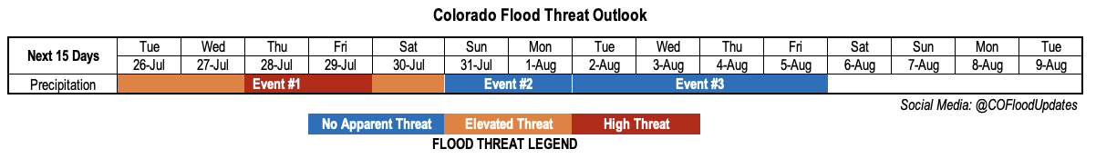
Valid Dates: 7/26-8/9
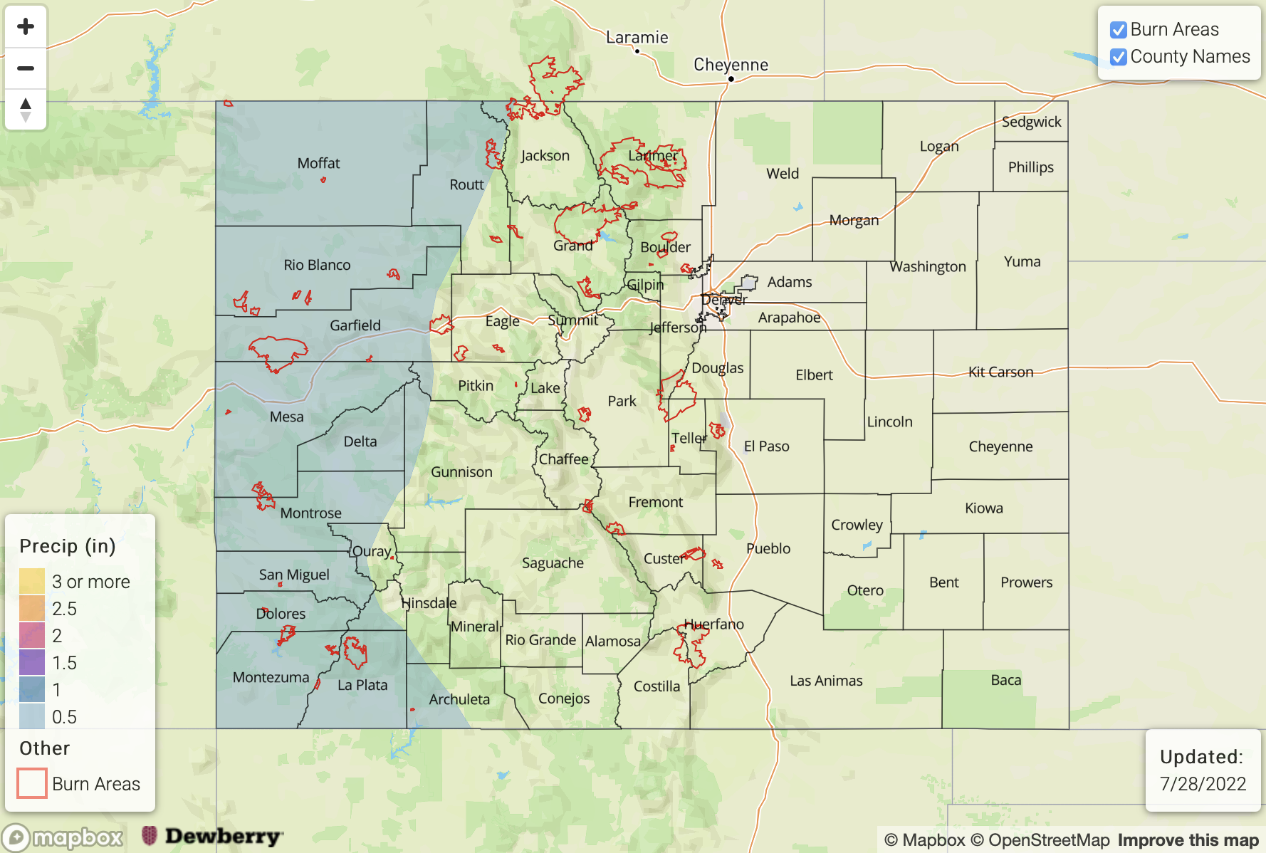
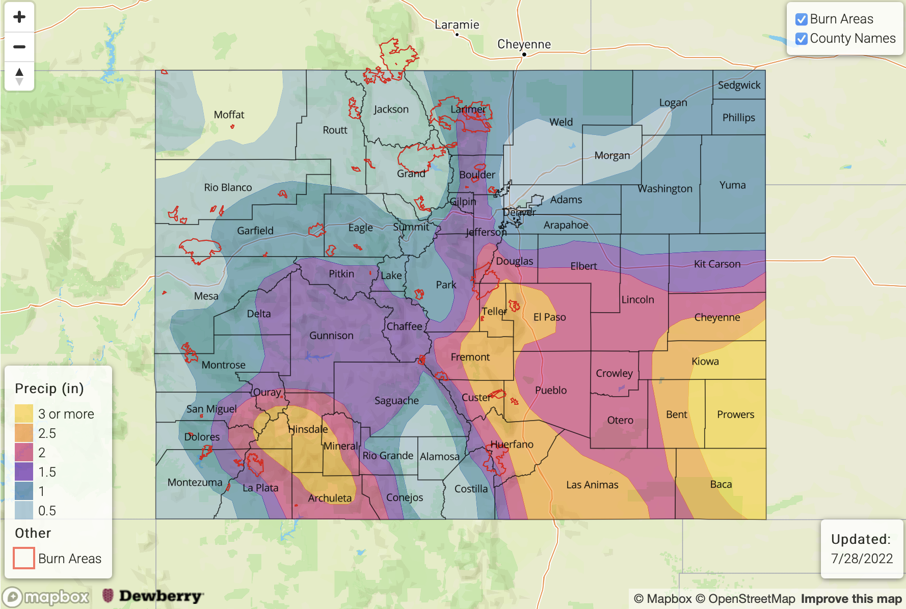
Shown below is the maximum daily estimated precipitation across Colorado since our forecast season started on May 1st. As we can see, it has been a busy season with 44 consecutive days of rainfall now observed since the early (but welcome!) start to the 2022 monsoon season. Moreover, as shown in the magnitude of the bars below, heavy rainfall (roughly measured by the 1 inch value) has been a recurring theme. Fortunately, the heaviest accumulations have been rather isolated in space, precluding significant flooding. Until now, that is. The past 24-hours of widespread heavy rainfall activity has been a foreshadowing to a very busy week ahead for Colorado.
It has now been 44 days since Colorado recorded a dry day statewide (last one was 6/10). We'll take that, over a #cofire threat, anytime. #cowx #coflood pic.twitter.com/bQQ156HwOz
— Colorado Flood Threat Bulletin (@COFloodUpdates) July 25, 2022
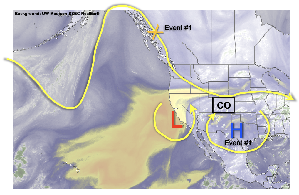
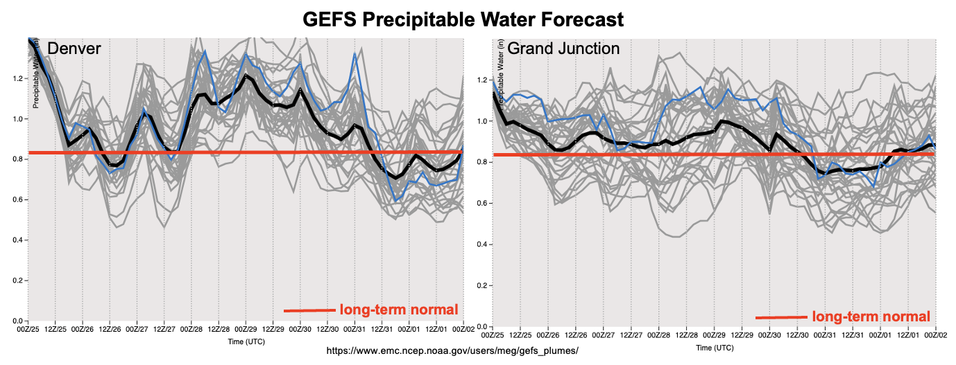
As shown below in this afternoon’s water vapor imagery, we will generally not have to stray far from home to see the main players in this week’s atmospheric circulation. By far the most important piece is the infamous upper-level ridge (often termed the “monsoonal ridge”). Anytime this feature is located east of Colorado, we are usually under an increased threat of heavy rainfall. The reason for this is due to the clockwise flow around the high pressure, deep subtropical or even tropical moisture can easily work northward into the Four Corners. Such will be the case over the next ~5 days or so. PW will gradually increase from the 0.9 – 1.3 inch range today to as high as 1.7 inches along our KS border by late Thursday (see forecast PW plumes, below)! Thus, we expect a prolonged period of heavy rainfall (Event #1) that will impact most of the state.
An Elevated flood threat is warranted for Tuesday and Wednesday as heavy rainfall will generally stay limited to the 30-60 minute duration. By Thursday, however, things turn interesting as a moist cool front drops south out of Canada (see “X” in the water vapor image above). A stalled frontal boundary will likely setup somewhere over eastern Colorado. To the north of this boundary, weak subsidence and limited instability will keep rainfall relatively light. This looks to be the case over the Northwest Slope, though the Northeast Plains may also fall into this category. Further south, however, with plenty of moisture, slow steering flow and sufficient instability, very heavy rainfall will be possible. In addition, there will be the chance of a prolonged period of heavy rainfall in the 3-6 hour duration, possibly longer, both Thursday and Friday. With antecedent wet soil conditions becoming more of a factor in limiting infiltration, runoff will be very efficient. This warrants a High flood threat for Thursday and Friday.
Notable drying and warmer weather is expected in the wake of Event #1, so that by Sunday, we stand a chance of seeing our first dry day statewide since June 10th. Thereafter, there is once again signs of another monsoonal moisture push, though at this time enough disagreement in guidance precludes a flood threat.
The identified precipitation events are described in more detail below.
Event #1: Tuesday – Saturday (July 26 – July 30)
Elevated Flood Threat Initially, With A High Threat Expected Later In The Week
Mainly higher elevation showers and storms are expected on Tuesday and Wednesday with 30-60 minutes of heavy rainfall expected. An Elevated flood threat is warranted with the chance of flash flooding, debris slides and mud flows. Some spillover of storms is anticipated into the Northeast and Southeast Plains, though at this time, flooding is not anticipated in these lower elevations.
By Thursday and Friday, almost all of the the higher terrain, especially east of the Continental Divide, will be under a threat of heavy rainfall mainly in the 1-3 hour duration. Max 3-hour rainfall approaching 2.5 – 3 inches could occur for elevations above 6,000 feet. Further east, storms are expected to grow into large complexes by the late afternoon. Heavy rainfall of 3-6 hour duration looks possible over mainly the Southeast Plains, though it’s possible the Northeast Plains will also be impacted. At this time, max 6-hour rainfall exceeding 4.5 inches looks likely at least over isolated parts of the Southeast Plains. In addition, the widespread nature of the heavy rainfall suggests a riverine flood threat will exist though mainly for smaller and medium-sized basins. A minor flood wave could certainly occur on the Arkansas River, but at this time it appears the main impacts at this scale will stay on the KS side of the border.
Conditions will begin to quiet down by Saturday, though an Elevated threat is still anticipated mainly for 30-60 minutes of heavy rainfall over the higher terrain of central and southern Colorado.
Event #2: Sunday – Monday (July 31 – August 1)
General Lull In Precipitation With Isolated Storms Along NM Border; No Apparent Flood Threat
Isolated storms are expected over the San Juan Mountains and Southeast Mountains on Sunday, with some northward increase possible into the Central Mountains by Monday. Rainfall amounts are expected to stay below 0.5 inches.
Event #3: Tuesday – Friday (August 2 – August 5)
Some Monsoon Moisture Returns, But No Apparent Flood Threat At This Time
Shower and storm coverage looks to increase into the widely scattered to scattered variety by Tuesday as monsoon moisture returns into the region. At this time, there is too much disagreement in guidance to issue an Elevated threat, so the next Outlook could update this. The best chances of storms will be over far western Colorado.