Issue Date: Friday, July 22nd, 2022
Issue Time: 9:30 AM MDT
Summary:
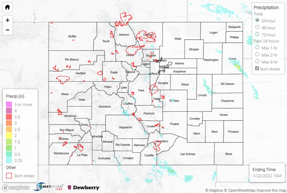
The heat continued Thursday with rising heights and warming temperatures aloft as the upper-level ridge shifted slightly eastward. Drier air, especially near the surface, was also able to work its way into the state. Together, the warmer temperatures aloft and drier air helped to suppress both convective intensity and coverage for most of Colorado. Nonetheless, isolated storms developed over the high terrain by midday, especially across the southern Front Range and into Park County. Convection remained confined to the mountains and foothills, with cells dissipating if they tried to move out into the adjacent Plains. Precipitation amounts were generally T-0.20” for the high elevations and Urban Corridor, although an automated station northeast of Ft. Collins reported 0.52”.
Farther east across the eastern Northeast Plains, better low-level moisture persisted, and two cells were able to produce heavier rainfall. Rain gauge coverage is sparse, but QPE data suggests localized totals of 1-2” across portions of northeast Lincoln and southeast Yuma Counties.
No flooding was reported yesterday; if you observe flooding in your area, remember to use the “Report a Flood” page to make any flood reports when you can safely do so. For precipitation estimates in our area, check out the map below.
