Issue Date: Thursday, July 21th, 2022
Issue Time: 11:15 AM MDT
Summary:
The weather across Colorado has been a broken record the last few days, and Wednesday was no exception. With the upper-level ridge remaining parked to our south, recycled monsoonal moisture continues to linger over the state, fueling daily rain chances. Showers and storms developed yesterday by late morning over the mountains and initially hugged the high terrain, before moving into the foothills and Plains later in the day as instability built at lower elevations. Upslope flow and diurnal heating, along with colliding outflow boundaries from collapsing storms, helped to initiate and maintain convection, while brief heavy rain, lightning, and gusty winds were the main severe weather threats. One report of 0.5” hail was received near Gypsum, while a mesonet station near Fort Carson measured a 58-mph gust. Temperatures remained above normal and hot for most of the state.
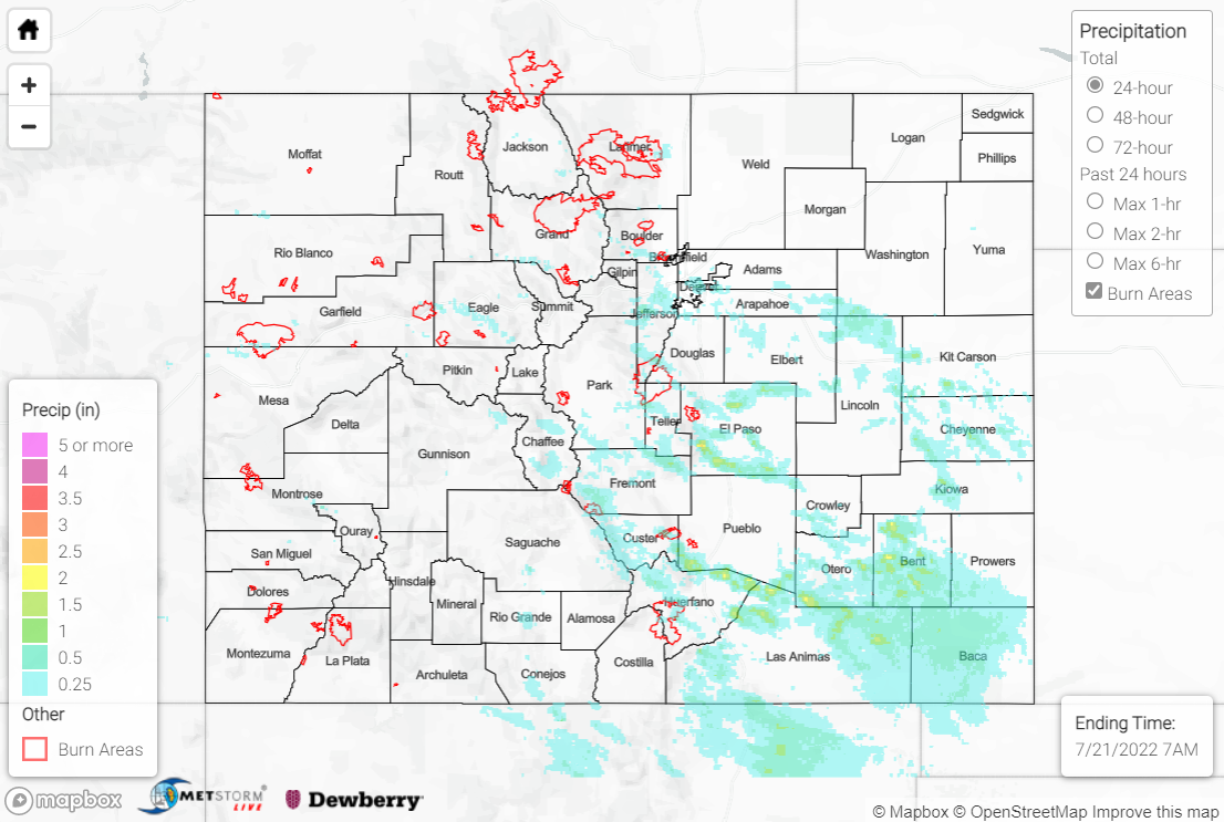
The heaviest rain fell in a swath from the southern Front Range/Urban Corridor southeastward across the Palmer Ridge and out into the western Southeast Plains. Here, QPE data suggests 0.50-1.50” of rainfall was observed under storms, with localized amounts exceeding 2”. Some noteworthy observations include:
• 1.21” at an automated station west of Fort Carson (at nearly 9500’ elevation!)
• 1.05” from a National Weather Service employee near Rye
• 1.04” from a CoCoRaHS observer near Colorado City
• 0.98” from a CoCoRaHS observer near Calhan
Farther north and west from the above swath, amounts were lighter, with locations that saw rainfall generally recording 0.30-0.60” or less. Flash Flood Warnings were issued for the Williams Fork burn scar, the Lake Christine burn scar (2018 fire), the Junkins burn scar (2016 fire), and south-central El Paso/northern Pueblo Counties, but no flooding was reported at any of these locations. Flood Advisories were also issued for a few locations, but again no flooding was reported.
If you observe flooding in your area, remember to use the “Report a Flood” page to make any flood reports when you can safely do so. For precipitation estimates in our area, check out the map below.
