Issue Date: Monday, July 18th, 2022
Issue Time: 3PM MDT
Valid Dates: 7/19 – 8/2
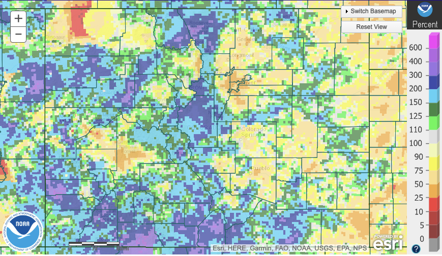
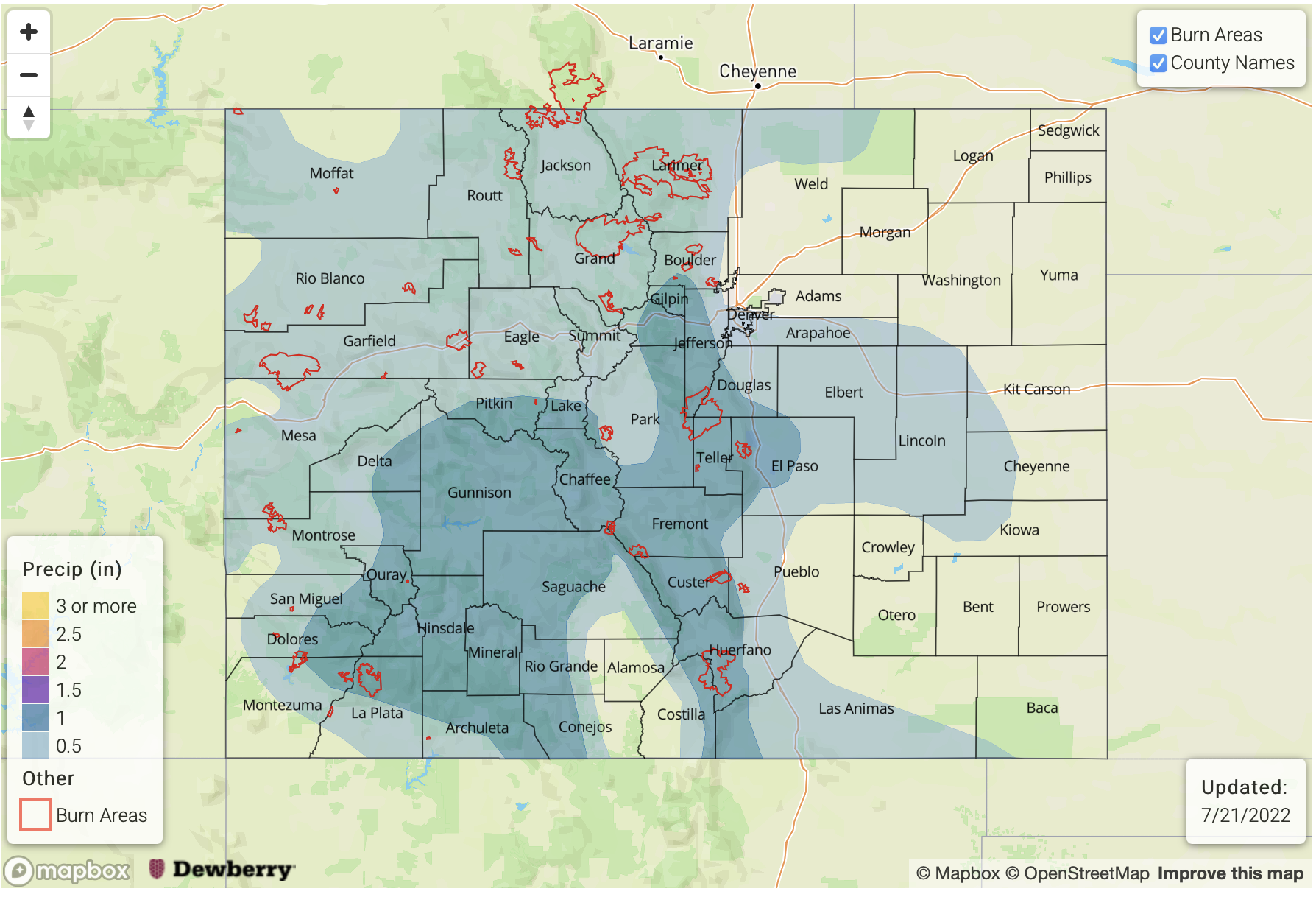
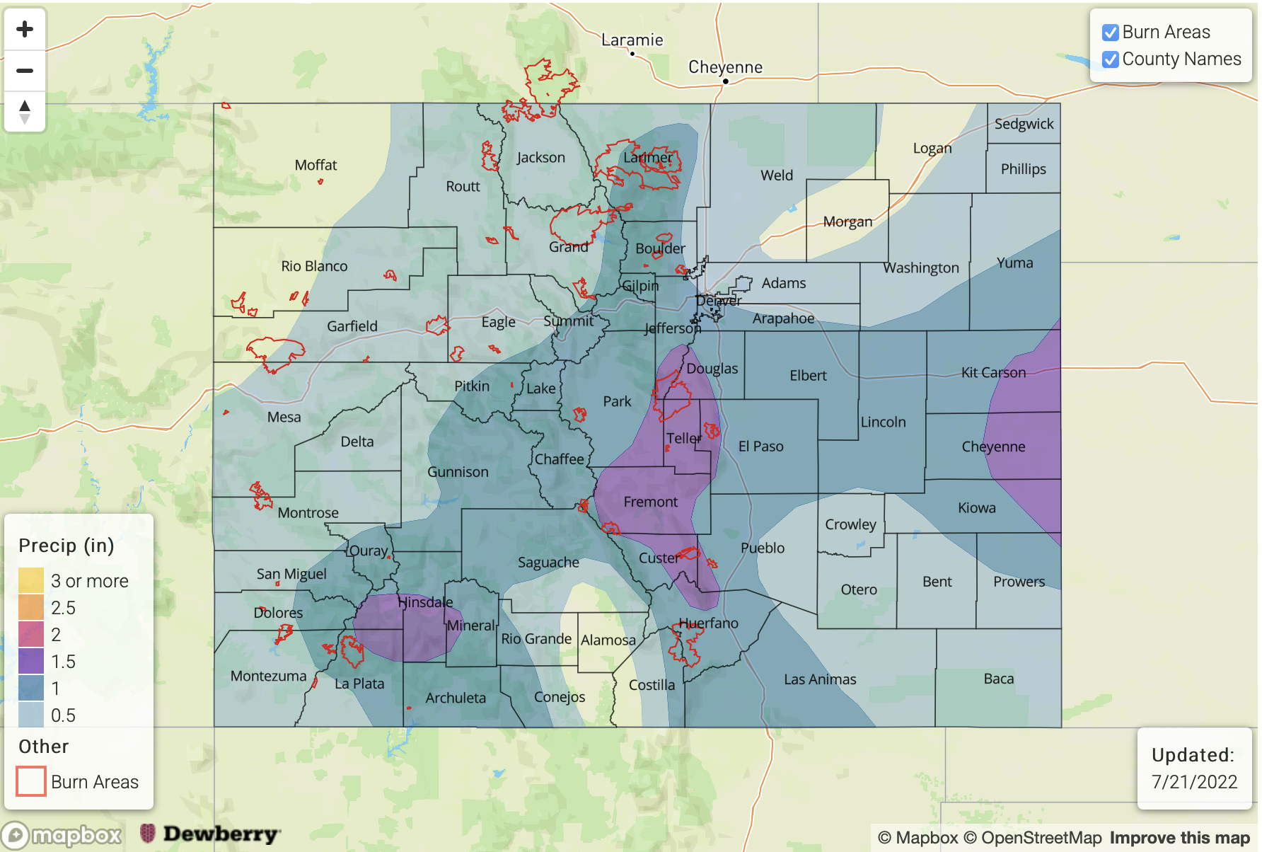
This summer has been an excellent example of how our unique terrain can “drive” its own circulation to produce heavy rainfall. But the most important ingredient required to accomplish this (much more important than in other parts of the country) is moisture. Moisture over the past ~30 days has been well above normal, both measured by PW over the total atmospheric column as well as in the boundary layer (measured by dewpoint temperature or low-level specific humidity). Yet, as shown below, if we look at total 30-day estimated rainfall departure as a percent of normal, it is clear that not everyone has benefited equally. More specifically, if we focus on areas that have received above normal rainfall, it is well correlated with elevation: higher areas have received much more than lower elevations. Although this is the case climatologically speaking, it is being significantly accentuated this summer.
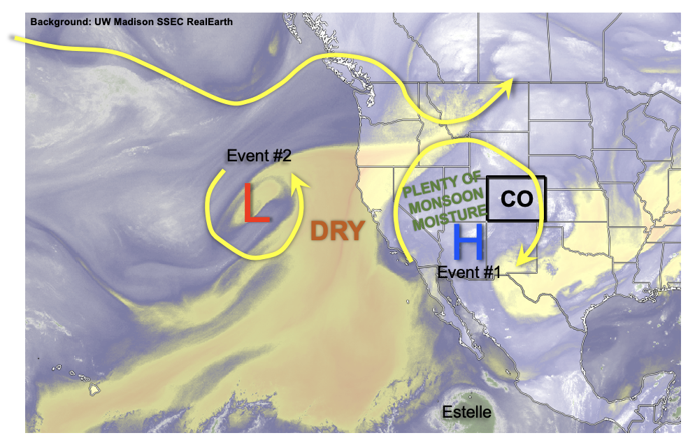
As we look at the water vapor image, below, it looks like this Outlook will feature a similar story: plenty of moisture along with a favorable monsoonal flow will continue to fuel daily afternoon and evening storm chances. However, they will likely be limited to the higher terrain (though an interesting setup next week may provide some much needed rain to the Northeast and Southeast Plains).
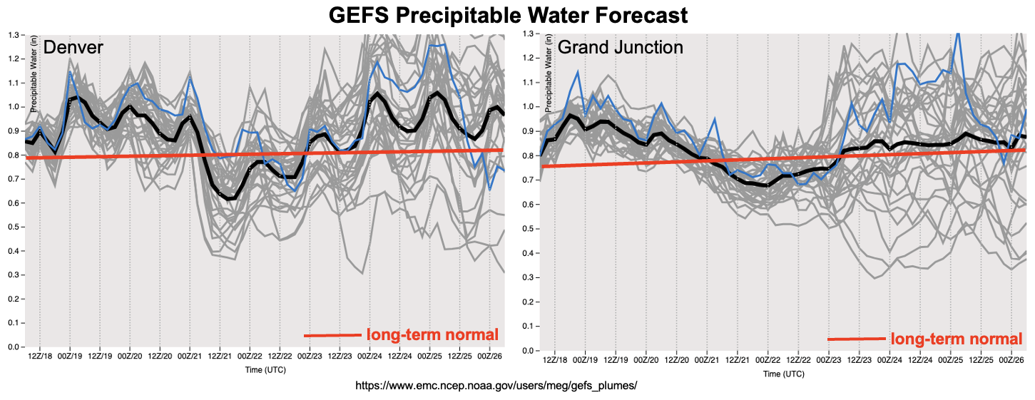
 As we see in the forecast PW plumes, below, note that the climatological averages (the red lines) are becoming nearly horizontal as we are finally approaching our highest expected moisture content over the entire year over the next 1-2 weeks! What we also note is that moisture will continue to run above normal levels for basically the entirety of this Outlook. This is occurring because of a favorable position of the upper-level monsoon ridge that will stay generally east of Colorado over the next 7-10 days. This promotes some southerly flow that is able to transport higher moisture from the moisture-rich monsoon hotspot of western Mexico.
Over the course of this week, we will see daily afternoon and evening storms mainly confined to the central higher terrain (Event #1), though there will likely be a brief downtick in storm coverage by Thursday and Friday. However, by Saturday, another strong push of monsoonal moisture will increase storm coverage and promote higher rainfall intensity. An Elevated flood threat is expected at least over the higher terrain. By early next week, things are looking a bit more interesting for areas further east as a cool front may drop southward and coincide with the monsoonal moisture. This type of setup could produce heavy rainfall chances statewide. If model trends continue to show this setup, there could be an upgrade to a High threat in the next Outlook.
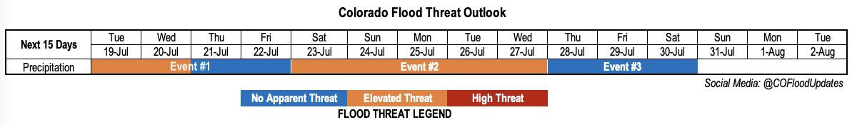
The identified precipitation events are described in more detail below.
Event #1: Tuesday – Friday (July 19 – July 22)
Low-end Elevated Flood Threat For Mainly Central Higher Terrain Through Wednesday, Then Rain Chances Decrease Temporarily
Scattered showers and storms are expected over mainly the central and southern higher terrain Tuesday through Friday. The highest coverage will be Tuesday and Wednesday, and max 30 and 60 minute rain rates exceeding 0.8 and 1.2 inches, respectively, will be possible warranting the Elevated flood threat. With a bit less moisture by Thursday and Friday, coverage will follow suit and a flood threat looks unlikely at this time.
Event #2: Saturday – Wednesday (July 23 – July 27)
Elevated Flood Threat First Over Higher Terrain, Then Possibly Over Plains; Upgrade To High Threat Possible
An increase in moisture will increase rainfall coverage and intensity by Saturday, starting mainly with the southwest and western higher terrain, then spreading eastward by Sunday. Max 1-hour rain rates exceeding 1.4 inches look likely, warranting an Elevated flood threat. By Monday and Tuesday, the approach of a cool front could provide additional dynamics to create a threat at the 3-6 hour duration (and upgrade to High flood threat) over the eastern Plains. However, even outside of that occurring, isolated heavy rainfall is expected along and east of the Continental Divide with max 1-hour rain rates likely exceeding 1.0 inch.
Event #3: Thursday – Saturday (July 28 – July 30)
No Apparent Flood Threat But Sufficient Should Keep Storms Around, At Least For Higher Terrain
Moisture should drop off notably after Event #2. However, it will continue to stay near seasonal normal. Isolated to widely scattered storms are expected over the climatologically preferred central and southern higher terrain. But there is No Apparent flood threat at this time.