Issue Date: Monday, July 17th, 2022
Issue Time: 10:15 AM MDT
Summary:
High pressure over the Four Corners region dominated weather across Colorado yesterday, limiting precipitation and maintaining very hot and dry conditions. Still, some late afternoon high-based storms were able to develop over the high terrain in the San Juan and Southeast Mountains, as well as the Southwest Slope. Calm low-level winds allowed for storms that did develop to remain largely stationary, increasing localized rainfall totals.
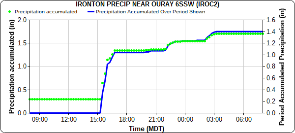
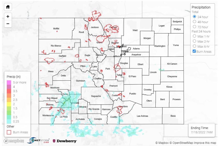
A MesoWest gage at Ironton, south of Ouray, picked up 1.14 inches of rain yesterday, with 1.04 of that falling in the two hours between 3:00-5:00 pm, as seen in the hyetograph below. A bit further north, 0.72 inches of rain was recorded at another MesoWest gauge on Dallas Creek near Ridgeway, with 0.61 of the daily total falling between 4:00-5:00 pm. CoCoRaHS observers across Ouray County reported 0.42-0.49 inches in the towns of Ouray and Ridgeway as well. Precipitation in the southwest tapered off through the evening, with just lingering widely-scattered showers in the Southwest Slope by nightfall. Precipitation totals in this area range from 0.05-0.25, with up to 0.41 reported from a CoCoRaHS observer in Mancos.
Gusty outflow winds from afternoon storms on the San Juan Mountains resulted in a few high-wind reports for non-thunderstorm wind gusts exceeding 45-mph at both Gunnison and Grand Junction regional airports. For the rest of the state, conditions were hot and dry, with temperatures in the upper 90s for the Eastern Plains, 80s for the high elevations, and upper 90s and even 100s for the Grand Valley and Western Slopes
Of note on today’s QPE map – the small area of 1-2 inch rainfall in Lincoln-Kit Carson-Cheyenne counites is from a radar artifact from a wind farm, not actual precipitation. For precipitation estimates in our area, check out the map below.

