Issue Date: Monday, July 18th, 2022
Issue Time: 9:30AM MDT
— Flooding is NOT expected today
— Fire-Burn Forecast Summary: 5 burn areas under LOW threat; click HERE for more info
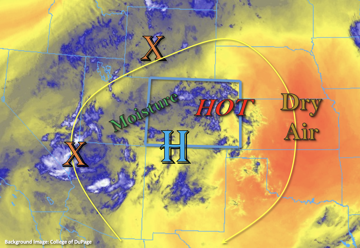
Afternoon high temperatures will be on the rise today, so expect a VERY hot day across the state thanks to the strong ridge overhead. A Heat Advisory has been issued for northeast Colorado (elevations below 6K feet) with the hottest temperatures expected over the eastern plains. Looking at the water vapor imagery, there is quite the dry air mass to our east, but a bit of moisture (blue shades) rotating around the High into Colorado. As a trough passes to our north, the High will be slightly pushed south, but plenty of moisture and mid-level energy should remain over the state along with WSW and westerly flow aloft. PW at Grand Junction was measured at 0.99 inches, so a decent increase from this time yesterday. This should allow scattered storms to develop over the western high terrains and mountains today as the typical diurnal flow pattern sets up with daytime heating. More isolated storms are expected over the adjacent eastern plains with PW at Denver estimated around 0.75 inches with values increasing to around 0.90 inches over the plains. For areas east today, the main threat today will be strong outflow winds that develop under the stronger storm cores.
Surface moisture, especially over western Colorado and the mountains, looks sizeable enough that some quick downpours will be possible with some mid-level lift also over the area. However, moderate steering flows associated with the passing trough should keep the threat from any given storm to around 20-40 minutes. Some isolated areas of training storms may help boost local accumulations, but rain rates should remain under flood threat criteria. Therefore, flooding is NOT expected today.
Today’s Flood Threat Map
For more information on today’s flood threat, see the map below. If there is a threat, hover over the threat areas for more details, and click on burn areas to learn more about them. For Zone-Specific forecasts, scroll below the threat map.

Zone-Specific Forecasts:
Central Mountains, Northern Mountains, Northwest Slope, Grand Valley, Southwest Slope & San Juan Mountains:
High temperatures today across the lower elevations will reach into the mid to upper-90°Fs with the century mark possible over the Grand Valley and far southwest corner of the state. Upper 70°Fs and 80°Fs are forecast for the mountain valleys. Best chance for storms today will be over the elevated mesas/plateaus and mountains with the best storm coverage over these central and northern forecast zones. Isolated, max 30-minute rain rates up to 0.85 inches will be possible. Where training storms set up (most likely around/near the Continental Divide, Flat Tops and Grand Mesa), isolated storm totals up to 1.4 inches will be possible over 2-3 hour period. With rain rates forecast to remain below flood threat criteria, flooding is NOT expected. Additional threats from the stronger thunderstorms that develop will be brief wind gusts around 55 mph and dangerous lighting.
Primetime: 12PM to 10PM
Front Range, Southeast Mountains, Palmer Ridge, Northeast Plains, Urban Corridor, San Luis Valley, Raton Ridge & Southeast Plains:
High temperatures are forecast to reach 80°Fs for the mountain valleys, upper 90°Fs to 100°F for the I-25 Corridor/elevated ridges and between 100°F and 105°F over the eastern plains. A Heat Advisory has been issued for elevations below 6K feet over northeast Colorado. As far as rainfall, thunderstorms and showers should be more widely scattered over these higher terrains with the best storm coverage anticipated over the southern Front Range, Southeast Mountains and elevated ridges. Max 30-minute rain rates up to 0.75 inches (west) and 0.85 inches (east) with isolated totals up to 0.9 inches will be possible. A couple stronger thunderstorm may develop over the border counties, but only if storms can make it there before instability drops off with the setting sun. The main threat from the stronger storms would be strong outflow winds with max 1-hour rain rates up to 1.25 inches possible. Flooding is NOT expected.
Primetime: 12:30PM to 11PM