Issue Date: Sunday, June 17th, 2022
Issue Time: 8:50AM MDT
— A LOW flood threat has been posted for parts of the San Juan Mountains
As easily seen in the water vapor image, below, significant drying has taken place across Colorado after a disturbance moved eastward out of the state over the past 24-hours. PW has dropped dramatically at Grand Junction from 1.22 inches yesterday to 0.79 inches this morning. As also seen in the water vapor image, a sliver of higher moisture remains right along the New Mexico border with PW likely in the 0.8 – 0.9 inch range. Closer to the surface, moisture is also maximized along the New Mexico border with dewpoints at 50F or higher at elevations as high as 8,000 feet. Steering flow remains weak and under the influence of the monsoonal upper-level ridge, which is now centered just east of the Four Corners. Steering of storms will be slightly southward to the east of the San Luis Valley but slightly northward over the San Juans, where the highest storm chances will be today. With not a cloud in the sky this morning, instability will quickly reach 1,000 J/kg CAPE or slightly higher over the southern higher terrain. With the sufficient moisture and slow steering flow, a LOW flood threat is warranted for the eastern portion of the San Juan Mountains where isolated heavy rainfall is expected with the strongest storms.
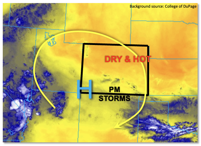
With lower moisture and weak subsidence elsewhere, the rest of Colorado will remain mainly dry today. Without the clouds to block out the summer sun, expect very hot temperatures with reading above 100F expected below 5,500 feet statewide. At least moisture will be lower today, making the heat a bit more bearable.
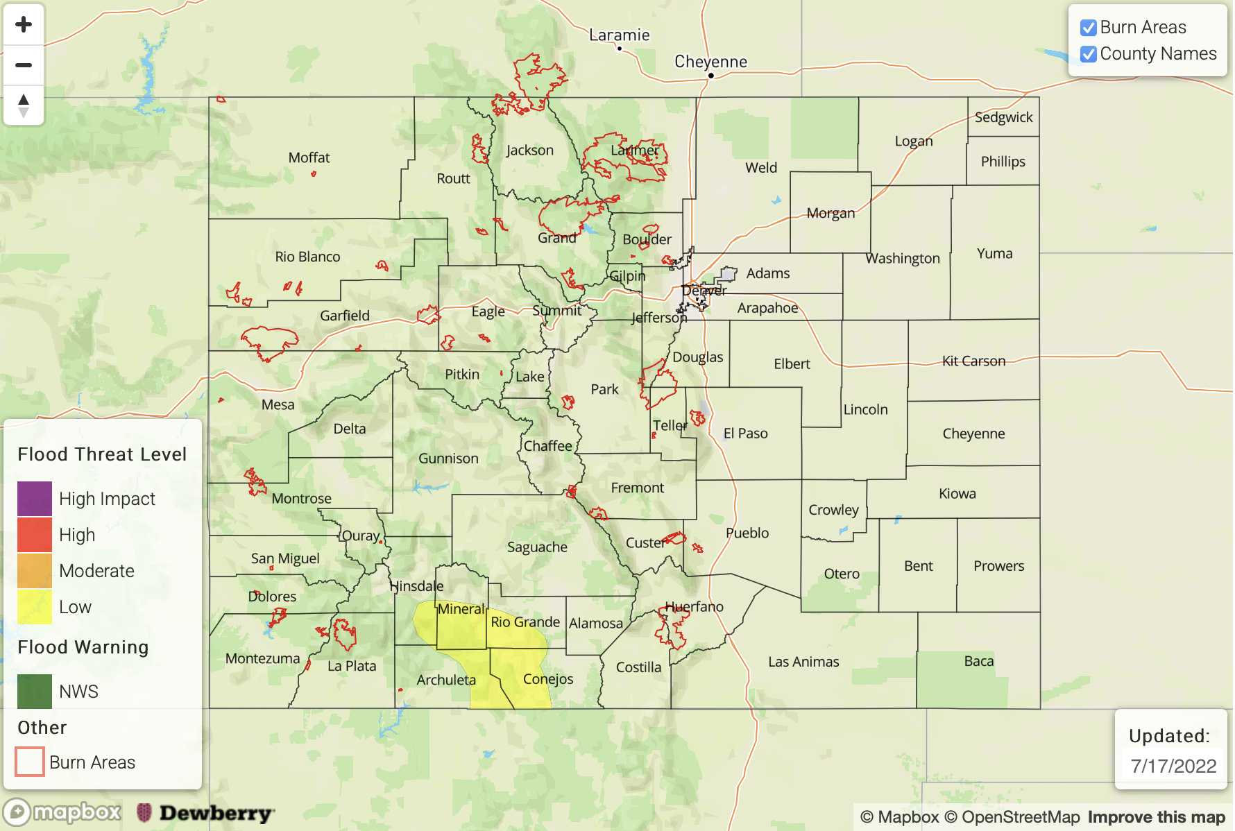
Today’s Flood Threat Map
For more information on today’s flood threat, see the map below. If there is a threat, hover over the threat areas for more details, and click on burn areas to learn more about them. For Zone-Specific forecasts, scroll below the threat map.
Zone-Specific Forecasts:
San Juan Mountains, Southwest Slope, Southeast Mountains & Raton Ridge:
Sunny early then partly cloudy with widely scattered showers and storms developing by early afternoon. Max 30-min rain rates up to 0.8 inches with max 1-hour rain rates up to 1.2 inches are possible mainly for elevations above 8,000 feet right along the New Mexico border. A LOW flood threat has been posted for parts of the region for isolated flash flooding, debris slides and mud flows. In the lower elevations, gusty winds up to 40mph could accompany the stronger storms.
Primetime: 1PM to 9PM
Northeast Plains, Southeast Plains, Front Range, Urban Corridor, Palmer Ridge, Northern Mountains, Central Mountains, Grand Valley, San Luis Valley & Northwest Slope:
Mostly sunny and very hot today with temperatures of 5-10F above normal, with readings above 100F likely across lower elevations. An isolated shower or storm cannot be ruled out along the Continental Divide over elevations above 9,000 feet. Max 30-min rainfall up to 0.3 inches is possible along with gusty winds, but flooding is NOT expected today.
Primetime: 1PM to 7PM