Issue Date: Thursday, July 14th, 2022
Issue Time: 10:45 AM MDT
Summary:
The warming trend continued Wednesday across the state as the upper-level ridge built westward. Conditions were drier but with a good amount of moisture remaining in place, scattered showers and storms developed in the high terrain by late morning from diurnal heating. Shear was much less than Tuesday which limited the severe weather threat, with only 0.25” hail reported near Stoner.
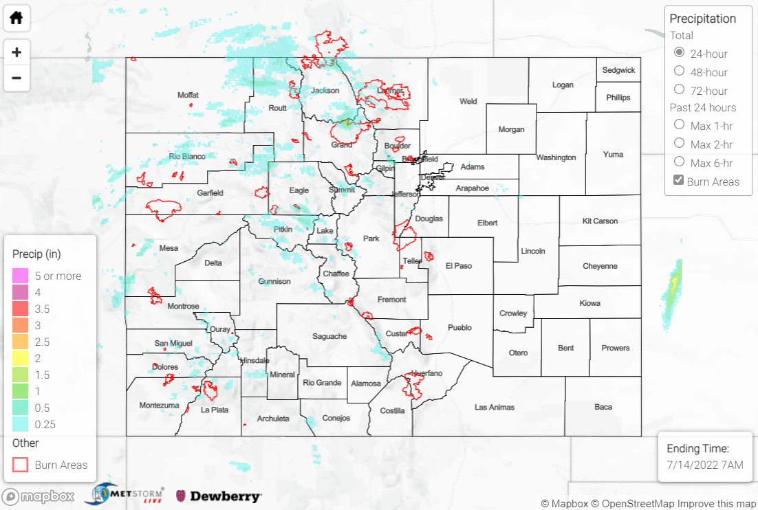
Precipitation was confined mainly northwest of a line from Durango to Denver, with the heaviest rain falling across the Northern Mountains. Amounts generally ranged from 0.25-0.50”, although locally heavier amounts up to and exceeding 1” were reported at some locations; Steamboat Springs saw 1.08”, while a station near Grand Junction measured 0.74”. Dry air across the lower elevations and Plains limited any precipitation to virga.
A Flash Flood Warning and Flood Advisory were issued for portions of the East Troublesome burn scar, but no flooding was reported.
If you observe flooding in your area, remember to use the “Report a Flood” page to make any flood reports when you can safely do so. For precipitation estimates in our area, check out the map below.
