Issue Date: Wednesday, July 13th, 2022
Issue Time: 10:45AM MDT
— A LOW flood threat has been posted for parts of the San Juan Mountains, Central Mountains, Northern Mountains and Northwest Slope
— Fire-Burn Forecast Summary: 4 burn areas under LOW threat; 3 burn areas under MODERATE threat; click HERE for more info
A typical mid-summer monsoonal pattern is seen in the atmosphere this morning over our state. However, as has been the theme since mid-June, one with plenty of moisture. A weak upper-level “monsoon ridge” continues to hang around the Four Corners, with ebbs and flows of moisture rotating clockwise around it. This morning, PW has increased notably in Grand Junction from 0.75 to 0.96 inches, though the boundary layer is only marginally moist (for lower elevation locations, that is). Overall, PW has increased into the 0.7 – 1.0 inch range across western Colorado, and was underestimated by 10-15% in this morning’s weather model initialization. Further east, some subtle drying was noted with PW falling by a few tenths of an inch into the 0.5 – 1.0 inch range across eastern Colorado. Closer to the surface, dewpoint temperatures in the 43-52F range were noted across western and southwestern Colorado. This is about 2-3F higher than yesterday morning (for a 1 degree increase in the dewpoint, CAPE instability can go up 100-200 J/kg depending on the moisture profile!). Moisture will remain steady or slightly increase over western parts of the state as a weak import of monsoon moisture is expected from the southwest.
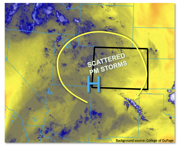
With nearly clear skies statewide this morning, we expect a quick warm up this morning with scattered to locally numerous showers and storms developing over most of our western higher terrain. With the aforementioned above normal moisture, slow steering flow and CAPE instability of up to 900 J/kg, locally heavy rainfall will be possible mainly above about 7,500 feet. A LOW flood threat is warranted for 30-60 minute heavy rainfall capable of producing flash flooding, debris slides and mud flows over the steeper terrain. Rainfall from storms will likely have a hard time making it down into the lower elevations. Thus, the flood threat is distinctly limited to higher elevation locations today.
Further east, some drying of the atmosphere and a lack of dynamics will reduce precipitation chances. However, isolated storms are still expected to come off the higher terrain to produce short-term moderate/heavy rainfall along with gusty winds. With higher flash flood thresholds though, flooding is not anticipated over the lower elevations of eastern Colorado today.
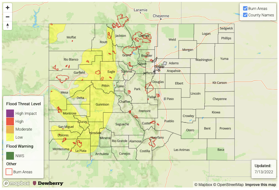
Today’s Flood Threat Map
For more information on today’s flood threat, see the map below. If there is a threat, hover over the threat areas for more details, and click on burn areas to learn more about them. For Zone-Specific forecasts, scroll below the threat map.
Zone-Specific Forecasts:
Northern Mountains, Central Mountains, Grand Valley, San Juan Mountains, Southwest Slope, San Luis Valley & Northwest Slope:
Mostly sunny early then partly to mostly cloudy and warmer with scattered to numerous showers and storms developing by early afternoon. Highest coverage will be over the higher terrain above 7,500 feet. Max 30-minute rainfall up to 0.9 inches is possible, with max 1-hour rainfall up to 1.2 inches. A LOW flood threat has been posted for most of the higher terrain for isolated flash flooding, debris slides and mud flows.
For lower elevations, gusty winds of 30-40 mph could also accompany the storms.
Primetime: 1PM to 9PM
Northeast Plains, Southeast Plains, Front Range, Urban Corridor, Palmer Ridge, Southeast Mountains & Raton Ridge:
Mostly sunny and warmer today with isolated to widely scattered storms possible mainly near the foothills. Max 30-minute rainfall up to 0.7 inches (west) and 1.0 inches (east) with max 1-hour rainfall up to 0.9 inches (west) and 1.4 inches east. Some nuisance ponding of rain is possible today but flooding is NOT expected. Gusty winds up to 40mph could accompany the strongest storms.
Primetime: 1PM to 10PM