Issue Date: Tuesday, July 12th, 2022
Issue Time: 10:45 AM MDT
Summary:
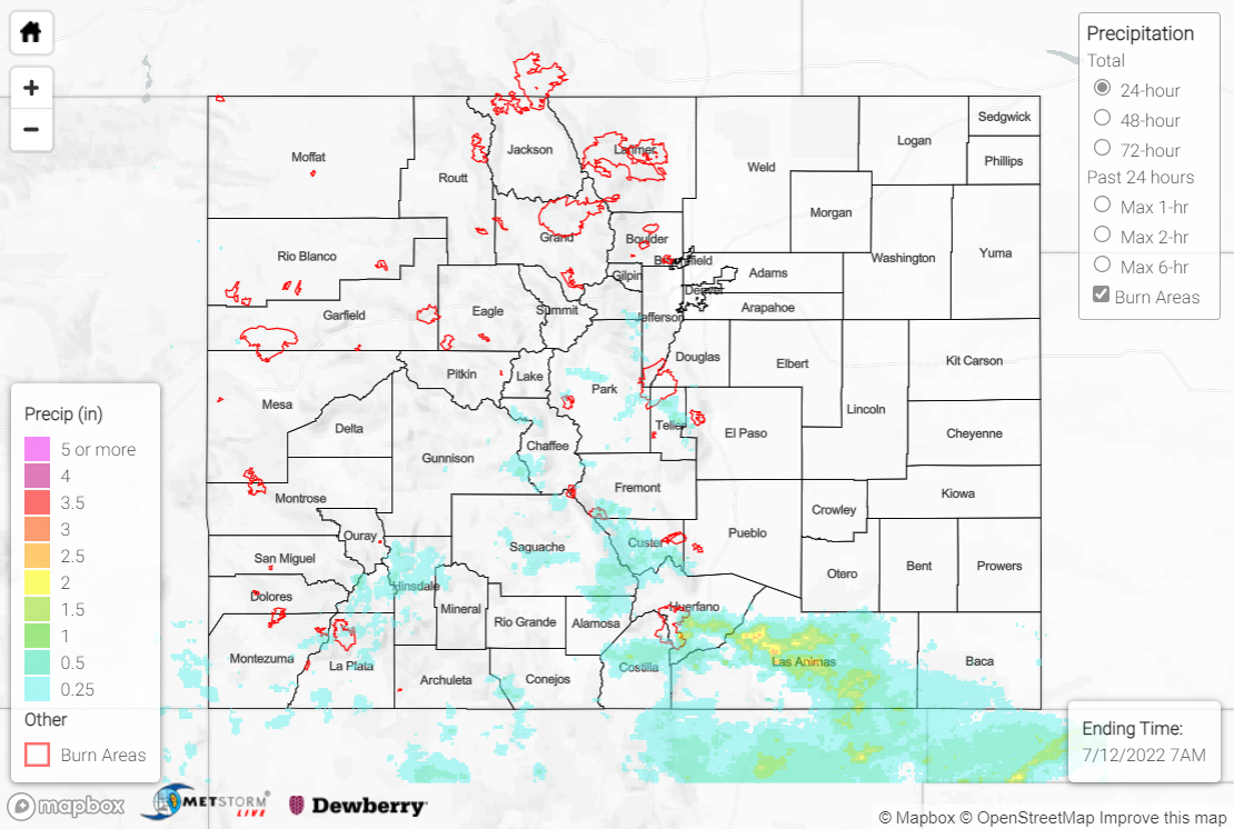
A cold front swept across the state Monday morning, shunting moisture and instability southward toward the New Mexico border. The stable post-frontal airmass precluded precipitation across the Plains and lower elevations, but storms were able to develop by mid-afternoon in the high terrain over and near the Sangre de Cristo Mountains. Storms remained confined to high elevations, with up to 1” of rain falling across portions of the southern Front Range (as far north as Pikes Peak), while 1-2” of rain (and localized amounts of 3+”) were observed across the Southeast Mountains and Raton Ridge.
Some of the storms across the Southeast Mountains and Raton Ridge produced extremely heavy rainfall rates. Flash Flood Warnings were issued for portions of central/south-central/southeast Huerfano, western Las Animas, and east-central Costilla Counties, including most of the Spring Creek burn scar. Emergency management personnel reported flash flooding along Highway 12 near mile marker 13, with the road closed due to water covering the highway; no debris flows were reported, however. The Indian Creek rain gauge on the burn scar measured 3.16” of rain in 54 minutes, which has an estimated ARI of over 1000 years! A mesonet station near La Veta measured 1.53”, while a CoCoRaHS observer near Walsenburg reported 1.30”.
Another Flash Flood Warning was issued for portions of southwest Fremont and northeast Saguache Counties, including portions of the Hayden Pass burn scar from 2016. Emergency managers reported mud and debris flowing across County Road 40 at Dinkle Ditch.
West of the Divide and south of I-70, storms were highly isolated and amounts were light (T-0.25″). One cell south of Telluride prompted a Flash Flood Warning for portions of northwest San Juan and eastern San Miguel Counties, but no flooding was reported.
If you observe flooding in your area, remember to use the “Report a Flood” page to make any flood reports when you can safely do so. For precipitation estimates in our area, check out the map below.
