Issue Date: Monday, July 11th, 2022
Issue Time: 3PM MDT
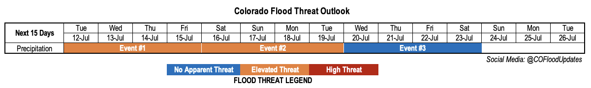
Valid Dates: 7/12 – 7/26
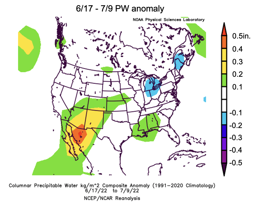
It has now been about one month since Colorado has recorded a statewide dry day. Now, it is true that some locations have benefited far more than others. For example, large parts of southern and southwestern Colorado have gotten 2-3 times their normal rainfall over the last 30 days. But fortunately (and most people will agree, we think), it looks like that wet streak will continue for a majority of this Outlook. As expected and shown below, the rainfall streak has been associated with an abundance of moisture as measured by PW. A long axis of above normal PW can been originating over the western Mexican highlands and stretching northward into mainly southern Colorado.
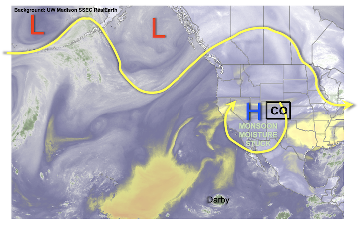
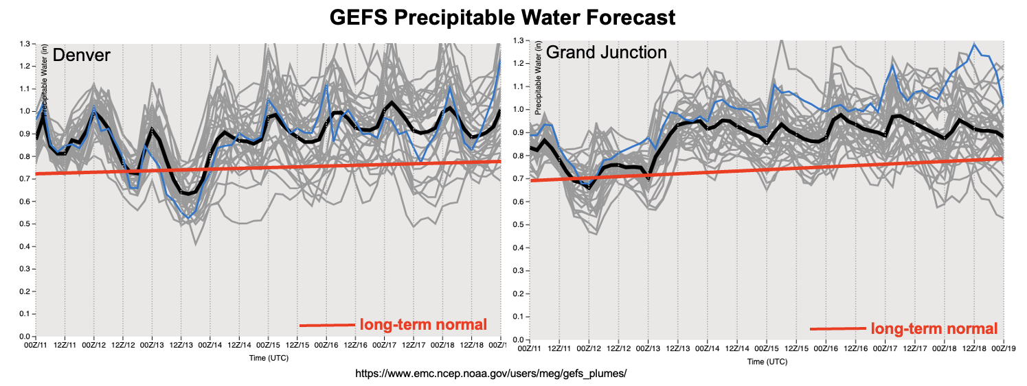
As shown in the water vapor image and GEFS forecast PW plumes, below, above normal moisture will be the continued feature in our weather through essentially the entirety of this Outlook. With little to no large-scale forcing to speak of, our weather will be driven by (1) the wobbling in strength and position of the upper-level ridge and embedded small-scale disturbances and (2) the degree of boundary layer and total column moisture that will be available for storm formation. All indications are that PW will remain in the 0.7 – 1.3 inch across Colorado over this Outlook. This is quite a bit above normal. Furthermore, boundary layer moisture also appears to plentiful with dewpoint temperatures in the 40s and 50s F across most of the state and exceeding 60F along our eastern border. Unfortunately, with this kind of steady-state pattern, there is less ability to resolve individual events. However, the main takeaway is that there is very likely to be a continuous Elevated flood threat for mainly the southern and central higher terrain through at least early next week. Check back each morning for daily Bulletin updates that will hone in on particular details.
In addition to above normal moisture, we also expect generally above normal temperatures over this Outlook (after today’s brief cooldown for northeast Colorado). However, the degree of heat will be largely determined by cloud cover and precipitation coverage. At this time, the highest probability for sustained heat will be along the eastern border where the lowest precipitation chances are expected.
The identified precipitation events are described in more detail below.
Event #1: Tuesday – Friday (July 12 – July 15)
Elevated Flood Threat As Daily Higher Terrain Storms Will Be Capable Of Heavy Rainfall
With PW running well above seasonal normal, morning sunshine and plenty of boundary layer moisture will fuel scattered to numerous showers and thunderstorms each day. The region with the highest chances is likely to change daily but overall, the best chances of storms will be over the higher terrain of the Central Mountains, San Juan Mountains, Southeast Mountains with possibly some spillover into the Palmer and Raton ridges.
Maximum 30-minute rainfall intensity of 1.0 inch is expected daily, which will be capable of producing isolated flash flooding, debris slides and mud flows.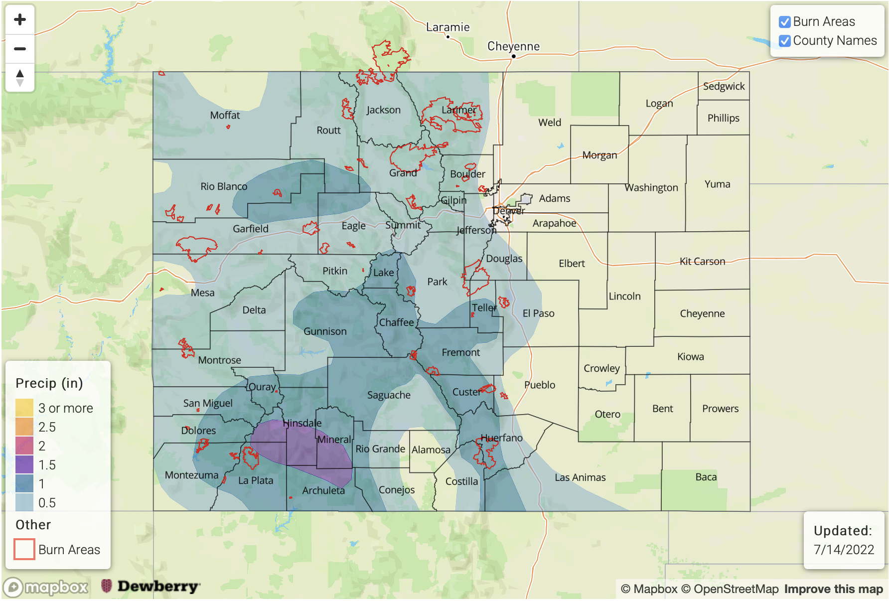
Event #2: Saturday – Tuesday (July 16 – July 19)
Continued Elevated Flood Threat With Precipitation Chances Also Extending Further East
The overall setup for this event will be similar to Event #1, although guidance suggests an increase in rain chances over the foothills of the Front Range, Palmer Ridge and Raton Ridges possibly associated with weak cool front passage. The primary storm type appears to be short-term convection with localized heavy rainfall of 30-60 minute duration. Maximum 30-min rain intensity of 1.0 inch and 60-min intensity of 1.5 inches looks possible. However, given the anticipated wet soils after Event #1, there could be an enhanced risk of small creek and stream flooding from efficient runoff. Over the course of Events #1 and #2, lucky higher terrain locations could pick up over 4 inches of rainfall!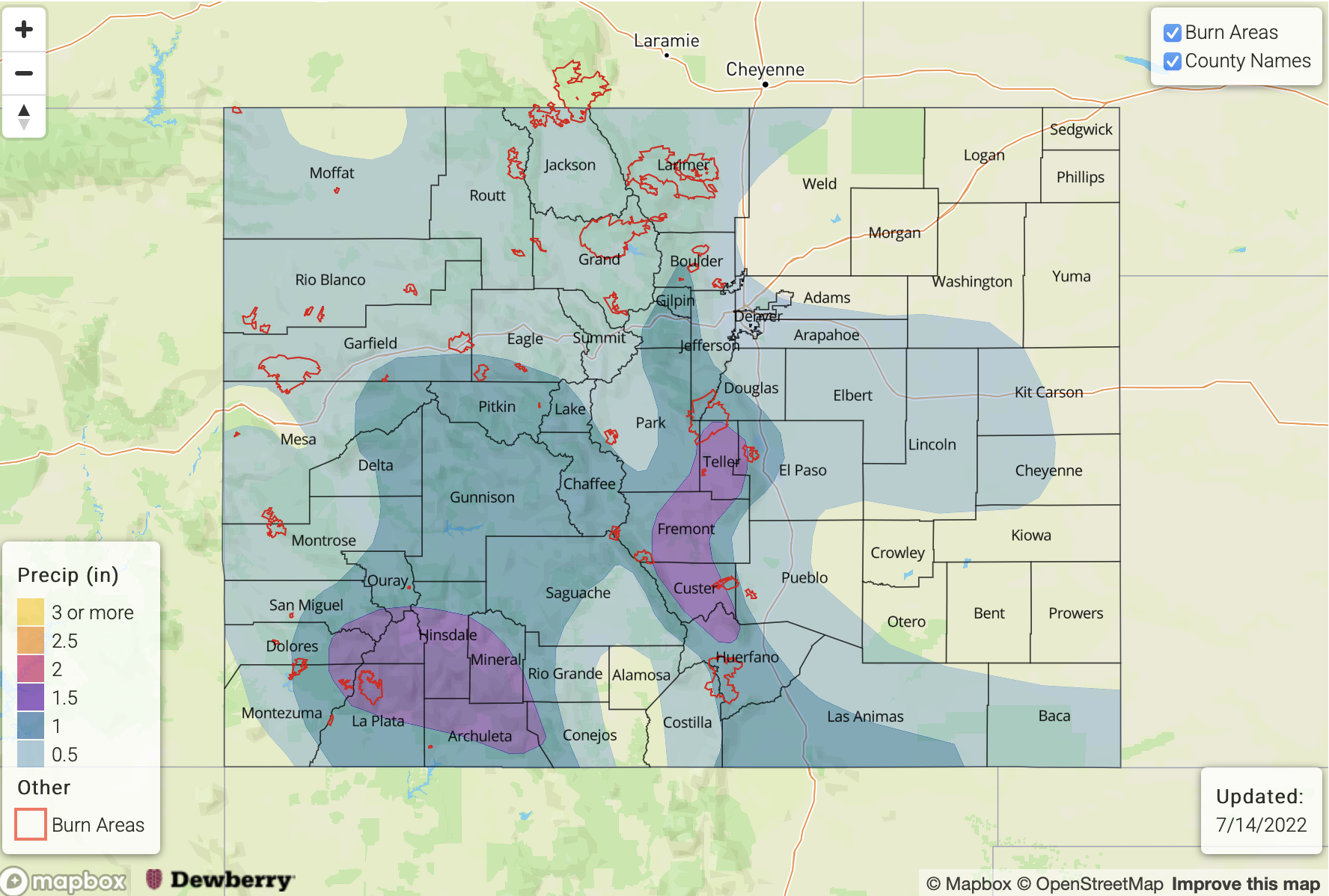
Event #3: Wednesday – Saturday (July 20 – July 23)
Precipitation Chances Look To Continue But With Uncertainty In Moisture, No Apparent Flood Threat
There is an increase in uncertainty beyond Event #2 with some guidance suggesting a drying atmosphere from the northwest, while other guidance points to a possible influx of moisture. At this time, there is No Apparent Flood threat though at least isolated shower and storm coverage looks likely for Colorado.