Issue Date: Tuesday, July 5th, 2022
Issue Time: 11:00 AM MDT
Summary:
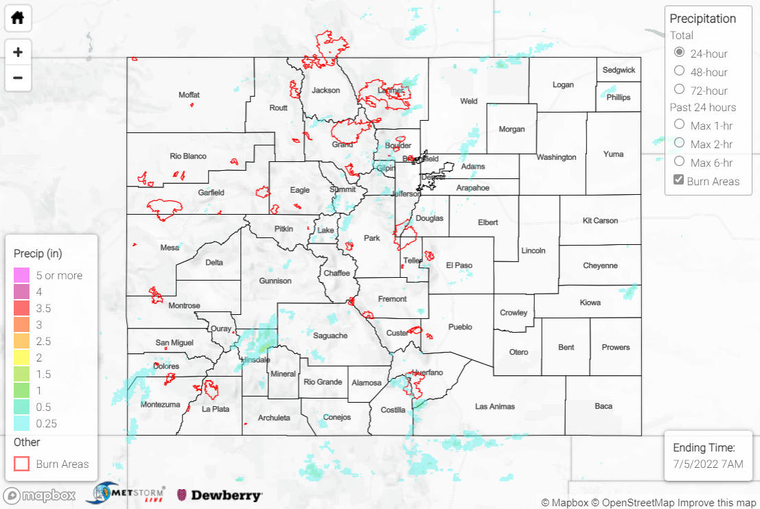
Independence Day was nearly a carbon copy of the synoptic setup of the past several days, albeit with slightly less moisture and instability. Subtropical moisture nonetheless remained overhead, and convection developed over the high country by early afternoon. Storm coverage was less than Sunday owing to the slightly drier atmosphere.
Showers and storms were confined to the mountains, valleys, and foothills across the state, with the eastern Plains remaining largely dry. The heaviest precipitation fell over the Front Range, Urban Corridor, and San Juan Mountains, where amounts of 0.25-0.50” were observed. Isolated totals of 0.75-1.25” were observed under some of the most intense cells, per QPE data.
Sparse storm coverage and lower precipitable water values limited the flooding threat yesterday, with only one Flood Advisory issued for small stream flooding in Larimer County.
Several fires were reported yesterday across the state as a result of firework usage, especially within the Denver metro area. Thankfully, fire crews were able to contain the fires quickly, including this brush fire near Aurora:
Update: 3rd Alarm Fire with homes threatened. Firefighters actively battling this fast moving fire. Gusty outflow winds making the operations especially challenging and dangerous. @ArapahoeSO @AuroraFireDpt pic.twitter.com/QXdROcs6eC
— South Metro Fire Rescue (@SouthMetroPIO) July 5, 2022
There was no flooding reported yesterday. For precipitation estimates in our area, check out the map below.
