Issue Date: Monday, July 4th, 2022
Issue Time: 11:45 AM MDT
Summary:
With an upper-level ridge centered to our south and east, broad south/southwesterly flow aloft kept a rich plume of moisture overhead, with precipitable water values once again 150-200% of normal. Weak lift associated with disturbances crossing the state, as well as additional lift from the right entrance region of a jet streak, helped to spark showers and storms over the mountains and valleys by mid-afternoon on Sunday.
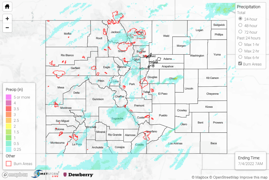
Locations that experienced showers and storms generally saw 0.25-0.75” of rainfall, with locally higher amounts observed under more intense storms. The heaviest rainfall across the state fell over the Palmer Ridge in Elbert County, where localized amounts exceeding 2.00” were observed, per QPE data.
The Boulder WFO issued three Flash Flood Warnings yesterday. Warnings were issued for central Larimer County, east-central Larimer County (including southeast portions of the Cameron Peak burn scar), and north-central Boulder County (including portions of the Calwood burn scar). Several Flood Advisories were also issued by the Boulder WFO, mainly for small stream and arroyo flooding. The Boulder Office of Emergency Management surveyed the Flash Flood Warning areas and thankfully found no flooding or debris flows; this is impressive, considering an automated gauge just west of the Calwood burn scar measured 0.43” of rainfall in 6 minutes!
There was no flooding reported yesterday. For precipitation estimates in our area, check out the map below.
