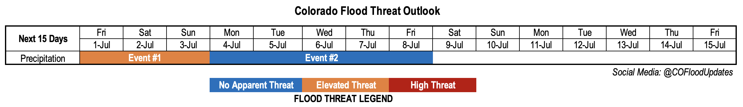
Issue Date: Thursday, June 30th, 2022
Issue Time: 2PM MDT
Valid Dates: 7/1-7/15
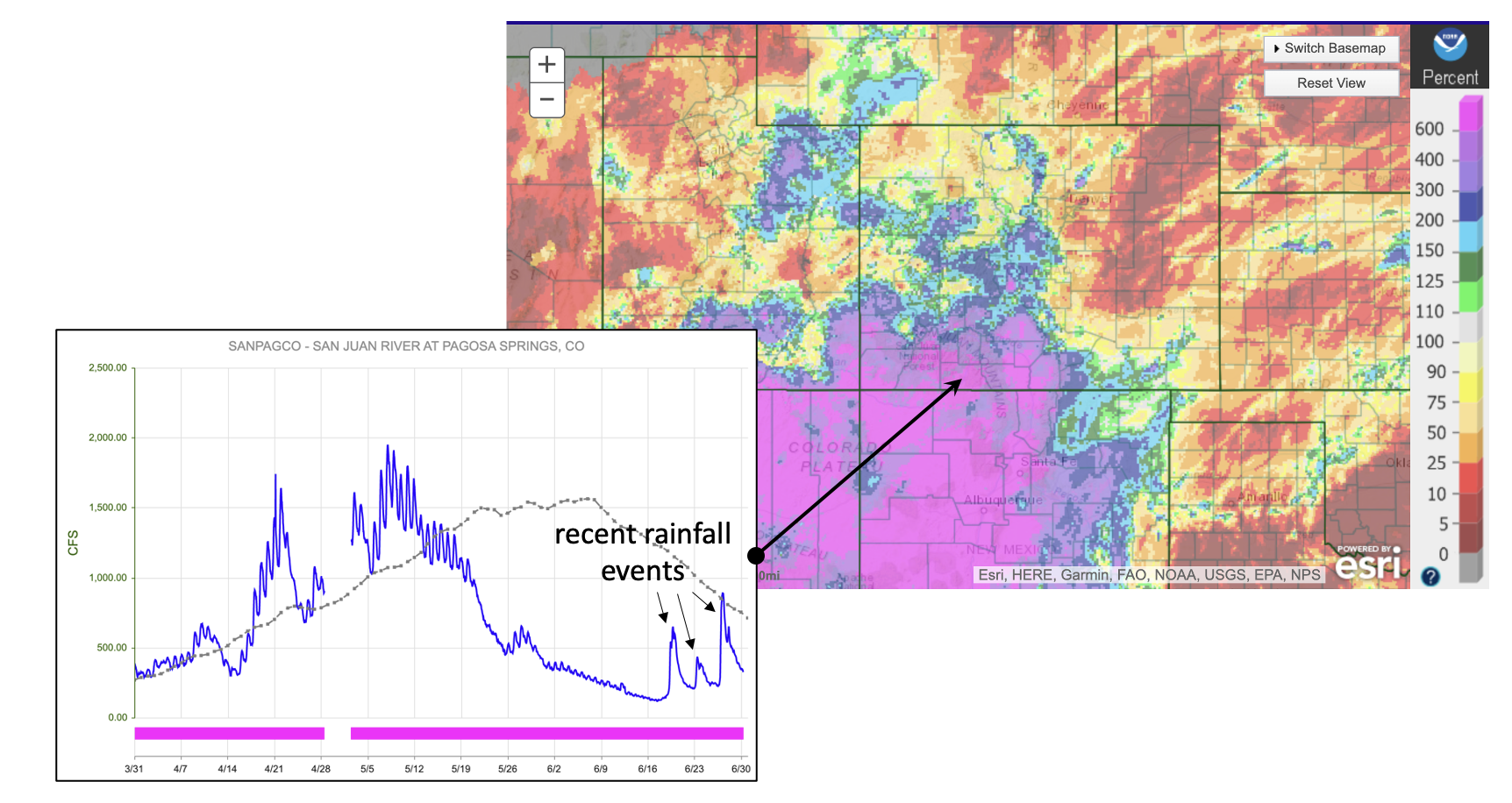
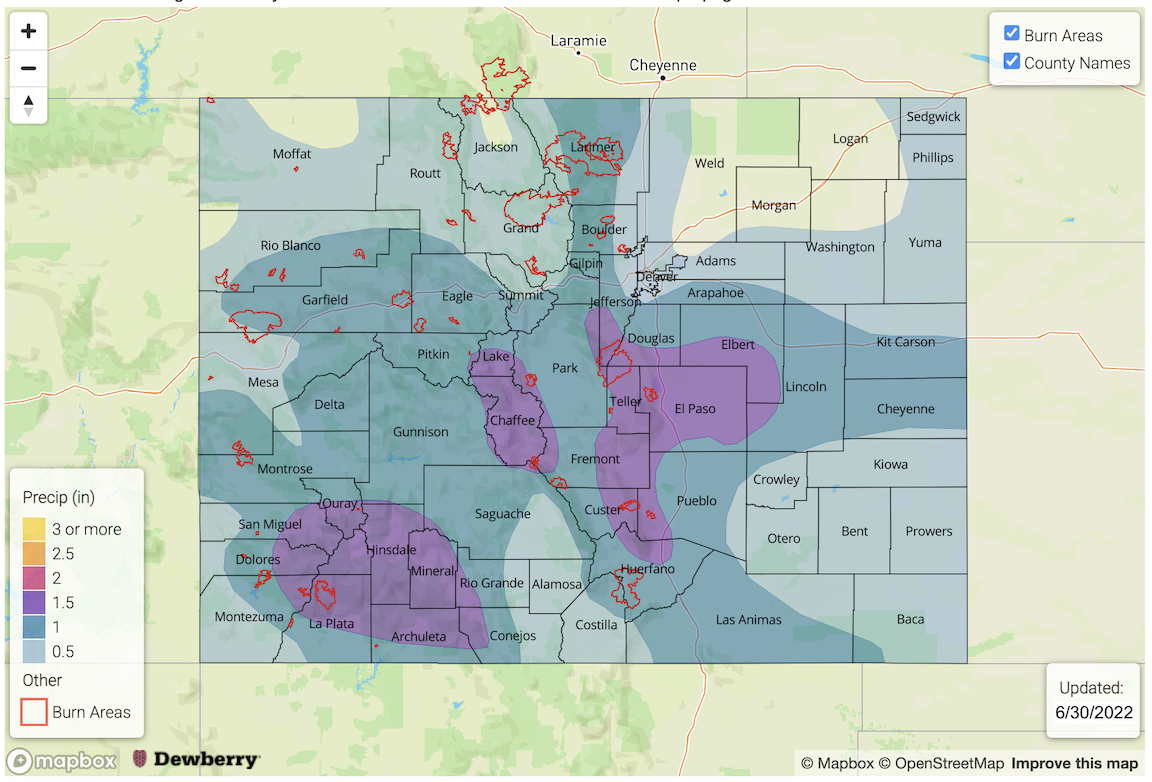
Mother Nature could not have done a bigger favor for southwest Colorado this June. With the early snowmelt and dry spring conditions in the San Juan Mountains, all concerns were focused on the building drought and possible wildfire potential there. Instead, as shown below, a majority of the region received 200-500% of their normal June precipitation. Some of these statistics are probably an overly generous depiction of the wetness, given that June is a typically a drier transition month (i.e. the divide by a small number effect). Nonetheless, as shown below for the San Juan River as an example (note 3 recent rain-related spikes of 500, 200 and 600 c.f.s.), almost all major rivers in southwest Colorado saw multiple spikes in streamflow during a time when average streamflow is typically quickly receding post snow-melt.
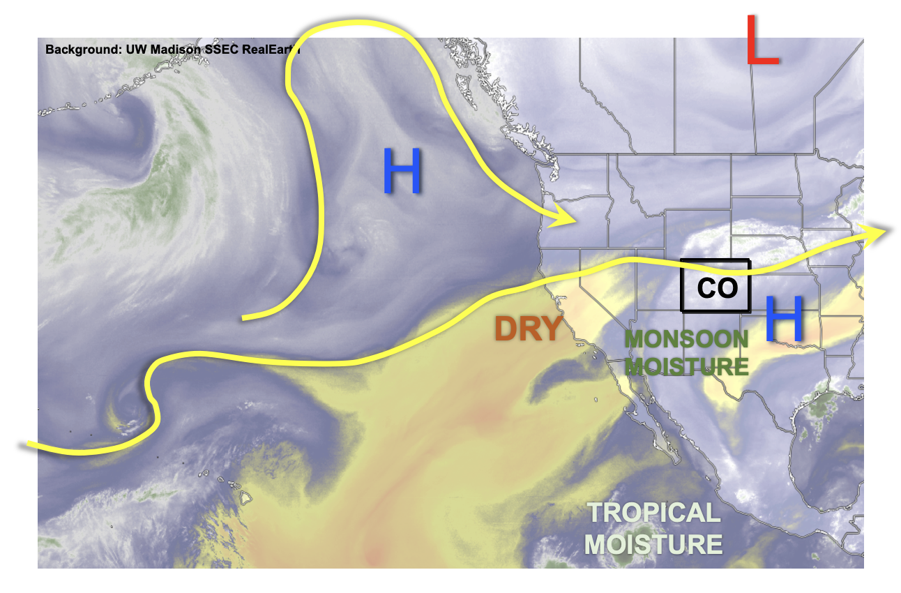
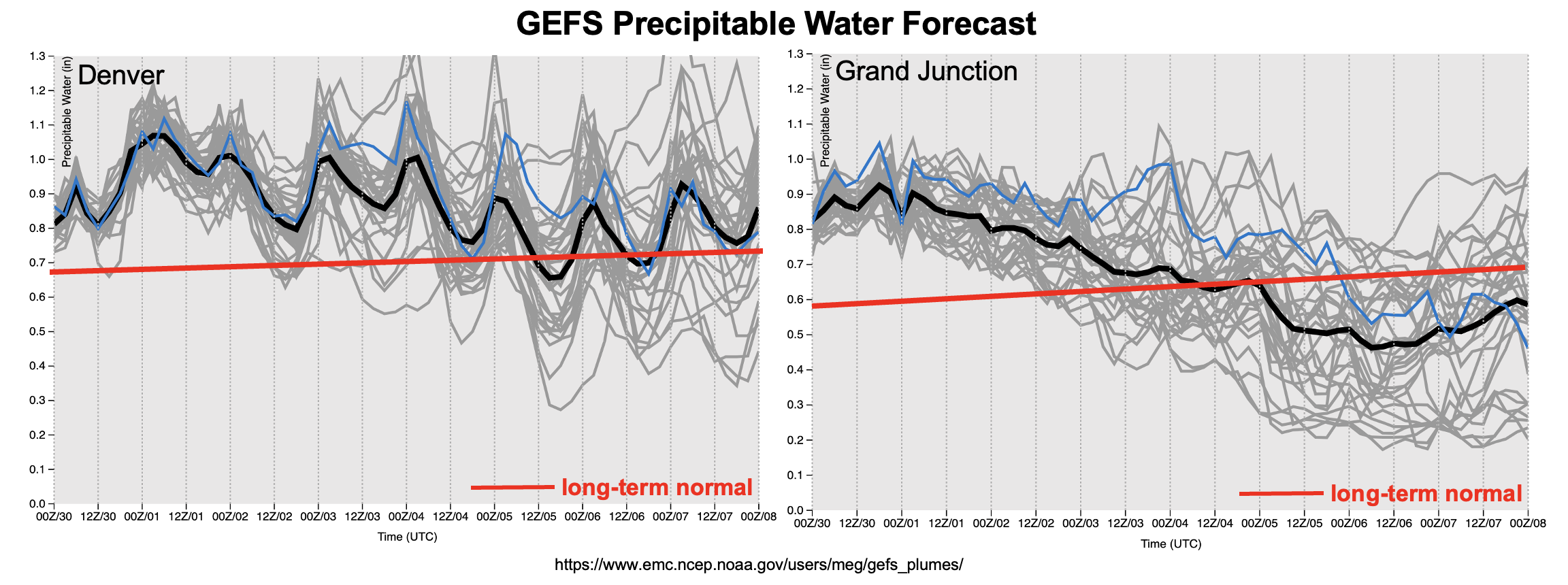
Switching back from hindcast to forecast mode, the water vapor image, below, shows a continuation of a relatively familiar pattern the Colorado has witnessed for about 2 weeks now. A week upper-level ridge is centered over the US Great Plains, around which clockwise flow is continuously directing monsoon moisture into our state. In fact, a (weak) connection all the way to the tropics is helping this cause. While moisture is by no means overwhelming, it will plenty enough to result in widely scattered to numerous showers and storms, depending on a given day’s subtler features, at least across our higher terrain (Event #1). Further helping this cause will be a cool front that will move across mainly eastern Colorado today and stall near the New Mexico border by Friday. While the lower temperatures behind this front will limit instability somewhat, the increase in moisture will offset this and still support widespread storm activity over mainly the central and southern higher terrain on Friday with some spillover onto the Southeast and Northeast Plains. By Saturday and Sunday, storms should be mainly limited to the higher terrain as a building ridge will promote subsidence over the eastern plains.
By July 4th, as shown in the forecast PW plumes below, some drying of the atmosphere will reduce storm coverage into the isolated to widely scattered variety. Over the course of the following week, we expect a continuation of these mainly higher terrain storms but with No Apparent Flood Threat. Later next week, a strong ridge looks to build over the Four Corners with near-record heat looking more likely. Fortunately, some moisture will still remain within Colorado for at least isolated higher terrain storms to provide some brief relief from the heat.
The two identified precipitation events are described in more detail below.
Event #1: Friday – Sunday (July 1 – July 3)
Elevated Flood Threat As Numerous Showers And Storms Expected Statewide
Afternoon and evening thunderstorms are expected daily Friday through Sunday with the highest coverage over central and eastern Colorado on Friday, shifting towards central, southern and southwest Colorado by Saturday and Sunday. Max 30-minute rainfall exceeding 0.8 inches with max 1-hour rainfall exceeding 1.0 inch looks likely over at least isolated portions of the higher terrain, warranting the Elevated threat. Further east over the plains, the heavy rainfall potential is more conditional but 1-hour rainfall up to 2.0 inches looks possible closer to the Raton and Palmer ridges each day. It is uncertain how far east storms will be able to propagate.
Event #2: Monday – Friday (July 4 – July 8)
Isolated Storms Possible Over Mainly Higher Terrain As Heat Builds Through The Week; No Apparent Flood Threat
The dominant story line will likely shift to a potential multi-day heat wave by next weekend. But in the run-up to that, sufficient boundary layer moisture will support isolated to perhaps widely scattered afternoon and evening storms over the higher terrain. Max 30-minute rainfall up to 0.5 inches looks possible, but flooding is not anticipated at this time. Some spillover is possible into the Southeast Plains but only brief moderate/heavy rainfall is currently expected.