Issue Date: Sunday, June 26th, 2022
Issue Time: 8:55AM MDT
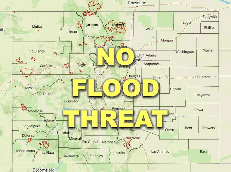
— Flooding is NOT expected today
Colorado remains under a weak flow aloft regime with more of a westerly flow over northern Colorado and southwesterly flow across the southern portion of the state forecast. It’s quite cool to borderline cold this morning, and afternoon high temperatures are forecast to be below normal statewide. This is especially true over the Southeast Plains where high temperatures are only forecast to reach into the low 60°Fs. Enjoy the cool while it lasts!
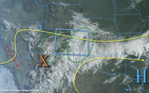
There are two areas of moisture marked in the visible satellite imagery below. The first is over eastern Colorado, which is producing cloudy and rainy conditions this morning. Rainfall currently occurring over the Southeast Plains and Southeast Mountains is forecast to continue through mid-afternoon with increasing upslope flow, and additional storms should developing over the high terrains by early afternoon further north. While PW was measured at 0.89 inches in Denver this morning, which is well above average, the colder temperatures and cloud cover will limit the instability that can build. Thus, only moderate showers are forecast with weaker thunderstorms that develop this afternoon through this evening.
The other area of moisture that is marked below is to Colorado’s west, which will help return widely scattered storms to the western high terrains today. PW at Grand Junction was also measured above normal at 0.85 inches, but most of the moisture was located at the mid to upper levels of the atmosphere. That higher moisture aloft and the cooler temperatures that are forecast should limit the heavy rainfall potential today. With some mid-level energy also moving across the southern tier of state by this afternoon, higher accumulations and best rainfall coverage is forecast over the San Juan Mountains. All activity today will follow our typical diurnal cycle, so any moderate rainfall that develops should end by this evening. It will be possible for some light rainfall to linger over the southern high terrains overnight. Flooding is NOT forecast today.
Today’s Flood Threat Map
For more information on today’s flood threat, see the map below. If there is a threat, hover over the threat areas for more details, and click on burn areas to learn more about them. For Zone-Specific forecasts, scroll below the threat map.

Zone-Specific Forecasts:
Southeast Mountains, Front Range, Raton Ridge, Southeast Plains, Urban Corridor, Palmer Ridge & Northeast Plains:
Light showers will continue over the Southeast Plains and Southeast Mountains through this afternoon with some additional rainfall likely developing over the El Paso County area this morning. An additional 1.1 inches of liquid precipitation will be possible with more widespread totals reaching 0.6 inches (west). By early this afternoon, a second set of storms should fire over the Front Range. Rainfall should mostly stick to areas along and near the Continental Divide but a weak storm or two may spill into the Urban Corridor. Max 1-hour rain rates up to 0.5 inches and isolated storm totals up to 0.8 inches will be possible. Due to the gradual nature of the rainfall, flooding is NOT forecast today. Light showers may persist over the Southeast Mountains overnight.
Primetime: Ongoing to 9PM
Northern Mountains, Northwest Slope, Central Mountains, San Juan Mountains, Southwest Slope, Grand Valley & San Luis Valley:
Rainfall returns to the forecast, but with a drier surface layer, increasing cloud cover and cooler temperatures, rainfall should only be light to moderate in intensity today. Isolated max 1-hour rain rates up to 0.7 inches over the Central and San Juan Mountains will be possible under the stronger storms and storm totals up 1.25 inches are forecast by morning. Flooding is NOT forecast. Light showers may linger over the eastern San Juan Mountains tonight.
Primetime: 11:30AM to 10PM
