Issue Date: Friday, June 24th, 2022
Issue Time: 10:10AM MDT
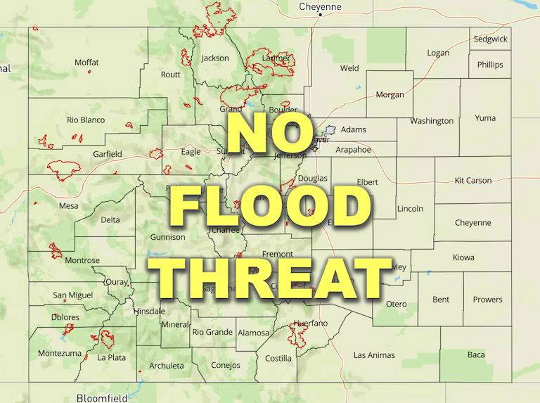
— Flooding is NOT expected today
— Fire-Burn Forecast Summary: 3 burn areas under MODERATE threat; 3 burn areas under LOW threat; click HERE for more info
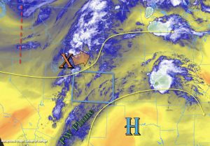
Colorado will be under the influence of both southwesterly and westerly flow aloft as a shortwave and its associated lift (orange “X”) move NNE throughout the day and the High pressure center spins to our southeast. There is a noticeable decrease in PW from yesterday morning across southern Colorado, but residual moisture is likely to produce isolated precipitation over the southern high terrains again this afternoon. Better moisture remains north with PW at Grand Junction and Denver measured at 0.85 and 0.61 inches, respectively. With the shortwave producing some extra lift as it moves NNE, scattered southwest to northeast moving storms are forecast once again.
The atmosphere remains quite juicy over northwest Colorado, and dew points in the 50Fs were noted over the Grand Valley. With the extra lift arriving from the shortwave after a few more hours of heating, storms will likely produce local downpours, similar to yesterday. Faster steering flows with a speed max overhead should limit the flood threat from any one storm, but training storms may cause local higher totals through this evening. Grand Junction’s morning sounding shows a bit more dry air in the mid and upper levels of the atmosphere, so rain rates should be at or slightly below yesterday. Therefore, flooding is NOT expected. However, this also means that if a stronger thunderstorm develops, there is a larger hail threat. As the shortwave passes by late afternoon, expect subsidence to fill in behind it.
As the mid-level energy arrives to eastern Colorado by mid-afternoon, widely scattered storms that develop over the high terrains are forecast to spill eastward into the adjacent plains. Better moisture is forecast over the far Northeast Plains, so expect more wetting rainfall for this region. However, with quick steering flows, flooding is NOT expected. The departing trough drops a strong cold front through the state overnight, which may produce some gusty winds as it drops south over eastern Colorado.
Today’s Flood Threat Map
For more information on today’s flood threat, see the map below. If there is a threat, hover over the threat areas for more details, and click on burn areas to learn more about them. For Zone-Specific forecasts, scroll below the threat map.

Zone-Specific Forecasts:
Northern Mountains, Northwest Slope, Central Mountains, Front Range & Grand Valley:
Storms will be moving quickly today and max 30-minute rain rates up to 0.85 inches will be possible. Training storms may cause local totals just over 1 inch by this evening. If a stronger thunderstorm develops, severe hail and very strong outflow winds may be additional threats. Flooding is NOT expected; however, an NWS Flash Flood Watch has been issued for the Grizzly Creek burn area. Please head over to our FBF page for additional burn area threats.
Primetime: 11AM to 8PM
Urban Corridor, Palmer Ridge & Northeast Plains:
Storms return to the forecast with more of a wind threat than heavy rainfall threat today, especially west. Max 30-minute rain rates up to 0.6 inches will be possible over and just east of the Urban Corridor and Palmer Ridge. Over the far eastern plains, deeper moisture may allow isolated rain rates to reach up to 1.25 inches. Strong outflow winds up to 60 mph will be possible with the stronger storms along with hail out east. Wind gusts in the 25-35 mph range are forecast early tomorrow morning as the cold front moves through. Flooding is NOT expected.
Primetime: 1PM to 11PM
San Juan Mountains, Southeast Mountains, Southwest Slope, Raton Ridge, Southeast Plains & San Luis Valley:
Widely scattered storms are forecast over the mountains today favoring the Saguache County area for accumulation. Max 30-minute rain rates up to 0.50 inches will be possible, which means that flooding is NOT expected. As storms move in from the west to eastern Colorado and potentially across the southern border, max 1-hour rain rates up to 0.25 inches are possible over the adjacent plains. Strong winds and lightning will be the main threats. Light showers may linger over the Southeast Plains into the overnight hours, but rainfall should end by mid-evening out west.
Primetime: 12PM to 3AM
