Issue Date: Thursday, June 23rd, 2022
Issue Time: 10:50 AM MDT
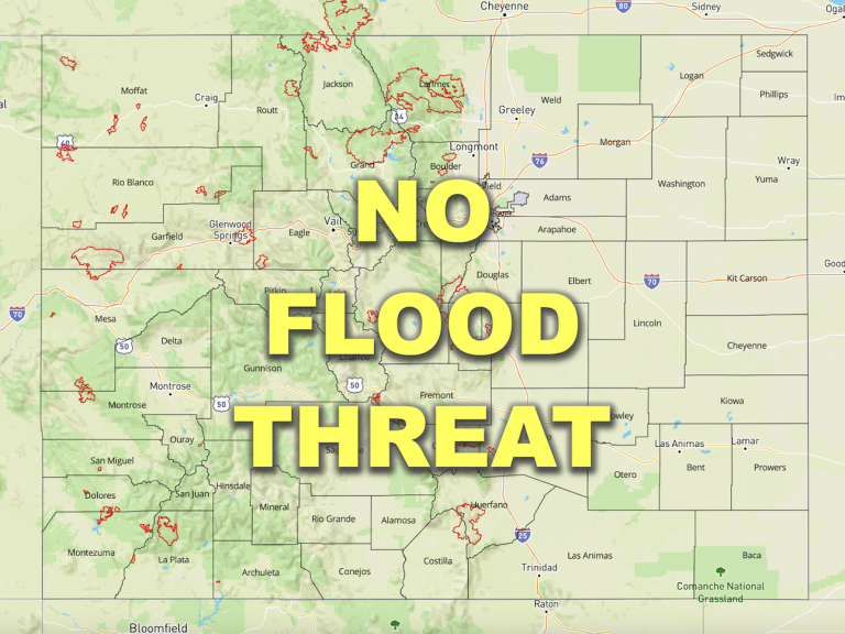
— Flooding is NOT expected today
— Fire-Burn Forecast Summary: 7 burn areas under LOW threat, click HERE for more info
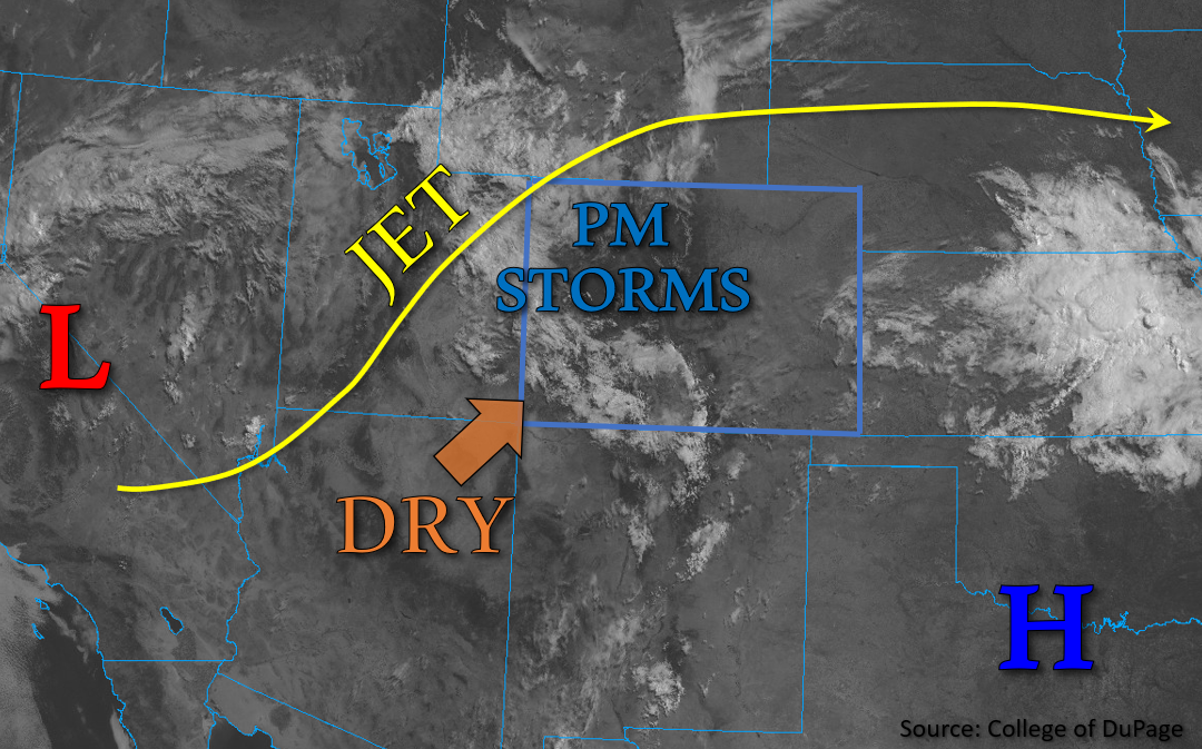
Temperatures are quite pleasant and mild this morning across Colorado. An upper-level cutoff low-pressure system is beginning to shift northeastward from east-central California into Nevada, while the southern plains high pressure system has shifted a bit further west. As a result, a break in the monsoonal moisture transport is expected. In its place, a dry airmass is being advected into southwestern Colorado this morning, as shown in the visible satellite image below, where a broken cloud deck is beginning to erode as drying is taking place. Meanwhile, a weak shortwave within the approaching upper jet is forecast to move through western Colorado this afternoon and increase wind speeds out of the west. This impulse is expected to trigger scattered showers and thunderstorms across western Colorado early this afternoon through the evening.
While Grand Junction observed PW of 0.89 inches this morning, the increasing southwesterly and westerly flow is expected to mix out surface moisture this afternoon. Still, some briefly heavy convective downpours are possible, particularly in the mountains where enhanced terrain-driven convergence may help intensify storms. Further east, Denver observed PW of 0.5 inches this morning, indicating more meager moisture. As such, the northeast portion of the state should remain relatively dry, aside from perhaps a stray light shower or two. The southeast portion of the state may also see a few storms in the afternoon, though they will likely be brief in nature due to decreasing moisture and weak instability. There is NO flooding expected today.
Today’s Flood Threat Map
For more information on today’s flood threat, see the map below. If there is a threat, hover over the threat areas for more details, and click on burn areas to learn more about them. For Zone-Specific forecasts, scroll below the threat map.
Zone-Specific Forecasts:
Northwest Slope, Grand Valley, Central Mountains, Northern Mountains & Front Range:
This morning, broken cloud cover overspreads northwest Colorado and temperatures are mild. Early this afternoon, scattered storms are expected to develop over northwest Colorado. The early development of these storms may limit their ability to take advantage of the peak daytime heating. However, stronger storms that develop today may have the potential to produce up to 0.75 inches of rain in 30 minutes. Additionally, strong outflow winds up to 50mph may also occur. Isolated areas of training storms over the higher terrains may cause 2-3 hour totals up to 1.25 inches. A second wave moving over western Colorado this evening will likely produce light, ongoing showers over the Northwest Slope and Northern Mountains through the night. Flooding is NOT expected today.
Primetime: Noon to Ongoing
Southwest Slope, San Juan Mountains, San Luis Valley & Southeast Mountains:
This morning, the cloud deck is showing some more clearing as a drier air mass intrudes from the southwest. Storms that do develop this afternoon will likely be concentrated over the mountains and higher elevations of southwest Colorado, but due to an expected decrease in moisture, storms are not likely to be intense for these forecast areas. Still, some areas of the San Juans could see isolated rain rates as high as 0.5 inches in 30-minutes and storm totals up to 1 inch. Some lighter showers may persist overnight as a second wave of precipitation arrives from the west. Flooding is NOT expected today.
Primetime: 11AM to Ongoing
Urban Corridor, Northeast Plains, Palmer Ridge, Southeast Plains & Raton Ridge:
This afternoon, a few widely scattered rain showers could re-develop over the Raton Ridge and Southeast Plains. However, due to weaker instability forecast across the area and intruding dry air from the southwest, these showers are not expected to produce a flood threat. Rain rates may reach up to 0.5 inches per hour, and isolated storm totals up to 0.9 inches will be possible. NO flooding is expected today.
Primetime: 1PM to 9PM

