Issue Date: Tuesday, June 21st, 2022
Issue Time: 9:30 AM MDT
Summary:
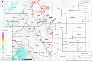
It was another calmer day in Colorado, with only a small amount of precipitation that was generally contained to the Southern and Central Plains in the east. Throughout the late afternoon and evening, weather reports grew a bit more interesting as storms moved through the area- 50 to 55 mph winds were observed east of Granada, along with 0.25-0.5” hail, according a CoCoRaHS reporter in Kit Carson and an NWS update.
What little rainfall did occur in Colorado was associated with those aforementioned storms in the eastern plains; totals for the day generally ranged from T-0.06” throughout the southeast corner of the state. The highest observation for the day was 0.14” of rainfall north of Lamar. For the rest of the state it was a dry day, with no precipitation observed west of the Front Range.
From both USGS and NWS sources, river flows and streamflow levels are reading normal or below normal levels for this time of the year, with none close to flood stage at this time.
There was no flooding reported yesterday. For precipitation estimates in your area, check out the map below.
