Issue Date: Sunday, June 19th, 2022
Issue Time: 11:45 AM MDT
Summary:
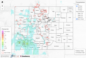
Yesterday’s ongoing subtropical moisture surge brought another round of scattered rain showers and thunderstorms across much western Colorado yesterday. While instability in parts of western Colorado reached up to 1500 J/kg of CAPE and PW values increased into the 0.8-inch range, the relatively quick steering flow kept storms moving quickly and helped minimize the flood threat. Still, periods of heavy rainfall occurred primarily over the San Juan Mountains and the San Luis Valley in afternoon and evening, with a few showers lingering into the overnight hours. Additionally, briefly heavy rainfall occurred over portions of the higher elevations of the Central Mountains in the afternoon, while a briefly intense storm occurred in Morgan County in the Northeast Plains with locally heavy rainfall there as well. There were no flood warnings or advisories issued yesterday, and there were no flood reports as of the time of this posting.
The highest rain totals recorded for the day were as follows:
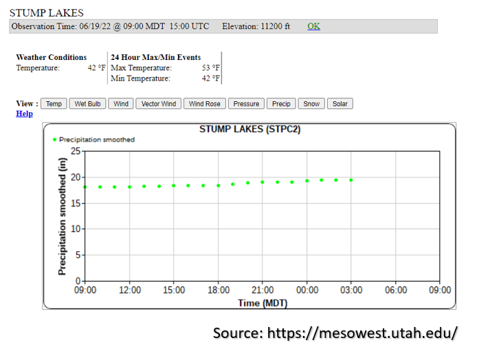
– 1.6 inches recorded by a SNOTEL gage at Stump Lakes at 11,200 feet northeast of Durango (shown in the image below)
– 1.24 inches recorded by a CoCoRaHS station 7 miles north of Bayfield
– 1.1 inches measured about 6 miles south of Pagosa Springs
In association with the briefly intense heavy rainfall that occurred over Morgan County, a CoCoRaHS station outside of Fort Morgan recorded 0.55 inches of rainfall for the day. Additionally, there were several wind gusts reported yesterday, with the strongest being measured at 62 mph in Garfield County.
At this time there are no rivers in flood stage, but rises have already begun and should continue over the next 24-hours with another day of rain ahead and saturated soils. This is especially true over the San Juan and San Luis Valley areas where 48-hour totals up to 1.5 to 2 inches have fallen.

