Issue Date: Tuesday, June 14th, 2022
Issue Time: 11:00 AM MDT
Summary:
Yesterday featured another day of heat before a slight respite today following a frontal passage across the state last night. An approaching upper-level trough over the Great Basin/Northern Rockies and the surface cold front preceding it helped to produce showers and storms by early Monday evening across the Northwest Slope, Northern Mountains, and northern Front Range.
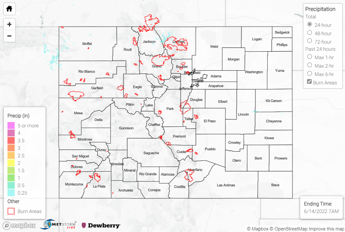
Precipitation amounts with these showers and storms were light, with T-0.15” generally observed. The heaviest precipitation fell across northwestern Moffat County and northwestern Larimer County, where amounts closer to and slightly exceeding 0.25” were observed. To the east of the mountains across the Plains, dry westerly downslope flow prevented precipitation from falling.
Fort Collins, Colorado Springs, Pueblo, and Burlington all broke record high temperatures yesterday, while Denver and Greeley tied record highs. Deep mixing across the state tapping into strong southwesterly flow aloft, along with a tightening surface pressure gradient, led to another day of windy conditions; gusts of 35-50 mph were widespread, with some areas seeing gusts of 60-70+ mph, including 74 mph near Douglas Pass. Red Flag Warnings, High Wind Warnings, and Wind Advisories were once again widespread.
Smoke from wildfires in Arizona, along with dust from New Mexico, was transported northeastward across much of southeastern Colorado yesterday, with notable reductions in air quality and visibility. Thankfully, most of this dust and smoke was cleared out with the passage of the cold front.
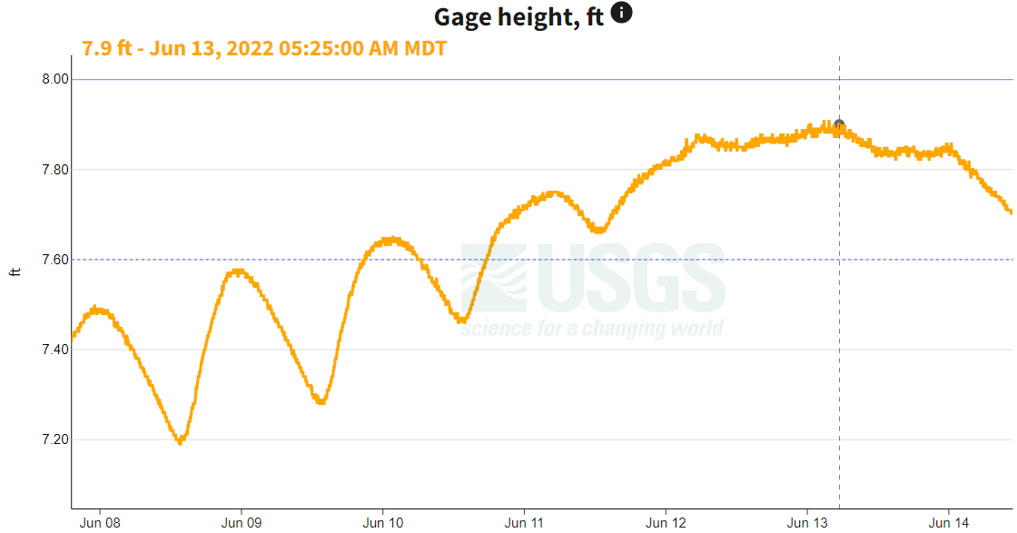
The Flood Advisory for the upper reaches of the Colorado River and Tonahutu Creek in Grand County remains in effect until 6:30 AM MDT tomorrow. The river appears to have peaked at 7.9 feet early Monday morning (flood stage is 8.0 feet), with flows decreasing since, per the USGS (see the gage height graph below near Grand Lake). Several other creeks, streams, and rivers in the Northern Mountains, Central Mountains, and Front Range continue observing above normal flows due to snowmelt.
There was no flooding reported yesterday. For precipitation estimates in your area, check out the map below.

