Issue Date: Monday, June 13th, 2022
Issue Time: 10:45 AM MDT
Summary:
Sunday was another hot day across Colorado thanks to the southern U.S. ridge that continues to dominate weather in the region. Thermometers tagged triple digits in many locations, with Grand Junction reaching 101 degrees and breaking the old record that had stood for 104 years!
With diurnal heating and a weak disturbance passing overhead, high-based showers and storms once again broke out in the afternoon along the I-25 corridor before tracking eastward into the Plains. The atmosphere was not overly conducive to severe weather compared to previous days, but a few storms became marginally severe and prompted numerous Severe Thunderstorm Warnings. Downbursts with gusts of 50-60 mph were reported, along with 1” hail near Burdett. One cell even spawned a brief landspout tornado just north of Denver International Airport:
Landspout tornado just north of DIA about 5 mins ago @NWSBoulder #insane #cowx pic.twitter.com/MGhxgGKxGb
— Brian Bledsoe (@BrianBledsoe) June 12, 2022
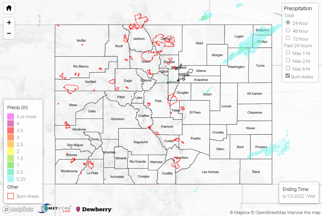
Precipitation was mainly confined to the Urban Corridor, Palmer Ridge, and Northeast/Southeast Plains, with amounts of 0.25-0.50” observed under most of the showers and storms. The exceptions were along the I-76 corridor northeast of Fort Morgan, and Bent and Prowers Counties, where localized amounts of 1.00-1.50+” were observed; storms in these locations were able to tap into better moisture from the east and produce heavier rainfall.
For the western half of the state, Sunday was dry, windy, and hot, with Heat Advisories, Wind Advisories, and Red Flag Warnings blanketing the map. A new wildfire, the Lopez Fire, was sparked 10 miles north of Del Norte, with an estimated 88 acres burned so far; U.S. Forest Service personnel are on scene.
Water levels remain high along the upper reaches of the Colorado River in Grand County, and the Tonahutu Creek is also now producing minor lowland/meadow flooding. As such, the Boulder WFO extended the Flood Advisory for snowmelt flooding through 6:30 AM MDT Wednesday. Several other creeks, streams, and rivers in the Northern Mountains, Central Mountains, and Front Range continue observing above normal flows due to snowmelt.
There was no flooding reported yesterday. For precipitation estimates in your area, check out the map below.
