Issue Date: Monday, June 13th, 2022
Issue Time: 9:45AM MDT
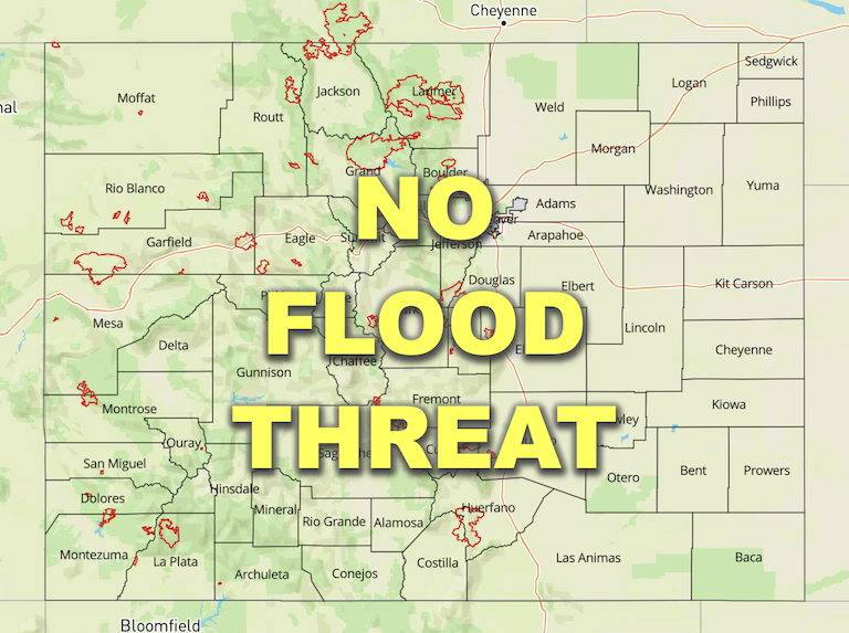
— Flooding is NOT expected today
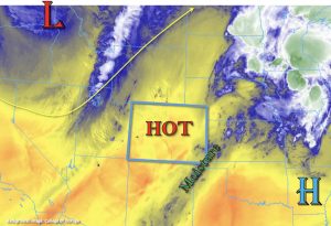
A change to the weather pattern is on the way, but not before another hot and windy day as Colorado remains under the influence of the ridge and an incoming jet. Dry southwest flow has helped to drop PW values at Denver and Grand Junction to around 0.25 inches this morning, and this dryness can be witnessed by the lack of cloud cover over the state. There’s a bit of moisture over the southeast corner of the state marked in green in the water vapor imagery below, but this is expected to mix out eastward as the trough pushes in from the west. Accompanying the trough is a strong jet, so windy conditions are forecast again over western Colorado. More on the associated critical fire conditions below.
While the majority of the state will lack the ingredients for afternoon rainfall, an incoming cold front should provide some moisture and lift to the northwest corner of the state by mid-afternoon for some showers and weak thunderstorms. Due to the dry boundary layer, it may take a bit for rainfall to reach the surface with plenty of virga forecast for the lower elevations. Over the higher terrains and hills, rainfall should be easier to accumulate, although only moderate rain rates are anticipated. Thus, there will be NO flood threat issued. Lighter showers will likely continue overnight across the Northern Mountains and northern Front Range. As the cold front dips south across eastern Colorado tonight, it could produce some windy conditions but it should remain dry.
Windy and dry conditions are forecast to continue over western Colorado, south-central Colorado and the Southeast Mountains as the jet with the next incoming trough move eastward. A large portion of these forecast areas have been placed under a Red Flag Warning from 10AM this morning to 11PM this evening, so use caution with any activity that could cause a spark.
The Colorado River continues to run high upstream of Grand Lake, and a Flood Advisory is in effect through Wednesday morning. The gauge was measured at of 7.9 feet this morning with 8 feet marking the Minor flooding height. Low-lying area and meadow flooding are possible from the entrance of RMNP down to Grand Lake and along the lower stretches of Tonahutu Creek (NE side of Grand Lake).
Today’s Flood Threat Map
For more information on today’s flood threat, see the map below. If there is a threat, hover over the threat areas for more details, and click on burn areas to learn more about them. For Zone-Specific forecasts, scroll below the threat map.

Zone-Specific Forecasts:
Northern Mountains, Northwest Slope, Front Range, Urban Corridor, Palmer Ridge, Raton Ridge, Northeast Plains & Southeast Plains:
Windy conditions are forecast for the Northwest Slope and portions of the Northern Mountains today. It will be dry and hot to begin the day, but a cold front will help to generate cooler temperatures, showers and weak thunderstorms over the northwest corner of the state by mid-afternoon. Dry lightning and brief outflow winds will be the main threats from the storms with isolated storm totals up to 0.80 inches possible over higher terrains. Showers will likely continue over the Northern Mountains and spill into the northern Front Range overnight. A couple rounds of rainfall may produce localized totals up to 0.70 inches in the mountain zones by morning. Flooding is NOT expected. As the cold front drops through eastern Colorado tonight, it may produce some strong gusts, which will be most likely to occur over the Northeast Plains and northern Urban Corridor. I think everyone is looking forward to a cooler start to the day tomorrow.
Primetime: 1PM to Ongoing
Central Mountains, Southeast Mountains, San Juan Mountains, San Luis Valley, Southwest Slope & Grand Valley:
Hot and dry today with several Red Flag Warnings and high Wind Warnings issued. Blowing dust and critical fire conditions are forecast from 10AM to 11PM this evening, so use caution with any activity that could generate a spark. More information about the warnings can be found from your local NWS office. Afternoon high temperatures should be slightly cooler but still hot with 90Fs forecast across the lower elevations. Light rainfall will be possible over the northern Central Mountains near the Continental Divide early tomorrow morning, but with totals remaining under 0.10 inches, flooding is NOT forecast.
