Issue Date: Sunday, June 12th, 2022
Issue Time: 11:45 AM MDT
Summary:
Saturday saw dry conditions for most of the state as the heat continued to build across the region. Denver tied its record high of 100 degrees set back in 2013 and also tied its record for earliest calendar day to reach 100 degrees. Grand Junction reached 102 degrees, breaking its old record of 101 set back in 1918!
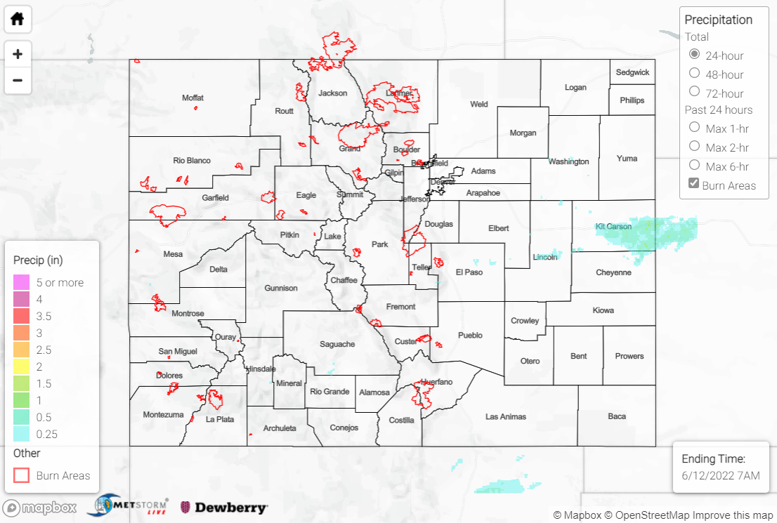
A few high-based showers and storms were able to develop by late afternoon in the high terrain thanks to a weak disturbance passing overhead; little to no precipitation (T-0.05”) reached the ground with this activity given the dry sub-cloud layer, but a few cells produced gusty outflow winds as they moved out into the eastern Plains. Late in the evening one cluster of storms along the far eastern I-70 corridor was able to intensify, overcome the dry low levels, and produce meaningful precipitation across Cheyenne and Kit Carson Counties with amounts of 0.50-1.00” falling. This same cluster prompted the issuance of a Severe Thunderstorm Warning, but no severe weather was reported statewide.
A unique atmospheric phenomenon was observed last night in the far eastern Plains and into northwest Kansas, as heat bursts occurred after midnight with the dissipating showers and storms. Heat bursts are relatively rare and usually occur after dark under certain atmospheric conditions when the outflow of dissipating storms loses its moisture to evaporation, and then warms due to compression as it descends to the surface. Heat bursts usually bring gusty winds, rapid increases in surface temperature, and rapid decreases in relative humidity. Check out this example from just across the border in Bird City, KS:
We’ve seen some interesting weather tonight as heat bursts are occurring in far eastern Colorado and northwest Kansas. The best example was in Bird City, KS as temperatures rose 15° in 30 minutes to reach 91° at 3:22AM! #COwx #HeatBurst pic.twitter.com/x3H8aJmh6Z
— NWS Boulder (@NWSBoulder) June 12, 2022
The Flood Advisory for snowmelt along the upper reaches of the Colorado River in Grand County remains in effect until 6:45 AM MDT tomorrow; numerous other creeks, streams, and rivers in the high country continue observing above normal flows due to snowmelt.
There was no flooding reported yesterday. For precipitation estimates in your area, check out the map below.
