Issue Date: Sunday, June 12th, 2022
Issue Time: 9:05AM MDT
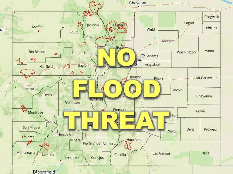
— Flooding is NOT expected today
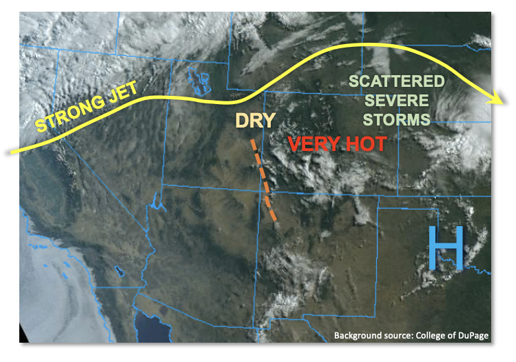
An upper-level ridge, centered over TX, will continue to hold its grip over CO through Sunday as shown in the visible satellite image below. Although the ridge has weakened a bit over the past 24 hours, afternoon high temperatures will continue to run well above normal to even near-record territory.
This morning’s PW at Denver was 0.63 inches, steady from yesterday, while Grand Junction’s value of 0.51 inches increased a bit. Boundary layer moisture continued to be impressive over the Northeast and Southeast Plains with dewpoint temperatures near 60F. PW is expected to drop over western and central CO as dry air mixes into the large boundary layer from above. PW is expected to rise over far eastern CO. A mid-level disturbance was noted over southwest Colorado today, currently manifested mainly as a cloud deck. This disturbance is expected to support isolated to scattered storms over the northeast quadrant of the state. Storm motion will increase from 20-25 mph early in the afternoon to 30mph+ by late afternoon, so rainfall will be limited in any given location. Nonetheless, brief heavy downpours are expected as storms grow into a larger complex on their way from the Palmer Ridge towards the KS/NE borders. However, aside from nuisance street ponding, flooding is NOT expected today. Storms are expected to become severe as they approach far eastern Colorado, with the primary threat being large hail and damaging winds.
As discussed in yesterday’s FTB, snowmelt continues in full gear over the Northern Mountains today, with warm nighttime temperatures supporting melting 24 hours a day (typically melting pauses at night as temperatures approach freezing over the higher terrain). The Colorado River is running high upstream of Grand Lake, and minor flooding may occur over the next 24-48 hours as the majority of the snow is expected by melt by then.
Lastly, the gradual approach of the strong jet stream and trough from the northwest will cause windy conditions to develop mainly across western Colorado. With relative humidity dropping this afternoon, Red Flag Warnings are in effect for today through tomorrow.
Today’s Flood Threat Map
For more information on today’s flood threat, see the map below. If there is a threat, hover over the threat areas for more details, and click on burn areas to learn more about them. For Zone-Specific forecasts, scroll below the threat map.
Zone-Specific Forecasts:
Northeast Plains:
Mostly sunny early then becoming mostly cloudy with scattered showers and storms developing by mid-afternoon. Max 30-minute rainfall up to 1.1 inches possible, with max 1-hour rainfall up to 1.5 inches. Nuisance field and road ponding is possible today, but flooding is NOT expected. Storms are expected to become increasingly severe as they approach the KS/NE border with large hail and gusty winds being the predominant threats.
Primetime: 3PM through 10PM
Southeast Plains, Front Range, Urban Corridor, Palmer Ridge, Southeast Mountains & Raton Ridge:
Partly cloudy and continued very hot today with temperatures up to 15F above normal. Isolated to widely scattered storms are expected mainly over the Palmer Ridge and Urban Corridor this afternoon. Max 30-minute rainfall up to 0.4 inches possible, along with gusty winds. Flooding is NOT expected today.
Primetime: 1PM through 7PM
Northern Mountains, Central Mountains, Grand Valley, San Juan Mountains, Southwest Slope, San Luis Valley & Northwest Slope:
Becoming mostly sunny and hot with temperatures of 5-10F above normal. Gusty winds will develop this afternoon and Red Flag Warnings are in place for parts of the area. An isolated shower or weak storm cannot be ruled out over the San Juan and Central Mountains but little if any rainfall is expected.
There is a Flood Advisory in effect for the Colorado River north of Grand Lake as snowmelt could cause minor flooding.

