Issue Date: Saturday, June 11th, 2022
Issue Time: 8:55AM MDT
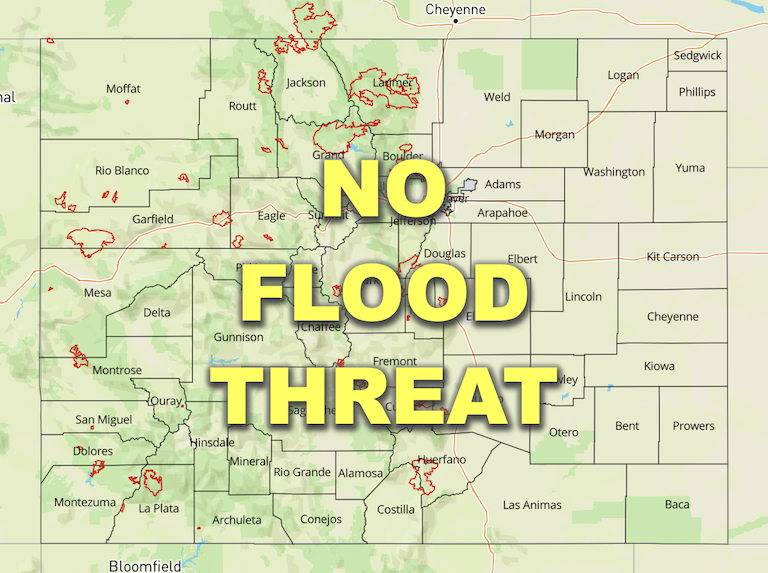
— Flooding is NOT expected today
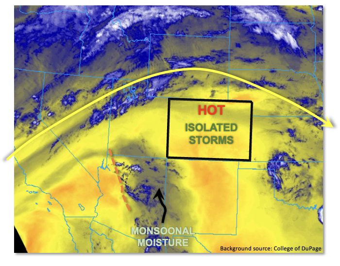
An early season heat wave will be on full display today across our state. As shown in the water vapor image, below, a strong ridge will remain in place today providing mid-level subsidence that will generally limit storm activity and crank afternoon high temperatures. Afternoon high temperatures will run 5-15F above normal across the state, making today the hottest day of the young summer before weak cooling begins by Sunday.
PW this morning measured 0.66 inches at Denver and 0.48 inches at Grand Junction. Statewide, PW ranged from 0.4 – 0.6 inches over the western half of the state and 0.5 – 0.8 across the eastern half. Some subtle moistening is expected over southwest Colorado as a weak pulse of mainly mid-level monsoonal moisture pushes up into the Four Corners region. Boundary layer moisture was marginal over western Colorado, but quite high further east with dewpoints exceeding 60F along the KS border! Overall, it will be the classic duel today between just enough instability to fuel storms and mid-level subsidence to suppress them. However, with a disturbance noted over AZ moving northeastward, we do expect an increase in storm coverage compared to yesterday. Widely scattered storms are expected to have their highest coverage over the Central and San Juan Mountains as well as over the Northeast Plains. However, with the limited instability, up to 600 J/kg CAPE, and steady storm motion, only light to briefly moderate rainfall is expected, along with gusty downdraft winds. Thus, flooding is NOT excepted today.
With the recent and ongoing hot weather, snowmelt will be nearing completion over the next few days for most areas. Until then, localized high flows will be possible especially over smaller basins in the Northern Mountains. A look at gauged flows this morning showed a couple of creeks and rivers running close to “Action” level: the Elk River north of Steamboat Springs, and the Colorado River north of Grand Lake. Remember that snowmelt-related flows at lower elevations (below 9,000 feet) usually peak daily during the overnight hours as it takes a while for the snowmelt to move down in elevation from the highest snowpack.
Today’s Flood Threat Map
For more information on today’s flood threat, see the map below. If there is a threat, hover over the threat areas for more details, and click on burn areas to learn more about them. For Zone-Specific forecasts, scroll below the threat map.
Zone-Specific Forecasts:
Northeast Plains, Southeast Plains, Front Range, Urban Corridor, Palmer Ridge, Southeast Mountains & Raton Ridge:
Becoming partly cloudy and very hot with temperatures 10-15F above normal. Isolated to widely scattered thunderstorms are expected mainly over the foothills and higher terrain around the Palmer Ridge, as well as over the Northeast and Southeast Plains. Max 30-minute rainfall up to 0.7 inches (east) and 0.4 inches (west). Gusty winds are also possible with the stronger storms. Flooding is NOT expected today.
Primetime: 2PM through 11PM
Northern Mountains, Central Mountains, Grand Valley, San Juan Mountains, Southwest Slope, San Luis Valley & Northwest Slope:
Becoming partly cloudy and very hot with temperatures 5-10F above normal. Isolated thunderstorms are expected mainly over the foothills and higher terrain around the San Juan Mountains. Max 30-minute rainfall up to 0.3 inches. Gusty winds are also possible with the stronger storms. Flooding is NOT expected today.
Localized high creek flows are possible over the Northern Mountains due to snowmelt. However, flooding is not expected at this time.
Primetime: 1PM through 9PM

