Issue Date: Friday, June 10th, 2022
Issue Time: 9:45 AM MDT
Summary:
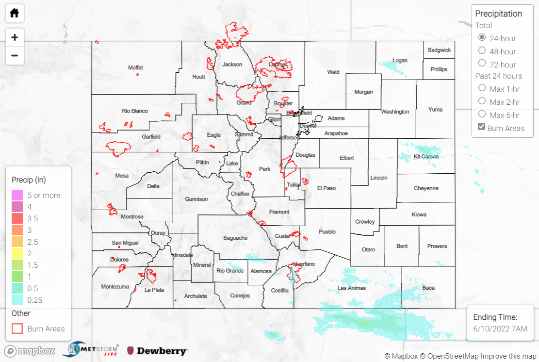
Yesterday saw relatively dry conditions across the state, with only light amounts of precipitation in most areas. The Front Range received a small amount of rainfall, with Denver reports ranging from 0-0.02”, and the Colorado Springs area recording up to 0.07”. Pueblo and south-central Colorado received some sparse rainfall as well, most notably 0.10” in Pueblo and 0.15” near Great Sand Dunes.
Two severe thunderstorm warnings were issued yesterday afternoon, just east of I-25 near the southern border of the state. However, the warnings were brief, spanning less than an hour each. In the central plains near the eastern border, two more severe thunderstorm warnings were issued a bit later in the evening. These areas received higher levels of rainfall, reporting 0.25” and 0.27” in Stratton and 0.21” north of Burlington. Lastly, the northeast corner of the state also had some storm activity yesterday- reports came in from Logan County, CO of 0.25-1.25″ hail and up to 0.21” of rainfall in Sterling.
Nice cell with half inch hail just south of Sterling, CO… #COwx @NWSGoodland @NWSDenver pic.twitter.com/V7eWFOnL0S
— Ren (@Renisme22) June 9, 2022
Up in the mountains, two stream gages are recording all-time highs for this day of the year, at Cross Creek near Minturn and Joe Wright Creek above Joe Wright Reservoir. However, most streams in this area are at or slightly above normal and none are above flood stage. There was no flooding reported yesterday. For precipitation estimates in your area, check out the map below.
