Issue Date: Thursday, June 9th, 2022
Issue Time: 10:15 AM MDT
Summary:
A cooler and more stable air mass pushed south through Colorado behind a cold front early Wednesday morning, while upper-level height rises and weak ridging aloft granted much of the state a welcome respite from the storms and severe weather of late.
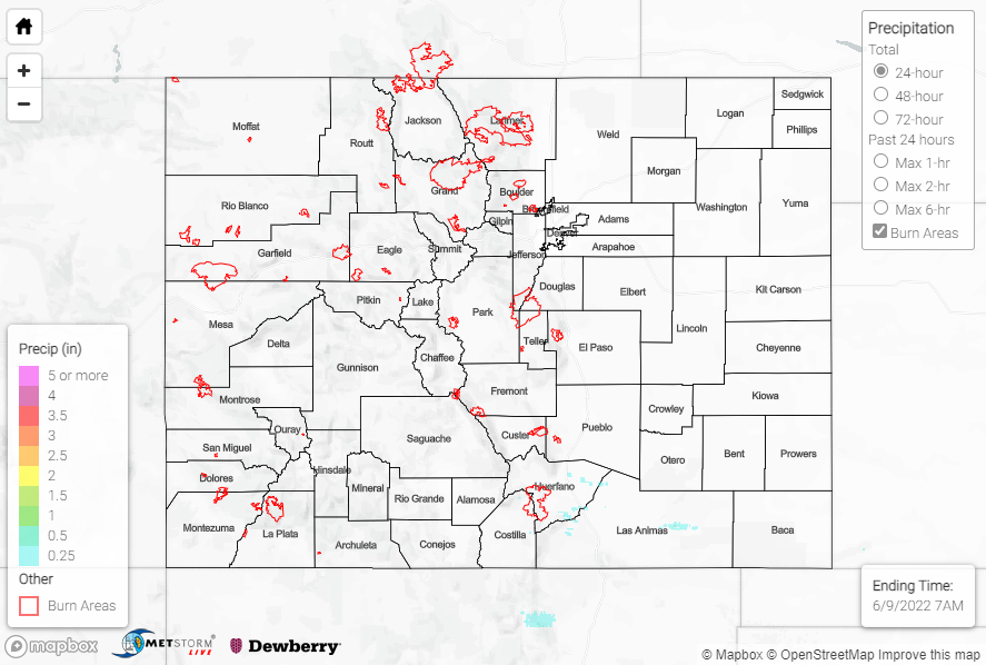
Appreciable moisture and instability were shunted well south of U.S. Highway 50, where a few showers and storms developed late in the evening along the Raton Ridge thanks to a weak disturbance passing overhead. The showers and storms moved off the Ridge and out across the southern Southeast Plains before weakening and finally dissipating after midnight. Precipitation totals were generally 0.25-0.50”, with a few locally higher amounts with the more intense storms. No severe weather was reported.
North of Highway 50 and west of the Divide, dry conditions dominated through the day yesterday and into the overnight period. Early this morning, a weak shortwave passing through the northern Rockies provided enough lift to spark some light showers across the Northern Mountains and northern Front Range, with T-0.25” reported from this morning’s precipitation.
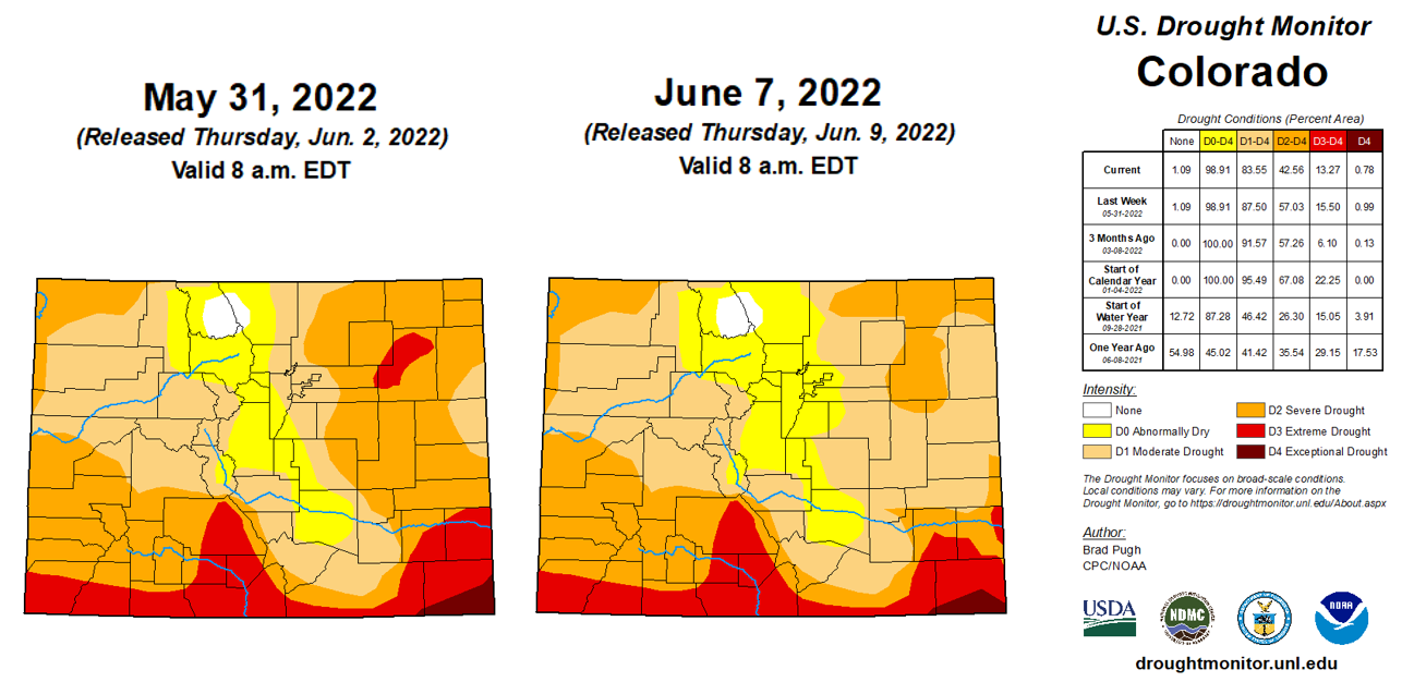
The updated U.S. Drought Monitor was released this morning, with another week of improvements across the state. Most notable was a significant reduction in severe and extreme drought conditions across portions of the Palmer Ridge and Northeast Plains. Statewide, percent coverage dropped 2.2% for extreme drought, 14.5% for severe drought, and 4% for moderate drought.
Flow on the Arkansas River near Lamar is on a decreasing trend after the heavy rainfall the past few days. There was no flooding reported yesterday. For precipitation estimates in your area, check out the map below.

