Issue Date: 8/23/2015
Issue Time: 9:55AM
— NO Flood Threat Today
— Elevated Fire Threat for Northwest Slope, Northern Mountains and Central Mountains
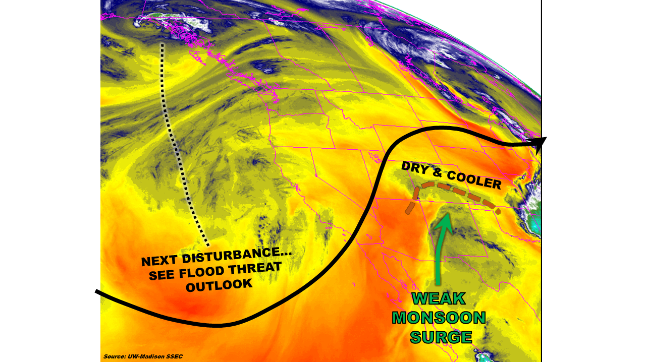
The passage of yesterday’s cool front will mean continued mostly dry conditions and an 8-12 F drop in this afternoon’s temperatures across most of Colorado. However, as shown by the water vapor image, below, not everyone will stay dry. A weak monsoon surge is noted across New Mexico. This has raised precipitable water (PW) values up to about 1 inch in Albuquerque, while readings in Colorado range from 0.45 to 0.8 inches (higher towards the south). A brief influx of moister air will imply a chance of showers and weak thunderstorms across roughly the southern third of Colorado. However, instability will be very weak and prevent heavy rainfall. Mid and upper-level winds will turn to the west by early evening, and should bring in drier air across most of the state, which will shut off all rainfall around or even before sunset. Flooding is not expected today.
Today’s Flood Threat Map
For more information on today’s flood threat, see the map below (hover over threat areas for more details). For Zone-Specific forecasts, jump below the map.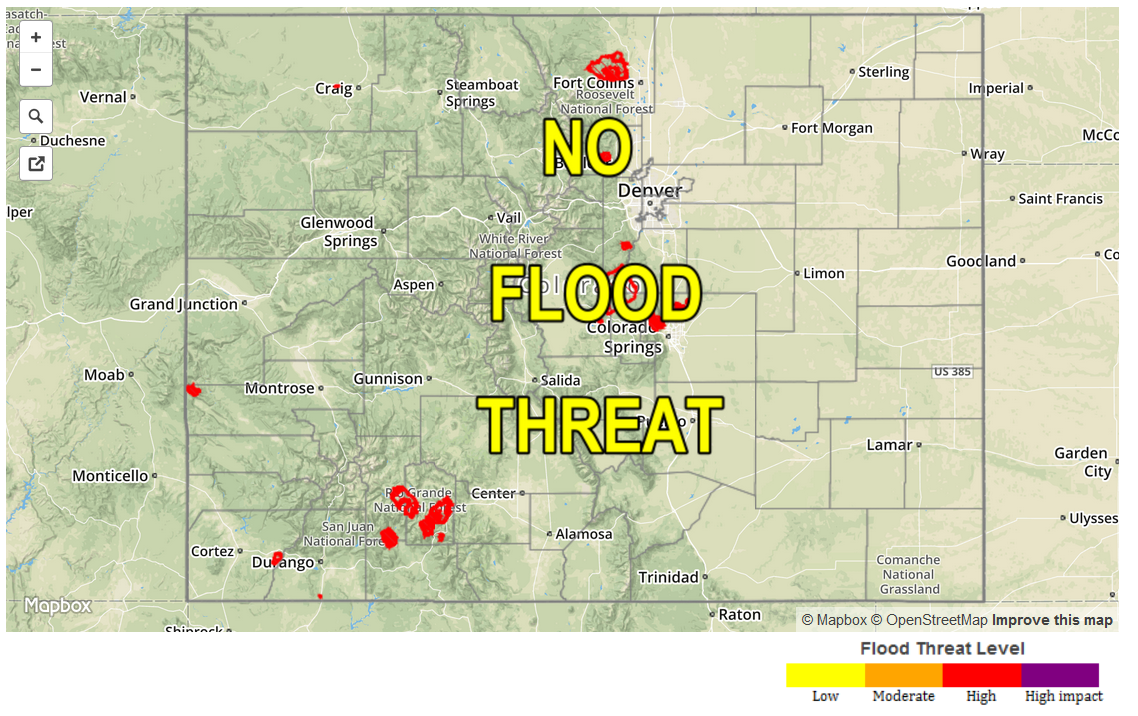
Zone Specific Forecasts
Front Range, Urban Corridor, Northeast Plains, Southeast Plains, Palmer Ridge, Raton Ridge, Southeast Mountains:
Mostly sunny to partly cloudy today and much cooler with highs in the 50s in the higher terrain to the upper 80s F in the lower elevations of the Arkansas River valley. Isolated to widely scattered thunderstorms will pop along the Raton Ridge, Southeast Mountains and in the Southeast Plains from the mid afternoon to early evening. However, rainfall will be limited to 0.4 inches or less due to weak instability. Flooding is not expected today.
Southwest Slope, San Juans, San Luis Valley, Central Mountains, Northern Mountains, Grand Valley, Northwest Slope, Southwest Slope:
Mostly sunny and cooler today with highs ranging from the 50s in the highest terrain to the low-90s in the lower valleys. Scattered showers and thunderstorms will occur over the San Juan Mountains and San Luis Valley, but rainfall will be less than 0.4 inches. Flooding is not expected today. Relative humidity values will once again be in the 10-15% range over the Northwest Slope, Northern mountains and Central Mountains, which will slightly elevate the wildfire threat. However, wind speeds are expected to remain weak today. Please check with your local National Weather Service Forecasts for detailed information.