Issue Date: Monday, June 6th, 2022
Issue Time: 11:30 AM MDT
Summary:
Sunday saw high-based showers and thunderstorms as an upper-level shortwave moved across the state. Precipitation was mainly confined to along and north of I-70, save for an isolated low-precipitation supercell that developed mid-afternoon in Kit Carson County and tracked south-southeastward. Severe weather was confined to the easternmost tier of Colorado counties, with hail being the predominant hazard reported yesterday. The aforementioned supercell lasted for several hours and produced hail up to 2” diameter as well as a 63-mph thunderstorm wind gust near Lamar; the storm prompted eight severe thunderstorm warnings as well as one tornado warning north of Lamar, although no tornadoes were reported. The only other severe weather reported yesterday was a thunderstorm wind gust of 54 mph in the northeast corner of the state near Julesburg. Check out these photos of the supercell from a storm chaser as it neared the town of Walsh:
Photogenic front and back of this “dusty” #supercell in SE CO near Walsh. Fun chase yesterday. 🙂 #cowx #wxtwitter pic.twitter.com/uomMfrB8sc
— Adrian Leyser (@TheNimbus) June 6, 2022
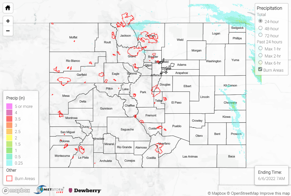
As far as precipitation goes, rainfall amounts were generally light with T-0.25” reported by observers across the Northern Mountains, Front Range, and Urban Corridor. CoCoRaHS observers in northern Sedgwick County reported over 0.50” of rainfall, with a maximum of 0.61” in Julesburg. The other swath of noteworthy precipitation across the state was associated with the low-precipitation supercell, stretching from Kit Carson County southward into northeastern Baca County. Rainfall observations are sparse, but a MesoWest station near Lamar reported 0.36” of rainfall. Remotely-sensed QPE indicates a narrow swath of 0.50-1.50”, although these amounts might be biased upwards; the presence of large hail within a storm can lead to incorrect rainfall estimates, and this storm had twelve confirmed hail reports, one of which explicitly noted the lack of rain falling.
There was no flooding reported yesterday. For precipitation estimates in your area, check out the map below.
